Euboic Olympus (1,170m) [P-730]
Summited On: April 18, 2026
Region: Eretria, Euboea, Central Greece, Greece.
Overview
Euboic Olympus (1,170m) [P-730] [”Ευβοικός Όλυμπος”] is an impressive and often overlooked massif situated Northeast of Eretria (”Ερέτρια”) in Euboea, Central Greece, which although relatively short features continuous steep slopes, high quality rock, and expansive Pine forests. Its location along the main line of human settlement from Chalics (”Χαλκίδα”) to Eretria and its function as a barrier into Northeast Euboea once made the mountain a critical stronghold, as betrayed by the countless ruined fortifications along its foothills. Most curious perhaps is the use of the term “Olymbos” to describe the massif throughout history, perhaps pointing to the now lost etymology of the word as being a term for mountain, loosely translated as “mountain of Euboea”.
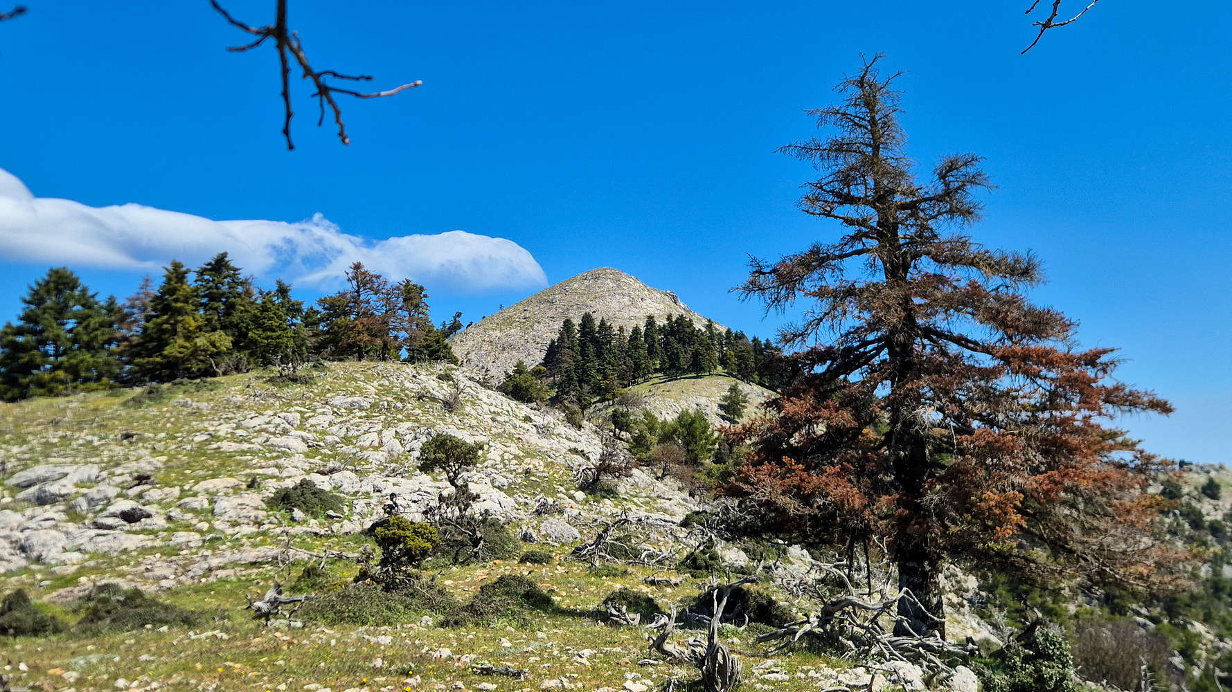
Psili Koryfi (1,170m) the highest of Euboic Olympus.
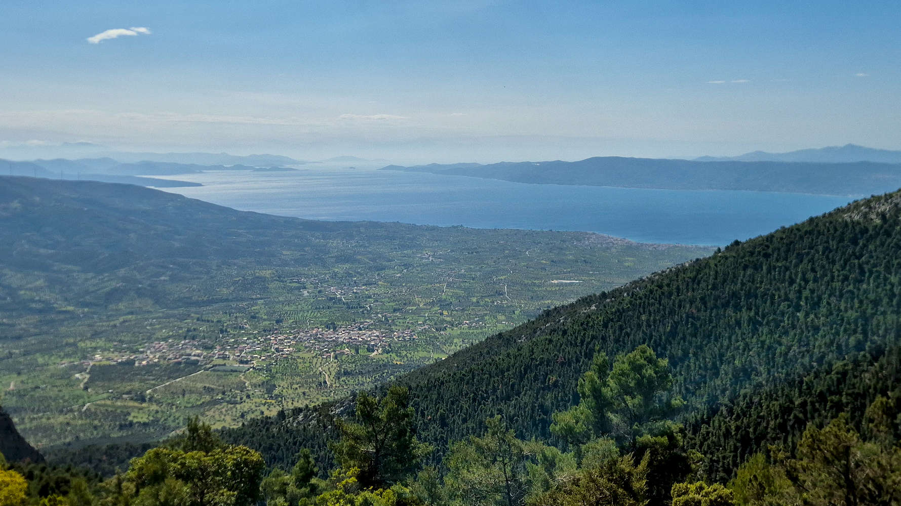
Near aerial views of Gymno from Elatias Col. (950m).
Today Euboic Olympus (1,170m) is overlooked for its more exciting neighbors, and utilized for extractive practices such as quarrying for Marble, and operating wind turbines. Yet, the high peaks, covered in a mix of Pine and Fir offer the perfect sanctuary for abundant wildlife, including an important population of birds of prey. The lower slopes are mostly known as tourist destinations, while in recent years the Twin Rock at Kamari (”Καμάρι”) has resurfaced as a popular climbing crag. Tragically, fires have significantly affected the massif, and in 2007 seven young local men died in an attempt to create a wildfire barrier; a chapel was built in their honor.
Route
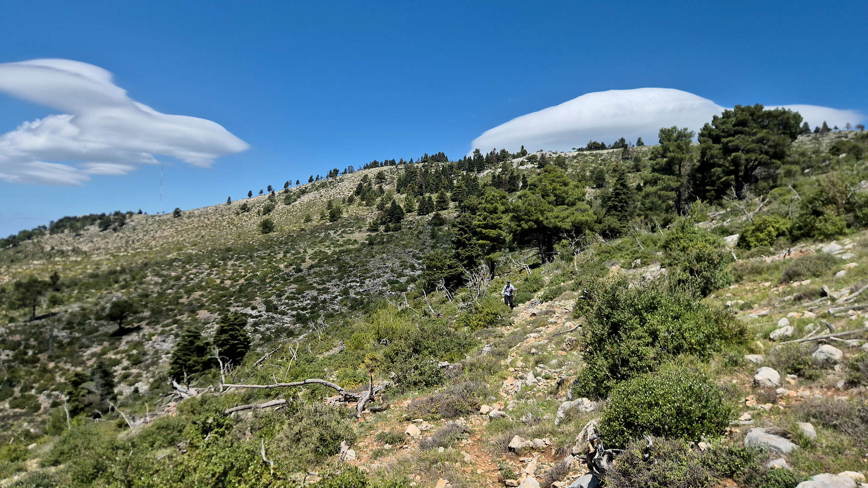
This massif has always been of particular interest to me, with it having a SummitPost page. Over the years, the idea of hiking the ‘normal’ route from the village of Theologos (”Θεολόγος”) came to mind, however the smooth incline and stretches of FSR found that route did not do justice to the imposing SE Face rising nearly 1000m from the village of Gymno (”Γυμνό”). Over time I became aware of this “SE Face Ravine” route but remained warry of conditions, as we are accustomed to in Greece, and it was only in the last couple of years that it became a real idea. The route gains nearly 900m from an unnamed dirt road above Gymno, following a forested ravine for 600m of elevation gain up to Elatias Col. (950m) before traversing to and then scrambling the hidden rocky summit of Psili Koryfi (1,170m).
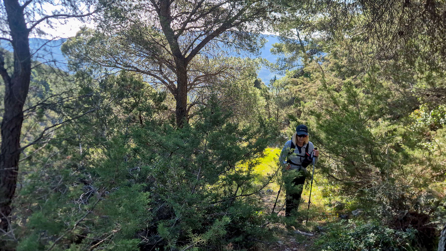
Terry entering the lower forest.
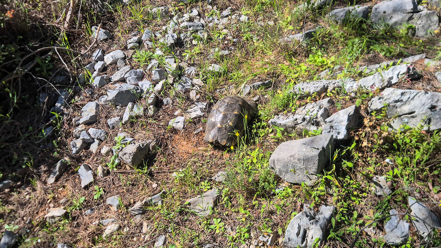
The Marginated tortoise using the trail.
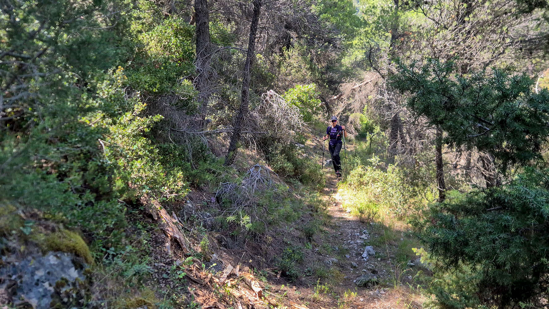
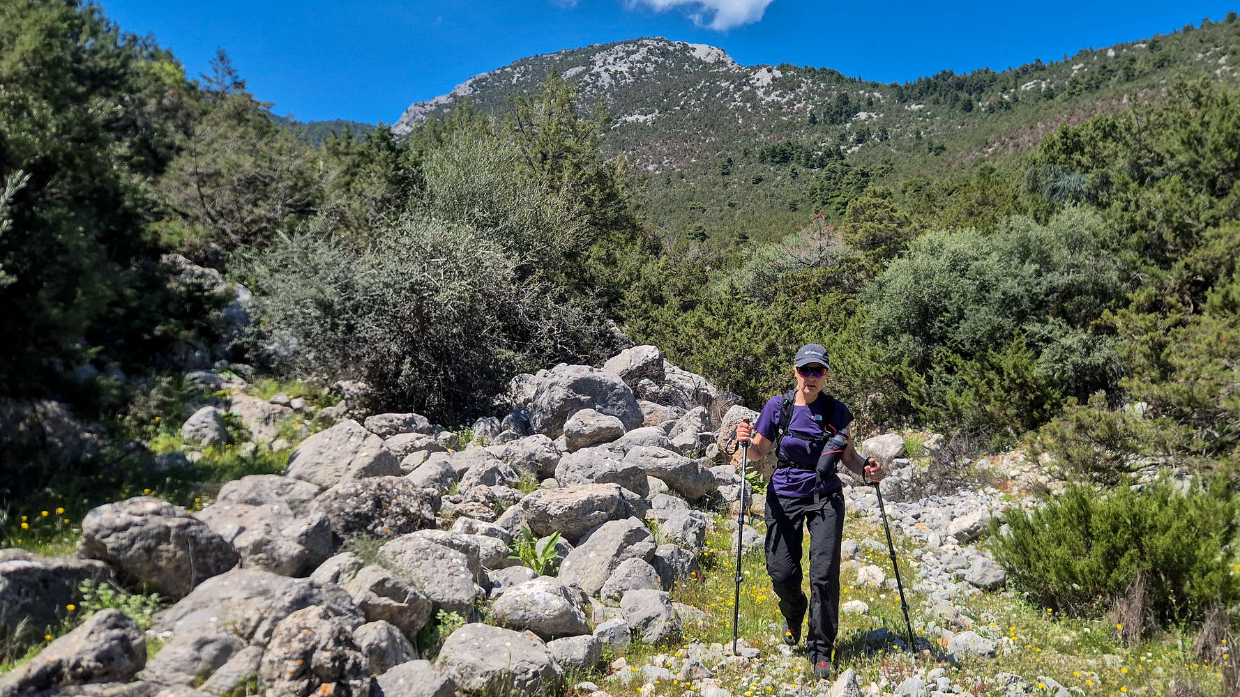
With the guard-dog of the house we parked by doing a lot of sunbathing, and very little guarding, we started off on a leisurely pace, aiming to find the start of the ravine which we would follow all the way to Elatias Col. (950m), vaguely visible 600m above us. The terrain begins easily enough as the ravine is entered briefly (T2+), before joining the left bank and adjoining Olive grove which it follows into the forest without a clear trail but plenty of Cairns (T1+). It soon enters the characteristic low Mediterranean forest of Pine (Pinus halepensis) where an obvious track can be found, winding and weaving between the trees (T1+). The terrain here is easy and pleasant with abundant wildlife, including a Marginated tortoise (Testudo marginata) which we saw in both directions.
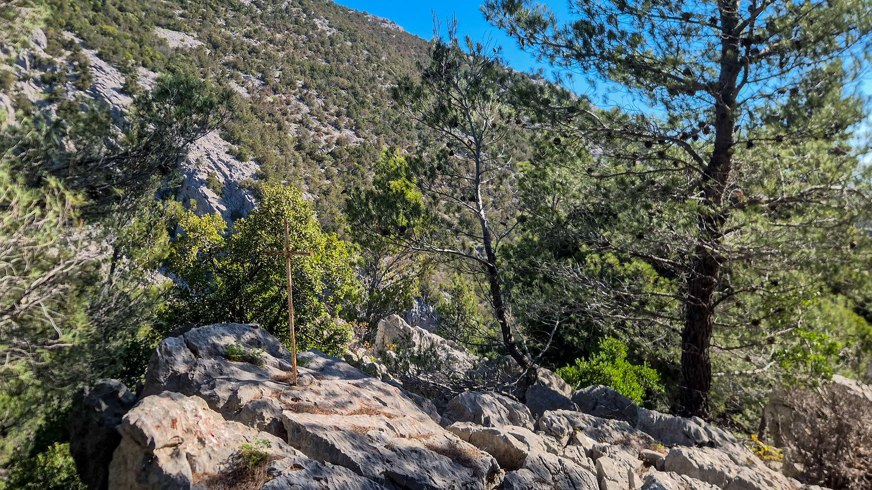
The rebar cross by the trail.
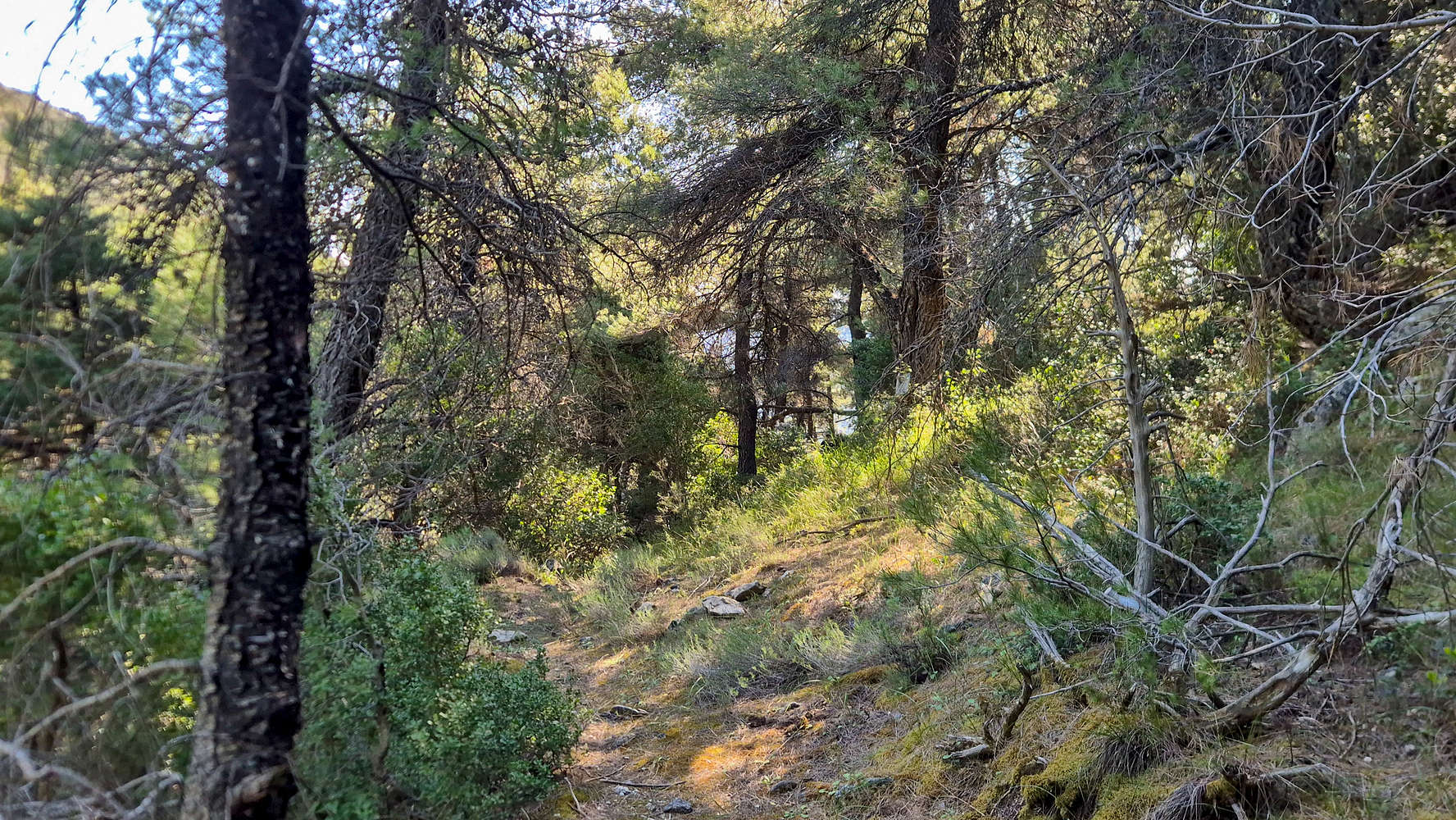
Section of the trail and forest.
The grade eases off as the main forest is reached with a curious cross made out of rebar marking the point from which the trail begins a small traverse (T1). Perhaps distracted by the exceptional views to a craggy ridge across, we reached the ‘top’ of this traverse, from which we would have to slightly descent before joining the direct line to the Col. In our infinite wisdom, we followed a faint trail heading left and slightly uphill, and were already quite far by the time I checked my GPS. With its quality being on par with the actual trail we followed it some more until it terminated above a cliff-band. With this 30 minute mistake behind us, we found ourselves back on the main trail, and soon reached the stream-bed that marks the base of the SSE slope after about 1 hour from the car.
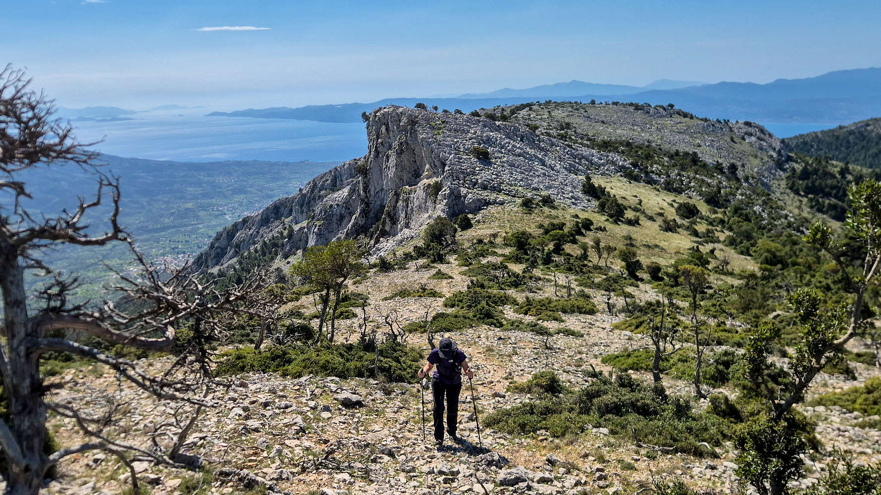
Breathtaking views at the scree-slope base.
Elatias (1,138m) seen from Elatias Col. (950m).
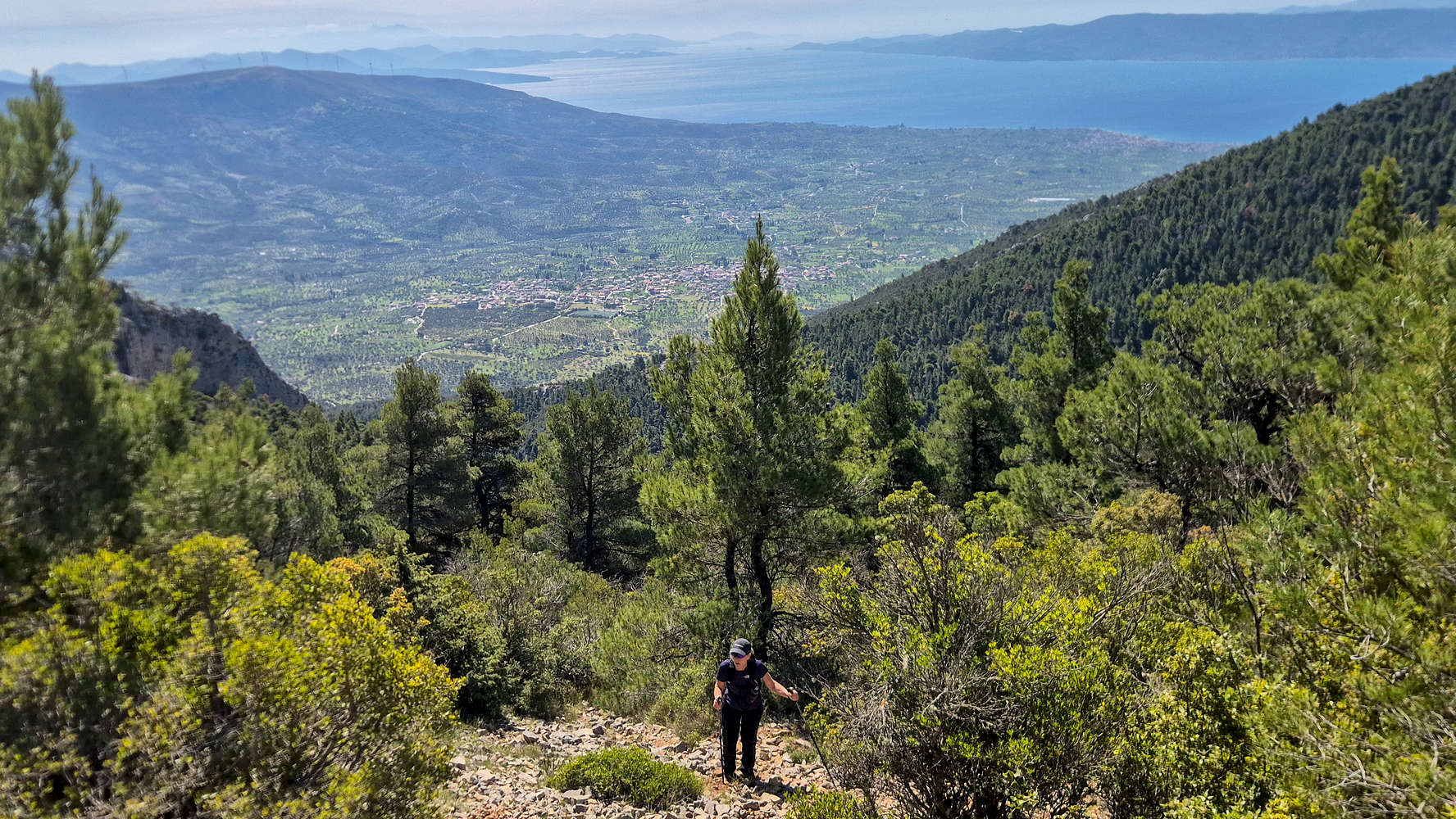
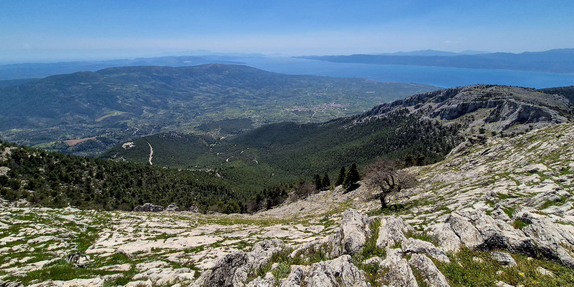
Here is where the majority of the elevation gain is made, with a steep ascent of 315m up to Elatias Col. (950m) over just 1.2km. The trail is generally navigable, although heavily overgrown in places, and care is needed due to the overall steepness which gradually increases. Up until 775m the route follows some long switchbacks which are tedious and overgrown but safe (T2), then it follows a long steep ramp to the NNE through the forest, with this section being tougher to navigate, more overgrown and slightly more consequential (T2). At approx. 880m, the Pine gives way to scree, and the steepest section is now reached, which is almost unmarked, rather steep, and littered with loose rock (T3), an exciting and apt finish to this part of the route. After 2 hours, the views SSE towards Gymno, the Eretria plains, and the Euboic Gulf are a worthy reward, with the slopes true steepness becoming clear at this point. Equally impressive is the beautiful peak of Elatias (1,136m) [P-188] rising above to the SSW with its forest of Cephalonian fir (Abies cephalonica) from which it takes its name.
Approaching Psili Koryfi (1,170m), its South Ridge behind.
Terry reaching the summit cone via the ridge.
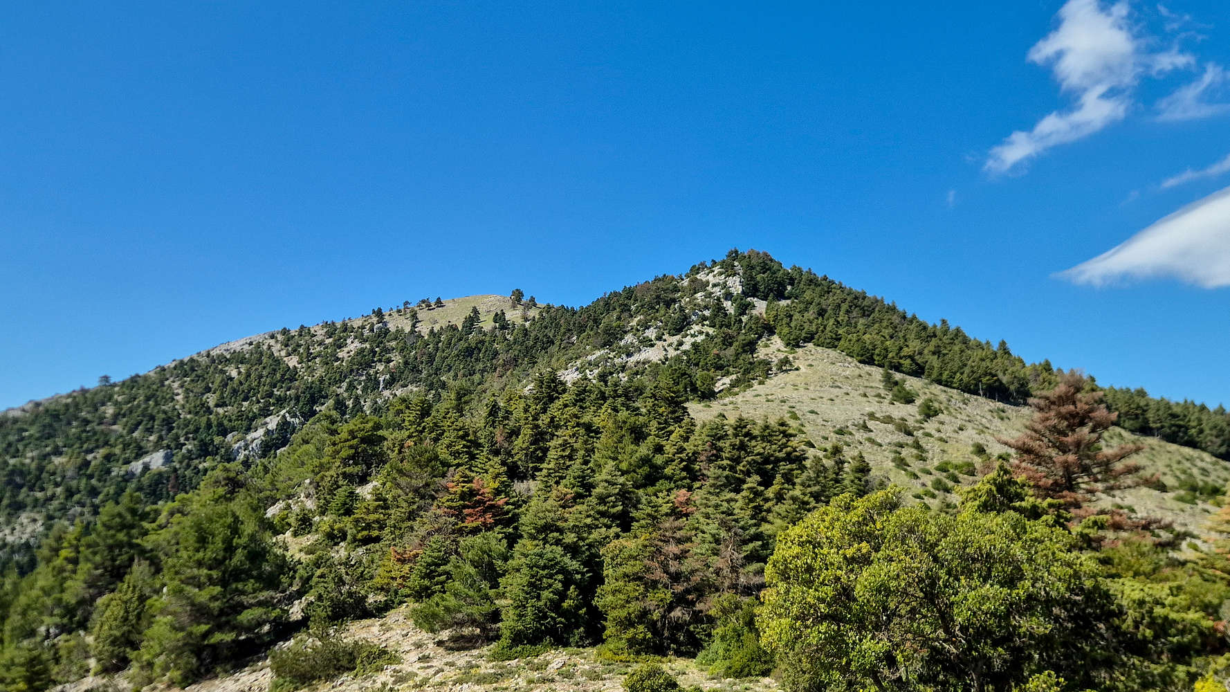
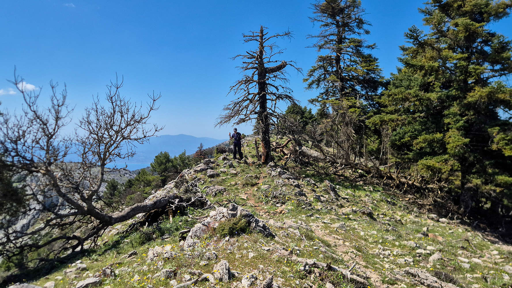
After a short break to take in the views, we continue North uphill and along the obvious ridge, with the trail forcing us to crest it and follow it from the NW side. Here the terrain was certainly subalpine, with shrubs and Firs, as well as a lovely small cliff band with lovely cracks. Although a fair distance, the traverse is dispatched with quickly mainly due to its clear track, and easy ground (T2). Once the mass of Psili Koryfi (1,170m) is reached, a slight ascent up towards a final forested ridge, is required, first through easy scree (T2+), and then passing through quaint meadows at nearly 1,050m. Here the trail markings give out again, and the logical line of the small and easy ridge (T2+) is used to bring us to the base of the summit cone. The views become increasingly spectacular, and the surrounding terrain adds to this with views towards the interesting limestone formations adorning the South Ridge.
Scrambling on the summit cone.
The airy final crest to the summit.
The summit cone itself could be the technical crux of the route, although it is incredibly straightforward. Essentially, it is a continuous craggy done with bulges of limestone that vary in size and steepness, a slightly experienced hiker should be able to discern the logical line which does not exceed (T3/+). Generally, it is quite a safe prospect with easy retreat, and a uniform grade, not to mention that the hardest move is perhaps the first climb onto the cone itself. The area around the ridge offer very easy options of about <1m in height. The summit itself is unmarked, but clearly the highest of the massif with expansive views across Central Euboea as well as a clear feeling of airyness, especially on the final crest (T3-). We reached the summit after 2:50 hours.
The ESE Face slabs and cirque, Gymno village far below.
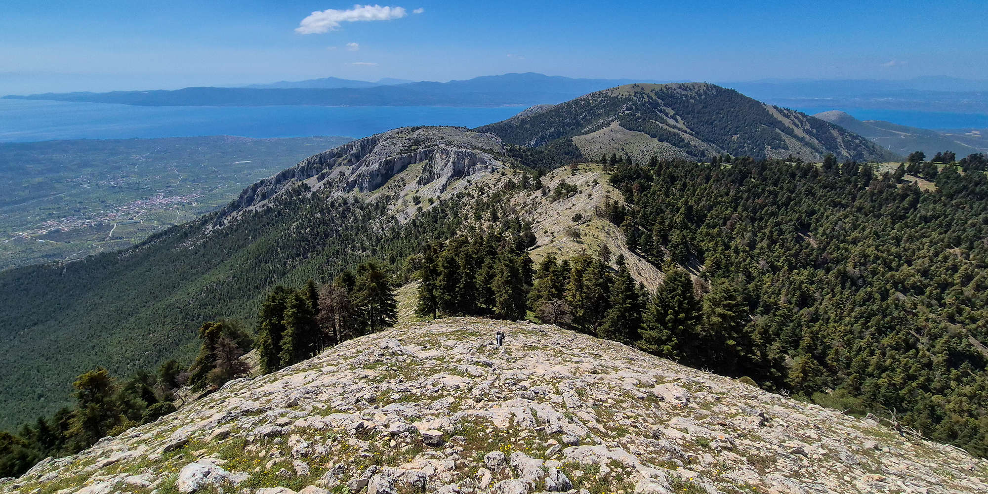
We spent nearly half an hour on the summit, enjoying the great views offered by this vantage, clearly observing Dirfis (1,743m) [P-1743], Manikia, and the entirety of the Euboic Gulf. We were joined by a Eurasian Kestrel (Falco tinnunculus) which made the best of the thermals generated by the steep slopes that opened up below us. The mass of the mountain, its prominence, and vast forests left a feeling of unique isolation, one perhaps only driven by elevation. After a few minutes of rest we began retracing our return.
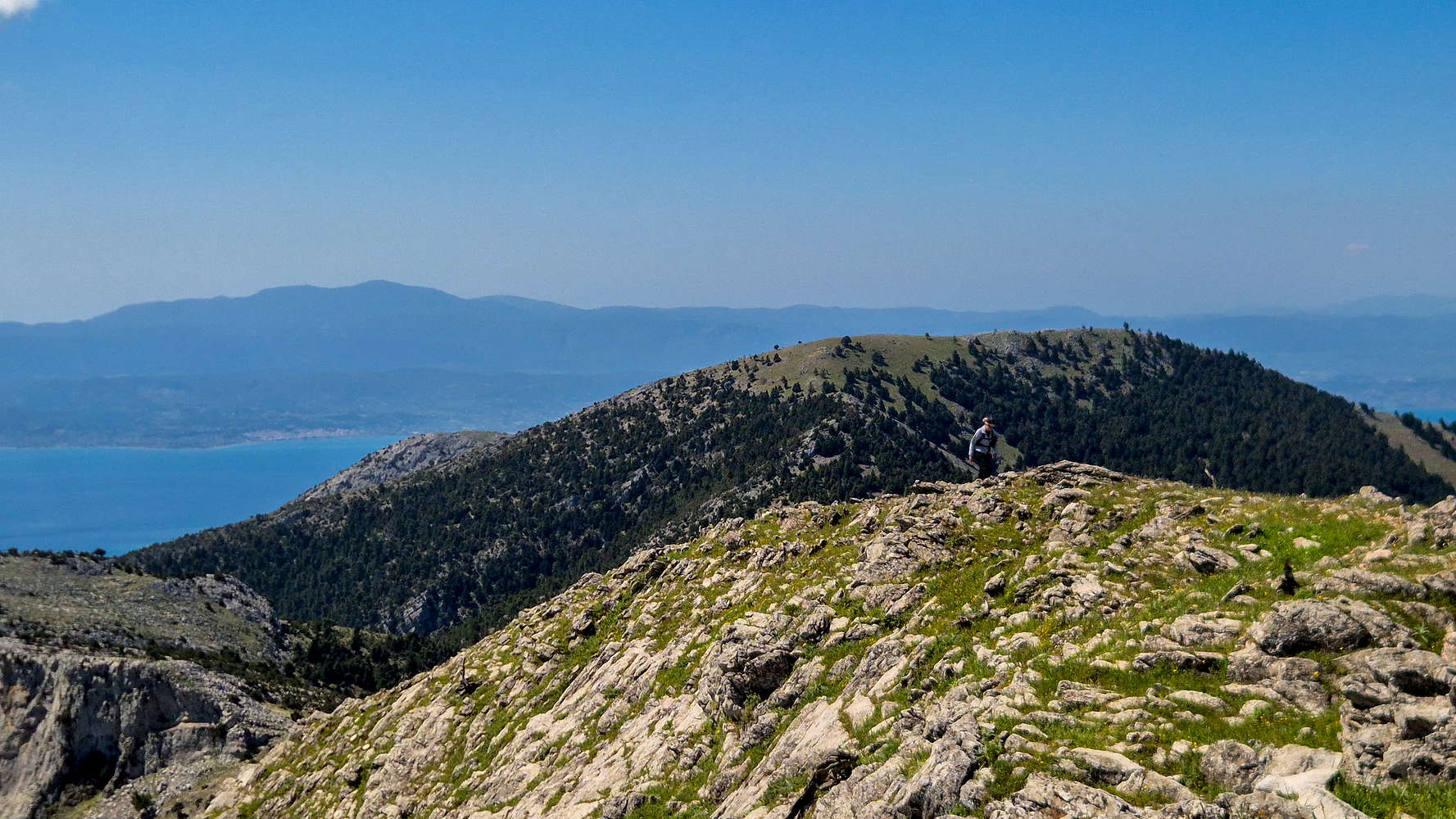
Retracing the traverse to Elatias Col. (950m).
Returning through the forest.
The summit cone needed some attention on the descent, deserving of its T3 rating, but was dispatched with quickly, as was the traverse back towards Elatias Col. (950m) which at first seemed tedious. It actually felt solemn to leave these limestone formations and old tress behind, since, perhaps, we would never get to see them again. The views from the Col. took our mind off things, enough to provide a false sense of safety as we descended rapidly. With every steep and strong step downhill Terry’s injured knee began to give out. Perhaps fueled by adrenaline she was able to complete the demanding descent in very impressive time, just 20 minutes for an equivalent 50 minute ascent! We were yet again in the flatter forest, and could coast back to the car.
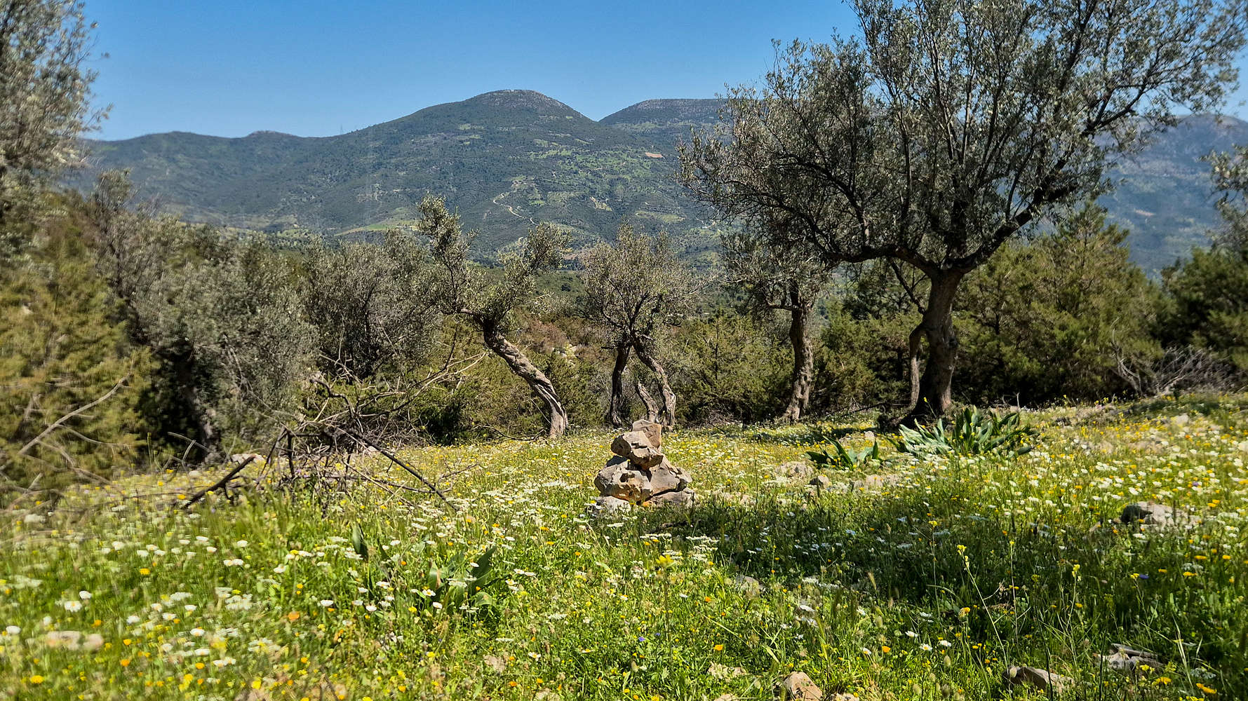
A cairn marking the way through the Olive grove.
Exiting the ravine after 5 hours.
This lower forest section is pleasant enough, and with a wide and well-trodden track on a low incline made for easy going. At this point the heat expected at this time of year and at this elevation had began to take a toll on us and our pace dropped. It wasn’t all bad as the views of the crags across, the company of unidentifiable birds, and a chance encounter with the same Marginated tortoise we saw earlier, kept things interesting. Under the glaring Euboic sun we exited the forest, and in our more relaxed pace had a chance to admire the quaint Olive grove the path made its way through, before dropping into the ravine; which we had been following up and down for nearly 5 hours. From there the few meters of rougher terrain could not keep us away from sitting under the AC in the car.
Interactive Map
Logistics
As a (half-) day trip from Athens, there was little logistical planning necessary. We simply drove 1:30 hours to this farmhouse (📍Google Maps), outside of which we parked, and then proceeded to hike. We returned early back to Athens but it is possible and recommended to combine the ascent with a visit to Eretria or Chalcis for some quality seafood.
Nearby Peaks
The following is a list of significant nearby peaks.