Kaliakouda (2,099m) [P-783]
Summited On: May 3, 2025
Region: Evrytania, Central Greece, Greece.
Overview
Kaliakouda (2,099m) [“Καλιακούδα”] is an imposing mountain making up the NE quadrant of Prousos - Karpenisiotis canyon (“Προυσός-Καρπενησιώτης”), located S of Karpenisi (“Καρπενήσι”) and Tymfristos (2,315m) and E of Chelidona (1,975m). The mountain is the third highest entirely in Evrytania (“Ευρυτανία”) - fourth overall - and due to its sheer summit cone is often mentioned in Greek folk music and stories. It is dominated by dense vegetation, mainly firs, and is composed primarily of limestone. However, it features a widely under-developed trail system as a result of its steepness and technical grade. In fact, the ascent to the summit is considered one if not the most technical normal route on any mountain in Greece*, featuring sections of Class II scrambling over significant exposure. Mountaineers can tackle this challenge directly during the summer by driving to Kaliakouda Pass (1,750m), one of Greece’s highest roads.
(*) Always excluding Olympus (2,917m).
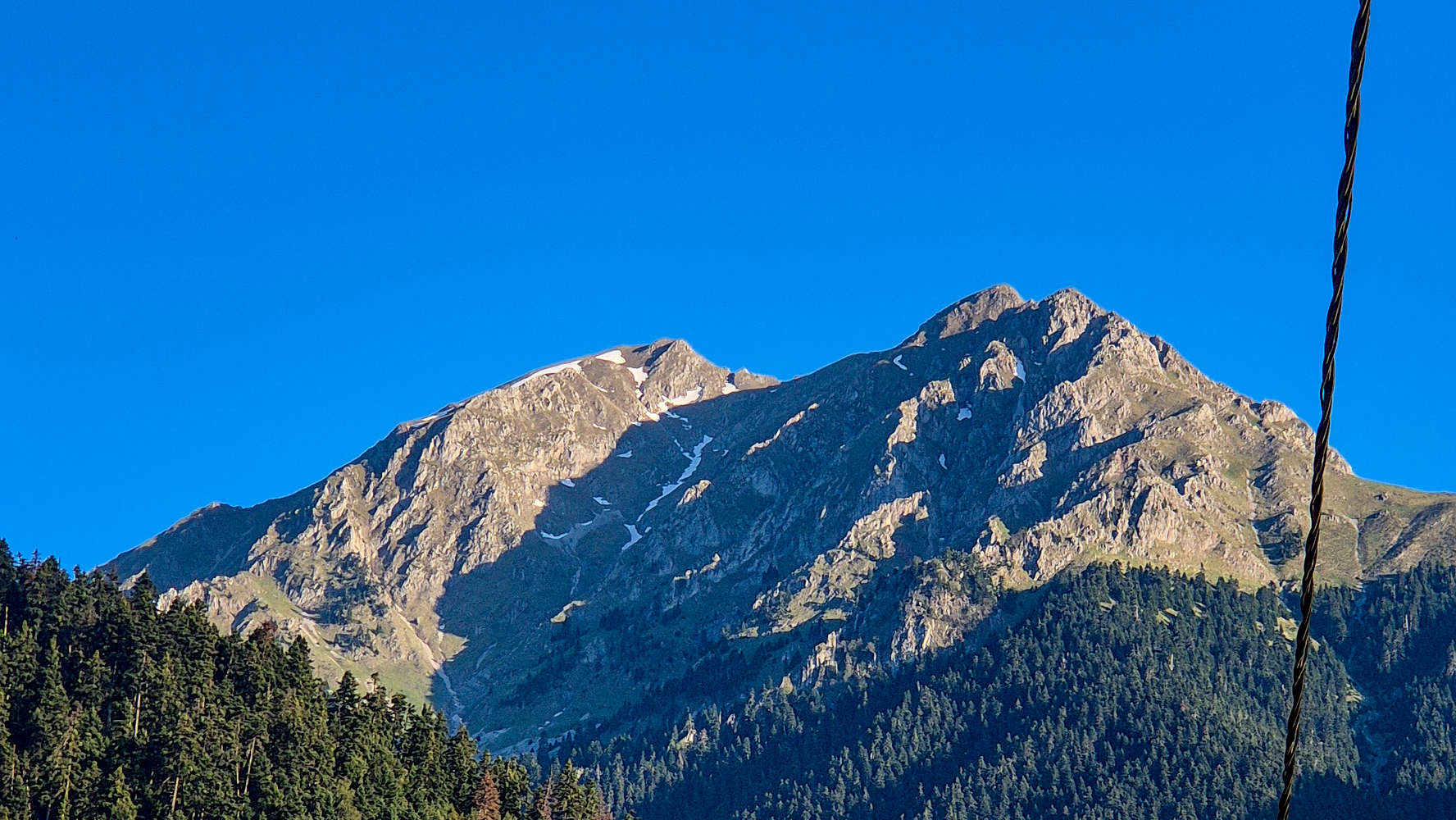
Kaliakouda as seen from Megalo Chorio.
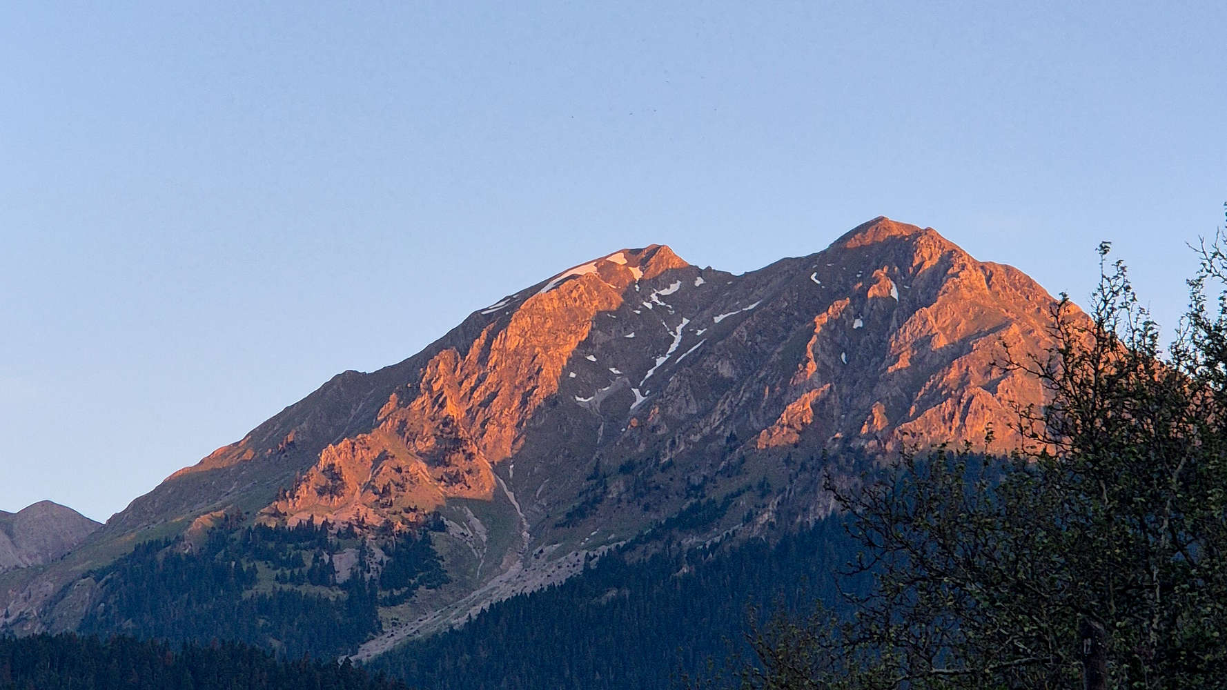
Kaliakouda during dusk.
Kaliakouda (2,099m) due to the seriousness the route in terms of scrambling and exposure was chosen as the primary objective of our Evrytania May 2025 Trip, since Velouchi (2,315m) had been summited by Terry before and bad weather diverted my solo attempt to Anemos (2,044m) [P-144]. As such on Saturday May 3rd we awoke for a second morning below the steep N Face of Kaliakouda (2,099m), this time aiming to reach its summit. We took a leisurely pace on account of the cool temperatures and stable weather and began driving towards Kaliakouda Col. (1,750m).
We decided on sleeping in and driving to the top of Kaliakouda Col. (1,750m) with our 4WD SUV instead of starting from the Refuge (1,500m) as was planned originally due to the lack of any technical challenges on the steep approach hike. We would instead focus our efforts on the summit pyramid, and have plenty of time to do so safely.
The Route
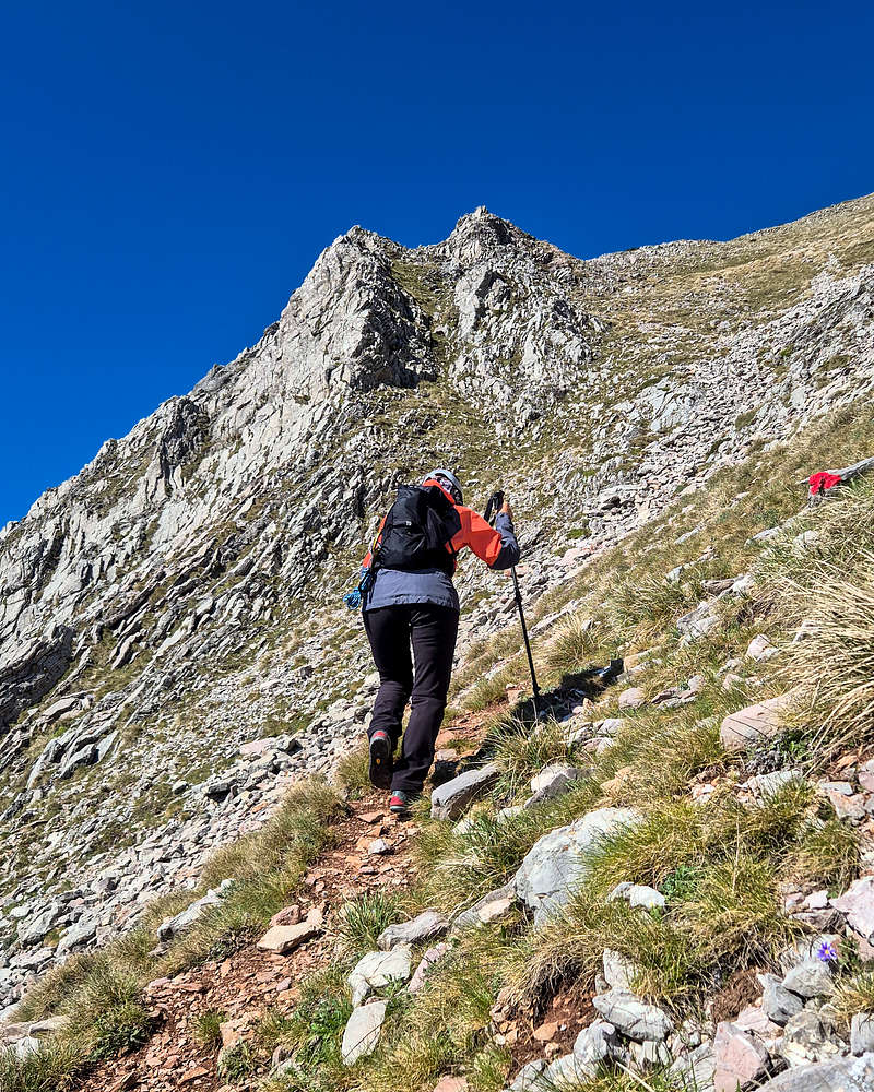
We pulled into the small flat spot of Kaliakouda Col. (1,750m) at around 09:30am, having briefly stopped at a small chapel on the forestry road, and quickly dressed into gear and wore our helmets for the first time in almost 10 years for a 2,000m summit objective. Just before starting, a solitary red figure appeared, I waved and he did too, and begun his own solo ascent on the route. He would assist us greatly by providing us with a visual cue on the maze of the route, impossible to discern from the col. Leaving some space between him and us we set of at 09:44am, with 350m between us and the summit. We followed the marked trail along the grassy ridge, next to the massive NE Face headwall and with incredible views towards Velouchi (2,315m). This first section starts easily and gradually increases both in steepness and route difficulty. Within the first 10 minutes the grade exceeds 25-degrees on rocky terrain, ascending via a thin ledge. The route will slowly traverse the East Face until nearly below the small headwall to the S (left) before heading directly for the 1st Crux. Up to here we felt secure with the trail condition and made good time of 18 minutes on the marked route, reaching the base of the crux at 1,875m. Up to here the use of hands (4-point-scrambling) is not required.
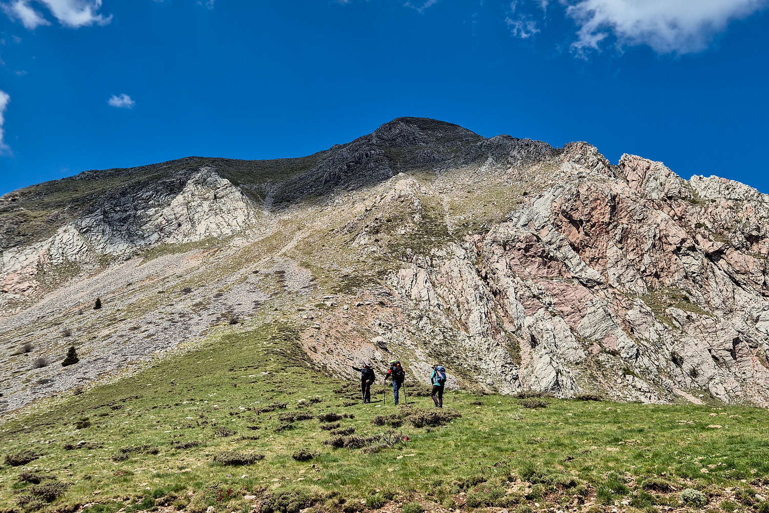
Hikers met at the end heading up Kaliakouda.
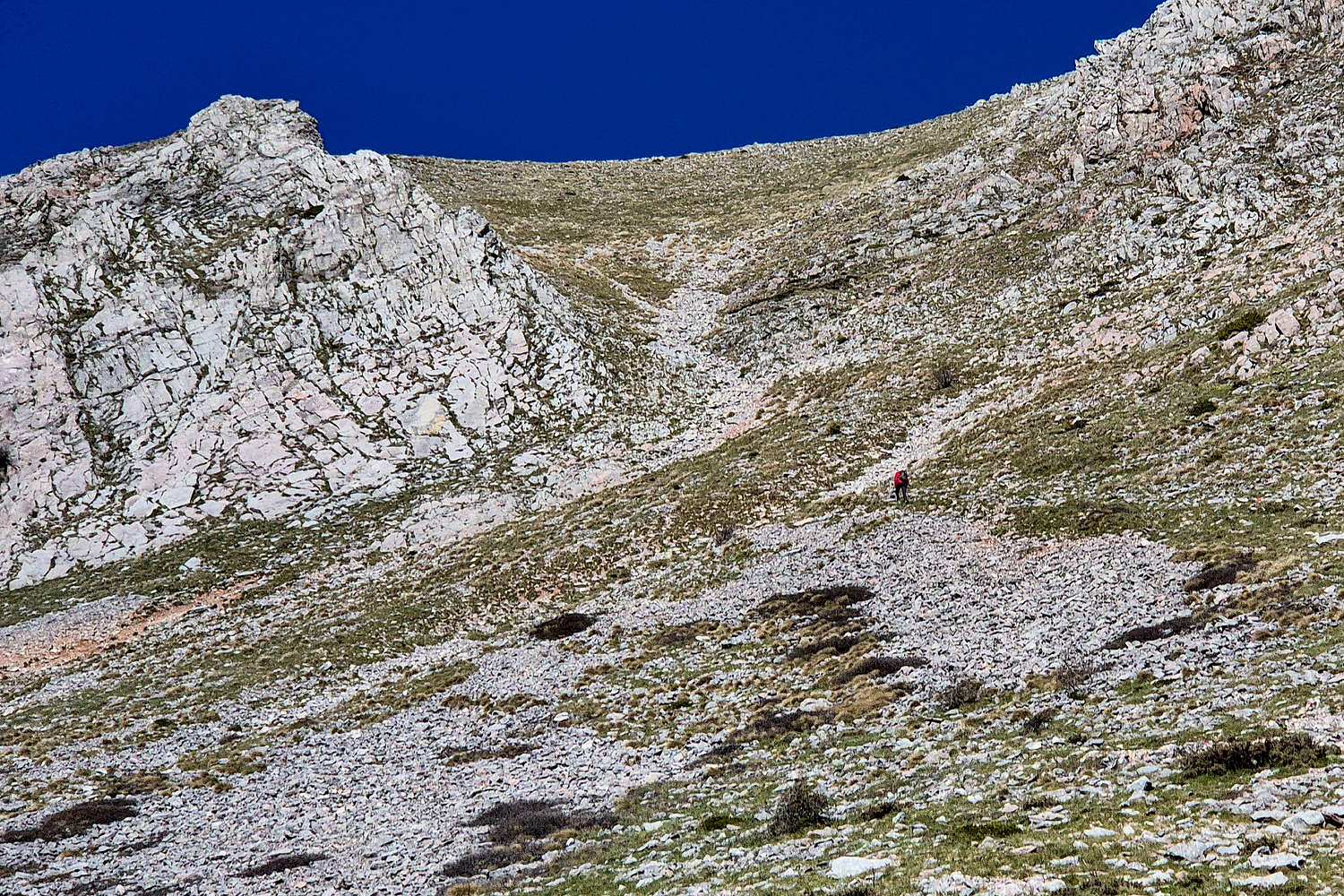
The solo hiker reaching the end of the traverse below the 1st Crux.
The 1st Crux is a long limestone ledge which must first be gained and then traversed. It is marked really well, but has consequential exposure to the right and behind the hiker. The only issues are either ice (verglas) or a short hiker; who may have difficulty making the first high step onto the ledge. Terry had some difficulty with this, but quickly gained the ledge. I found this section to be much easier than expected, having a mild local incline, it would narrowly be graded as a Class I passage. After traversing the ledge safely we continued up the face following the markings on ever looser and steeper track (T4+), and closer to a marked mountaineering route. Another traverse is required 1,950m - at the base of which we were within 40 minutes from the start - which however has no scrambling difficulty, but airy exposure into the face. The traverse ends at the base of a small Spur on the East Ridge which is the next crux at 1,980m.
Terry at the end of the traverse below the 1st Crux.
Terry ascending the 1st Crux of Kaliakouda.
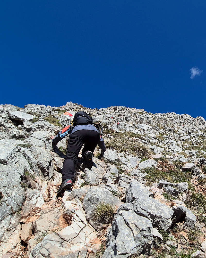
The 2nd Crux is a steep scrambling section which is “slab-like” offering a mix of holds without any specific feature on the concave outcropping of rock. Depending on the season, vegetation can alter the availability of holds. On our visit careful selection of holds was required to ascend the 4-5m at the steepest point. Here on the hikers right there is also a limestone wall forming a dihedral, offering a more technical but less exposed line of ascent. I opted for the “slab” to the left. This is undoubtably the route crux, at a comfortable UIAA II, or GSS II+ and is especially problematic for downclimbing - especially in case of an accident.
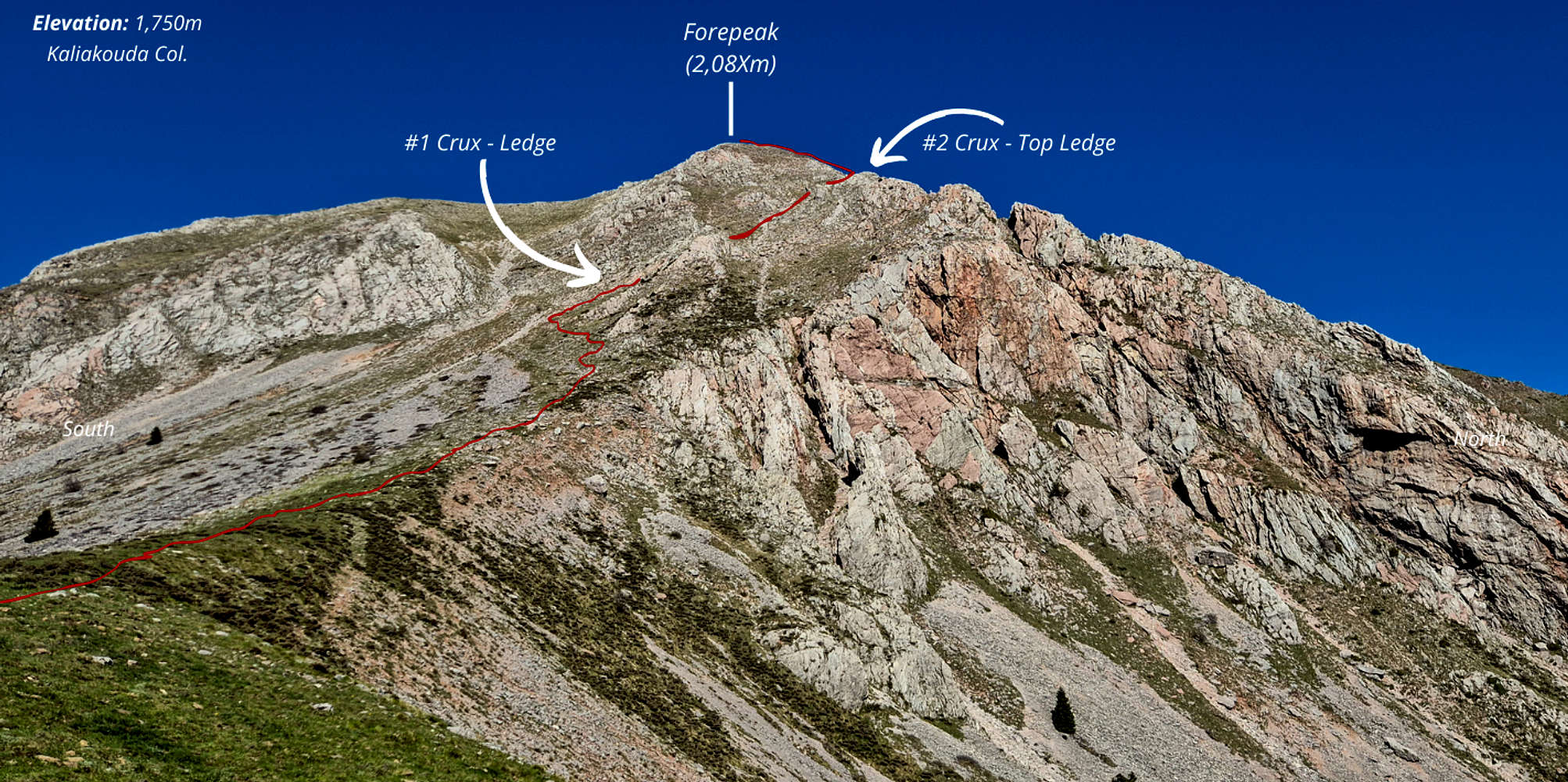
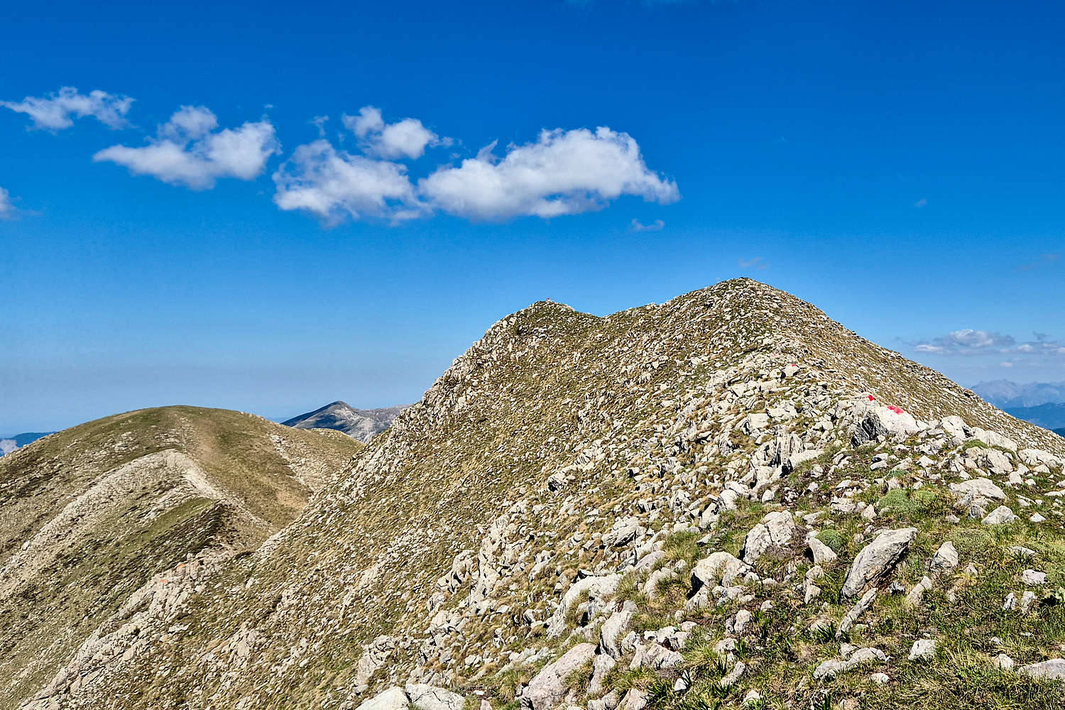
The Route as seen from Kaliakouda Col.
Topping out the 2nd crux we enjoyed a well deserved break on a small ledge, atop the massive NE headwall, providing an exceptionally refreshing airy experience after being “trapped” in the face for an hour. The reprieve was short-lived however, as a final section of ascending the small Spur ridge E → W towards the summit ridge (N → S) still remained, and looked formidable. With very few stable handholds available, a serious grade, and a very airy location 350m atop the face this final steep and loose section is a final committing challenge for this summit. After countless switchbacks we topped out on the summit ridge 1:15 hours after starting; time 10:59am.
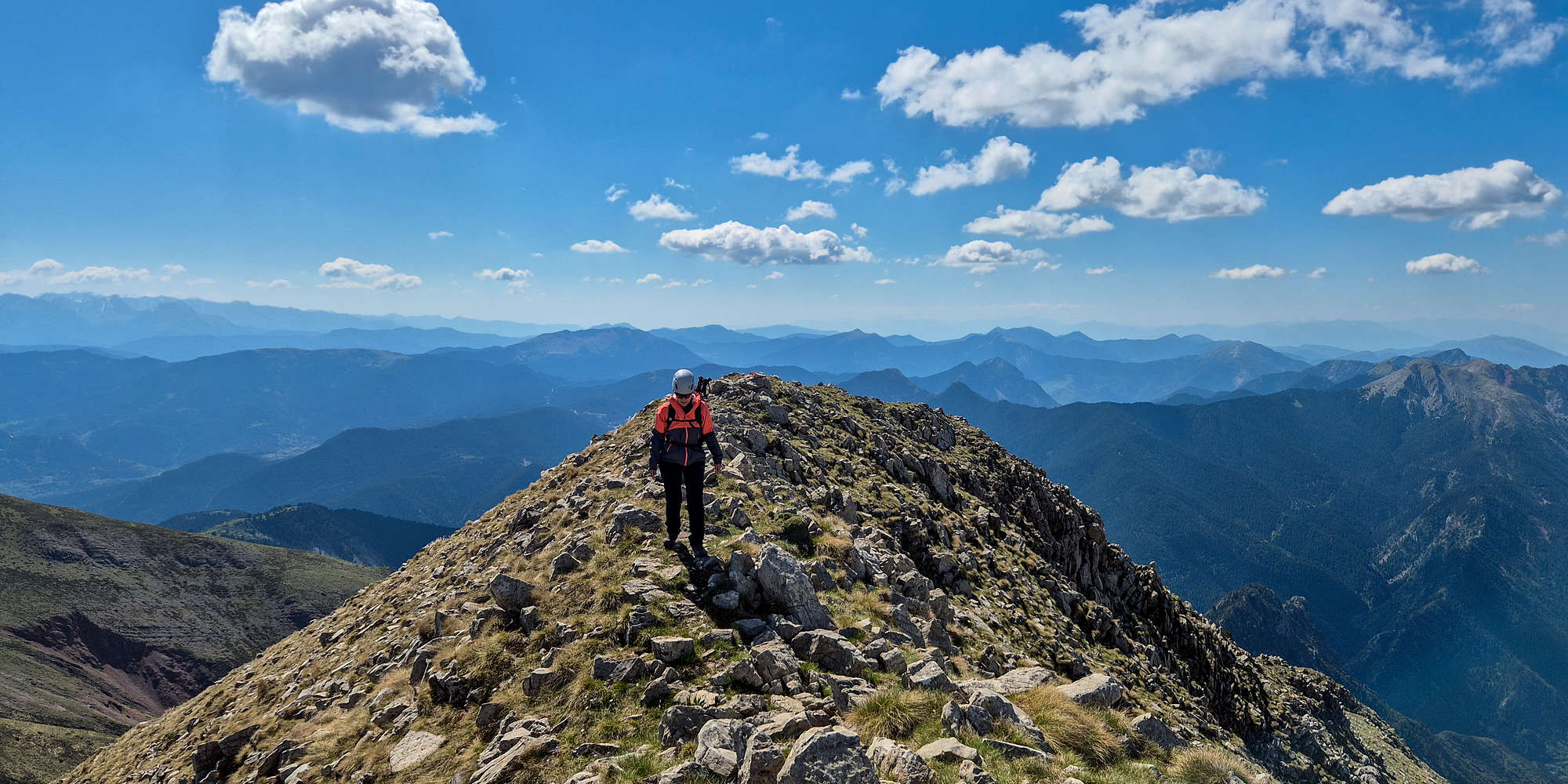
Terry on the top-out ridge!
The final section to the true summit and trig point was a tightrope walk across a couple of small ridges for 150m or so. The knife-edge-thin ridges of the mountain provide an exceptionally airy experience and are in my view, unrivalled. Additionally, the grassy friendly terrain up here was a welcome break from the rocky hellscape below. We gained the last few meters on this otherworldly place and I literally hugged the trig. in relief after 1:23 hours. We enjoyed a long chat with the mornings mysterious figure on the summit before heading back down.
The summit of Kaliakouda.
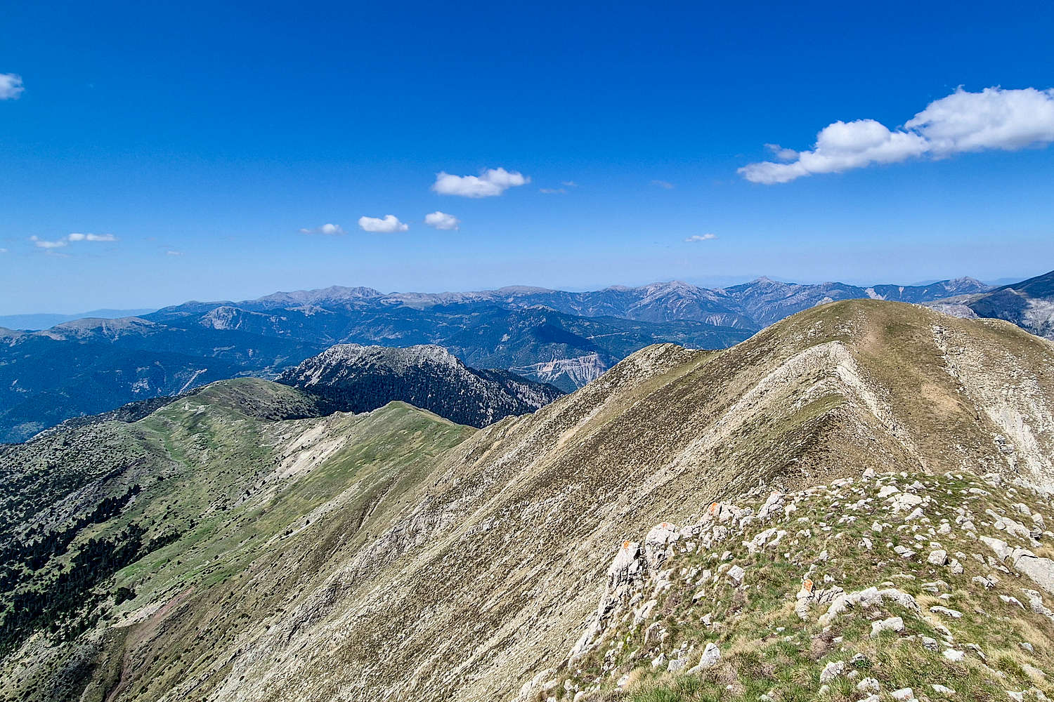
The West ridge of Kaliakouda from the summit.
The descent was an equally, if more, serious affair due to the steepness of the route, and potential hazards. I decided to downclimb the 2nd crux via the dihedral, which is definitely a GSS Class III+ passage, and we were quickly reminded of the difficulty of the route, making slow work of the crux downclimb. The 1st crux was much easier with it being a ledge and large steps, but the sense of urgency and risk was still present. We were glad to reach relatively “safe” ground under the 1st Crux at 1,875m after 2:35 hours from the start. The rest of the descent was made slowly still but no difficulty was encountered here. Helmets were unclipped within 50m of the car, we were done with a total time of 2:50 hours. Just as we reached the car a party of 3 aiming to be the third party to summit arrived at the Col., pleasantries and beta were exchanged. They went off towards the sky, and we were off towards home.
Sightseeing
Since it was planned to be our last day of the trip, with an afternoon arrival into Athens, we had limited plans to have any sightseeing, in comparison to the previous day of the trip during which we visited Prousos (”Προυσός”) after the ascent of Anemos (2,044m) [P-149] in the morning. We had limited interest in staying around having seen most of the area before, and headed to a bakery and butchers to buy some lunch and local foods (cured meats & cheese) to bring home.
Terry had kept an eye out on some local beers that were selling at some of the tourist shops around Megalo Chorio and suggested we pay a visit to the brewery as our “sightseeing” on the way back to Athens.
Carpinus Brewery
Conspicuously located behind a supermarket in lower Karpenissi city Carpinus Brewery is a small batch artisan brewery operated by a local father-and-son team. They produce a variety of very flavourful beers including ones with cherry, and chocolate with whiskey taste. Some of their batches are incredibly small, measured in the few thousands bottles (500ml) range. The love for their craft was evident and we were more than happy to purchase two large cases of assorted beers, as well as a couple for the lunch we just bought.

The owner of Carpinus Brewery in the small office & his beer cap collection.
We bid farewell and visited Karpenissi center to enjoy our baked goods and refreshing beers at the small Bakogiannis Park just outside the center. Soon we hit the road again, this time finally returning to Athens.
Interactive Map
Logistics
This was the last objective of our May 2025 Evrytania Trip, during which we stayed in Megalo Chorio (”Μεγάλο Χωριό”), a village South of Karpenissi at “Levanta Guesthouse” for two nights. Our approximate iteniery was:
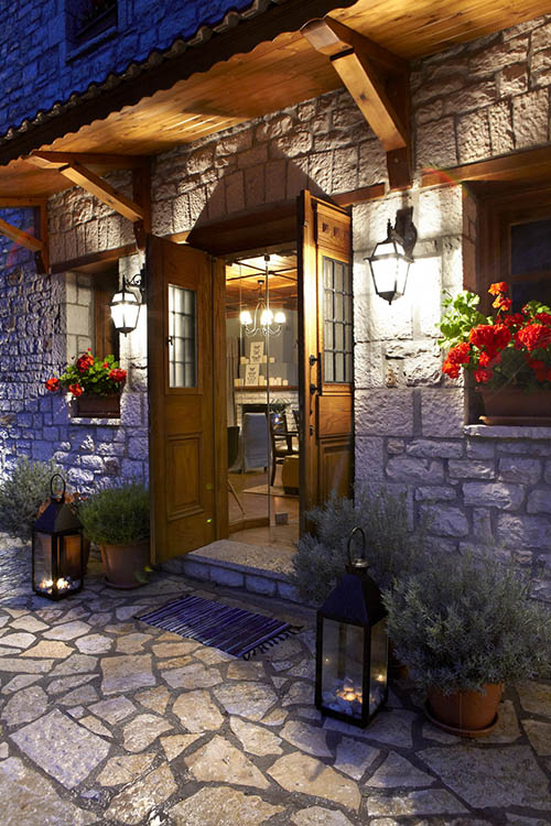
Λεβάντα Guesthouse
We spent two nights at Levanta Guesthouse (meaning Lavander) situated at the entrance of Megalo Chorio with exceptional views across the valley towards Chelidona (1,975m). The room was nicely appointed and kept in excellent condition, the balcony was similarly lovely and with the aforementioned great view. A solid breakfast was included and the location had convenient parking very close by. Great experience, exceptional value for money and friendly staff.
Complimentary maps available at reception!
Nearby Peaks
The following are notable peaks nearby Kaliakouda (2,099m) [P-783].
Chelidona (1,975m) [P-734]
Tymfristos (Velouchi) (2,315m) [P-1117]