Makriplagi (1,369m) [P-1032]
Summited On: May 18, 2025
Region: Attica-Corinth, Central Greece, Greece.
This was first posted on Summitpost.org as “Attica Classics I - Geraneia”.
Overview
Geraneia (1,369m) is a large mountain range situated N of the Isthmus of Corinth and SW of Athens, it is well known due to its prominence and limestone ridge, visible to drivers making their way into the Peloponnese. Some winters, its exposed ridge bids farewell to travelers covered in snow, a rare and pleasant sight in the otherwise dry and hot region. Wind-blasted, and sand-beaten the immediate area of the isthmus (between Ancient Corinth and Megara) is dominated by only one landform, Geraneia (1,369m), crowned by a soviet-looking telecom tower on the center of its summit ridge. The area today is nothing but a highway; our point of entry, Ag. Theodoroi, an old summering town for Athenian working class is now but a shell of its former self. The nearby town of Loutraki attracts older folks due to its large Casino, and the ruins of the Heraion of Perachora remain all but forgotten, alongside Sousaki Volcano. An area of rich naturalistic interest just 45 minutes from the Athenian front door but wildly overlooked as “nearby” and “unimpressive”, which in reality is nothing but.
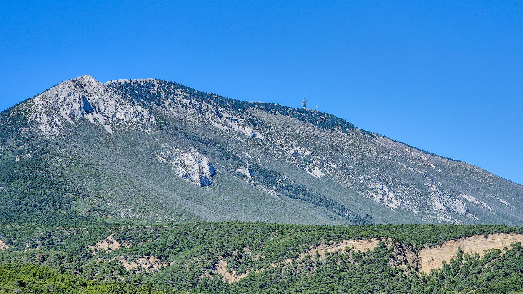
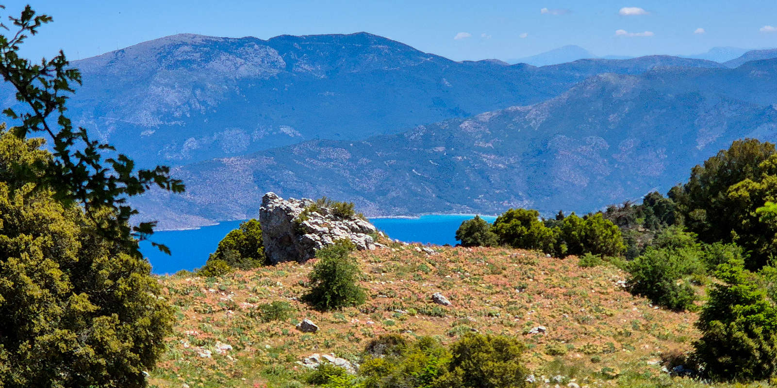
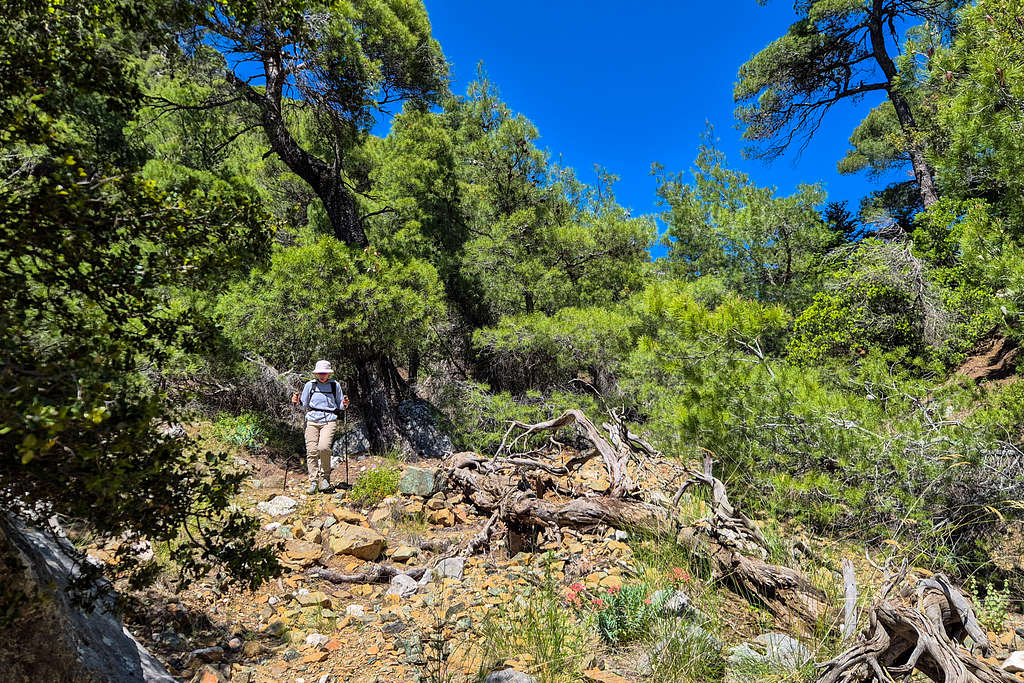
Makriplagi of Geraneia as seen on the approach.
About the Attica Classics
The more I spend time outside the more I find the edict of peakbagging, focused on solving for the easiest path to the top, to lack a certain soul, at least in a place like Greece where poorly maintained dirt roads make their way to most summits. That is not not suggest I am not guilty of the same crime. In that spirit I collated the Attica Classics, a project involving the ascent of the highest mountains of Attica, the regional department of Athens. Most of our local mountains, including the highest, Parnitha (1,413m), have paved roads leading up to their summits, and they are frequented by thousands annually; and besides they are nearly half as tall as others. Those are all bad reasons to overlook these mountains, and thus, the Attica Classics project aims to answer an important question:
How much fun can you have hiking up to 1,413m and about 1 hour away from a city of 5 million?
The general specifications for the routes selected are simple. They must be on one of Attica’s high mountains, they must be hiking or scrambling routes (i.e. no protected climbing*), and they must be less than 1:30h away from my house. Each route is considered to be the ‘best’ route on each mountain.
Route
Part I: The Gambler
Driving on the swerving narrows of the final paved roads above Ag. Theodoroi, I was amazed to discover a new perspective into this gorgeous mountain. From our vista above the S-SE drainage the mountain’s true size revealed itself in front of us. Lush low-elevation Mediterranean pine and assorted shrubbery spanned tens of kilometers on either direction, no buildings were to be seen, other than the sentinel of a communication tower on the summit, some 1,200m above us. As we dropped into the drainage, following dirt roads to slowly gain elevation, the size and steepness of the Makriplagi (1,369m) massif made itself evident. The pines hung to its slopes from vey low, eventually giving way to darker colors of the temperate pine forest, and above that shining rocks and minuscule shrubs of the alpine. In awe but still under the impression of control we arrived to our trailhead Ntantiza plateau, an amphitheater of incredible volcanic and sedimentary formations at 650m of elevation directly in the heart of the mountain.
Here, according to legend - arcane Greek hiking websites - there should be a marked trail ascending the SW gully, gaining 300m to Tries Portes Pass (1,047m) and then making a direct ascent of the summit ridge from the E-NE. This brings one to the end of the road for the telco equipment, and then a final 800m of ridge walking is required to the true summit, all the way to the SW. According to our undated beta we should expect 3 hours from car to summit. And so, we started our ascent, happy to have landed the route in perfect cool, windy and shaded spring conditions. We stumbled around to find the first marker, crossed the gully for the first time, and disappeared into the dense vegetation.
Part II: Into the Bush
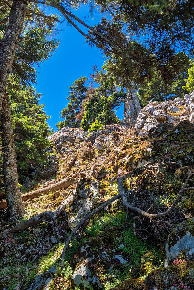
The first few trail markers initially cleared us of any worries of trail quality as we weaved through the dense pines and scattered boulders, although it quickly became obvious that it had been left unmaintained for some time. As we continued trough the narrow gully, slowly gaining elevation our predicament became even clearer as trail marking disappeared, the trail outlines multiplied, and the debris became normal. While we were right on the mapped GPX track the hyper-active geology of the area, that being rapid erosion of the volcanic N slope, and the earthquake activity of the nearby Halcyon Fault, had forced away any type of human infrastructure on this remote slice of the massif. Even the several springs and watering holes were destroyed, simply debris left behind crushed and covered by rocks. After about an hour we broke above the dense vegetation of the gully floor and into the pines above, we walked under gigantic limestone cliffs, unclimbed, with negative angles straight out of a route-setters dream. But navigation here, devoid of any markings and with few ‘goat trails’ quickly became arduous under the morning sun. The usual fallen trees, tight bushes, and large boulders began to slow us down, and like Megaros millennia before us, we raced our way upwards, escaping not but a flood but the clenches of the impassable bush below us.
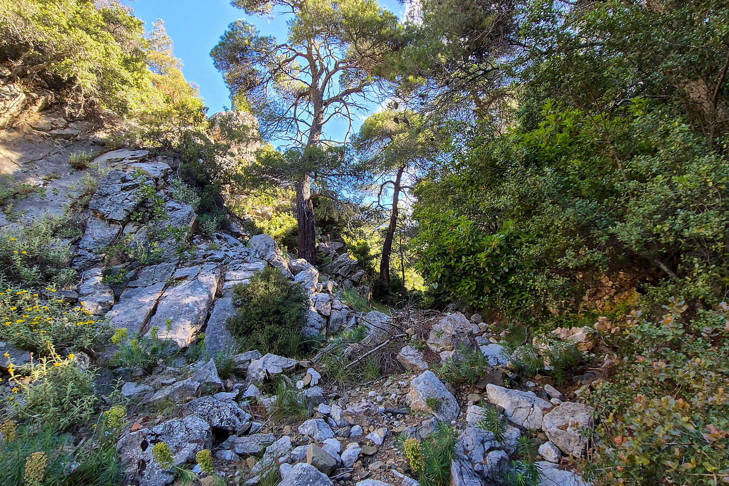
The entrance to Ntarntiza Gully (650m).
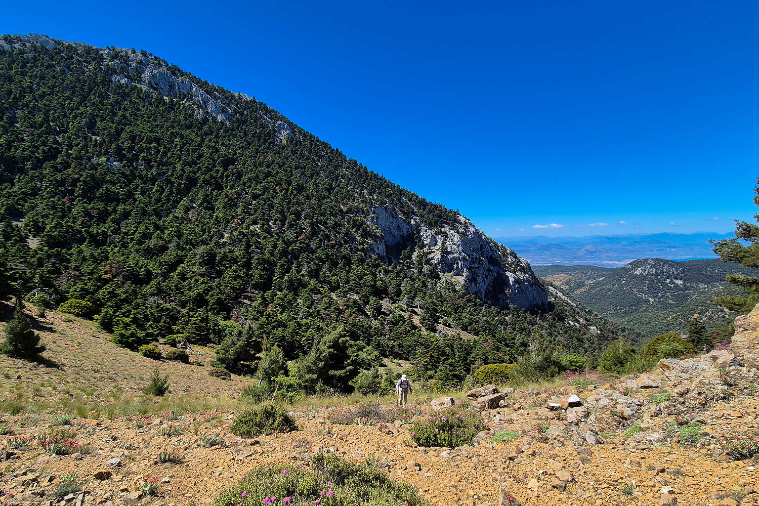
Topping out near Tries Portes Pass - 1,047m
Part III: A Halcyon Crux
The moment the striking blue of Halcyon Bay hit my eyes I at once felt elevated from my own self, as if somehow I had walked into a dream. The clarity was unprecedented with unimpeded views to all the neighbouring mountains, and with the homonymous islands seemingly within an arms length. Here on the NW edge of the main massif, the tilted limestone of the mountain rises sharply from the sea. It felt as if stepping past the pass and onto the slope would at once sent your rolling into the blue, some 1,100m below.
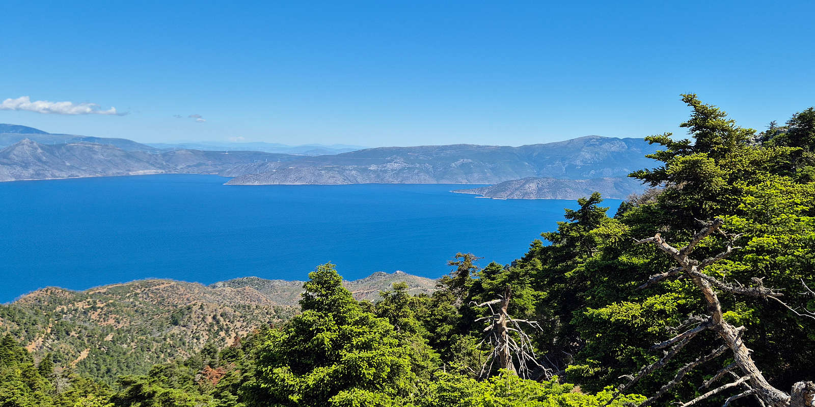
The Halcyon Bay looking N from Tries Portes Pass @ 1,047m
A view to the NE, Bay of Aleopochori and Kithairoinas visible.
Rejuvenated, and seemingly compelled we continued, initially traversing foot of the NW ridge on a narrow scree trail and with the sea steeply below us to the left. Ending our traverse well to the NE of the telco tower we were almost ready to turn SW (right) and begin our ascent; but not until the mountain opened to give us a spectacular view into the beautiful turquoise beaches of Alepochori (”Αλεποχώρι”). We foolishly joked about returning to the car and heading down for food; we were just over 2 hours from the car.
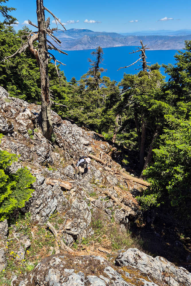
Terry gaining the easy scrambling crux on the NW flank.
A view of the crux from below.
Beginning our ascent of the NW flank we were enveloped in the sparse but beautiful alpine pine forest, rising almost from the sea and into the sky, and protecting us wonderfully from the bright sun of noon. Route finding became increasingly complicated while the lack of a trail on the steep forest scree was a challenge in of itself. Slowly but surely we progressed upwards, eventually gaining the W ridge, but here, where its large limestones meet the main summit cone, a true crux is to be found. Almost 3 hours in, we began ascending a limestone outcropping (Class I-) of about 7m with a clear view into the deep blue of the Halcyon bay below, in complete silence and solitude.
Part IV: Life in the Sky
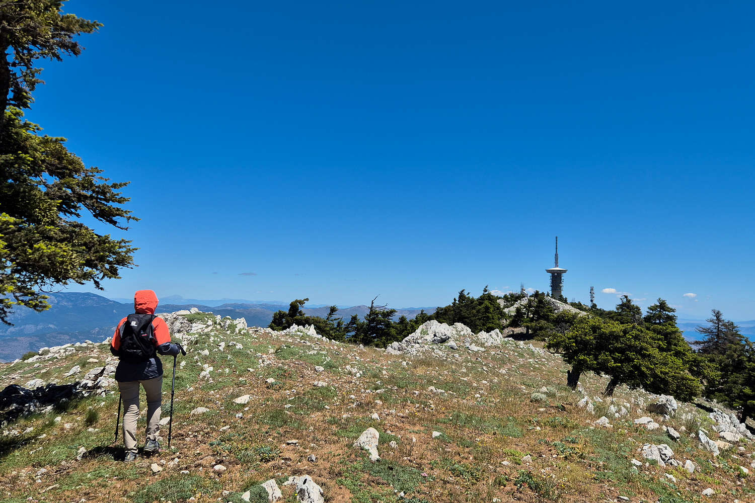
Still a ways away from the true summit we began the final slog through the ever steepening forest and towards the communications buildings above us. Luckily we were not aiming for the dystopian monster of a tower on the middle summit, but a small outbuilding further along the ridge. Still slowly gaining elevation we began to leave behind the taller pines of the temperate zone, and entering the brief low elevation alpine, beaten by winds and ice. Here the essentially unmarked trail was lost quickly and we made quick work of on-sight route finding to make our way to the ridge. Unbeknownst to us, going further E and ascending E to SW to the outbuilding made for a safer and easier ascent than the actual direct, which went straight up.
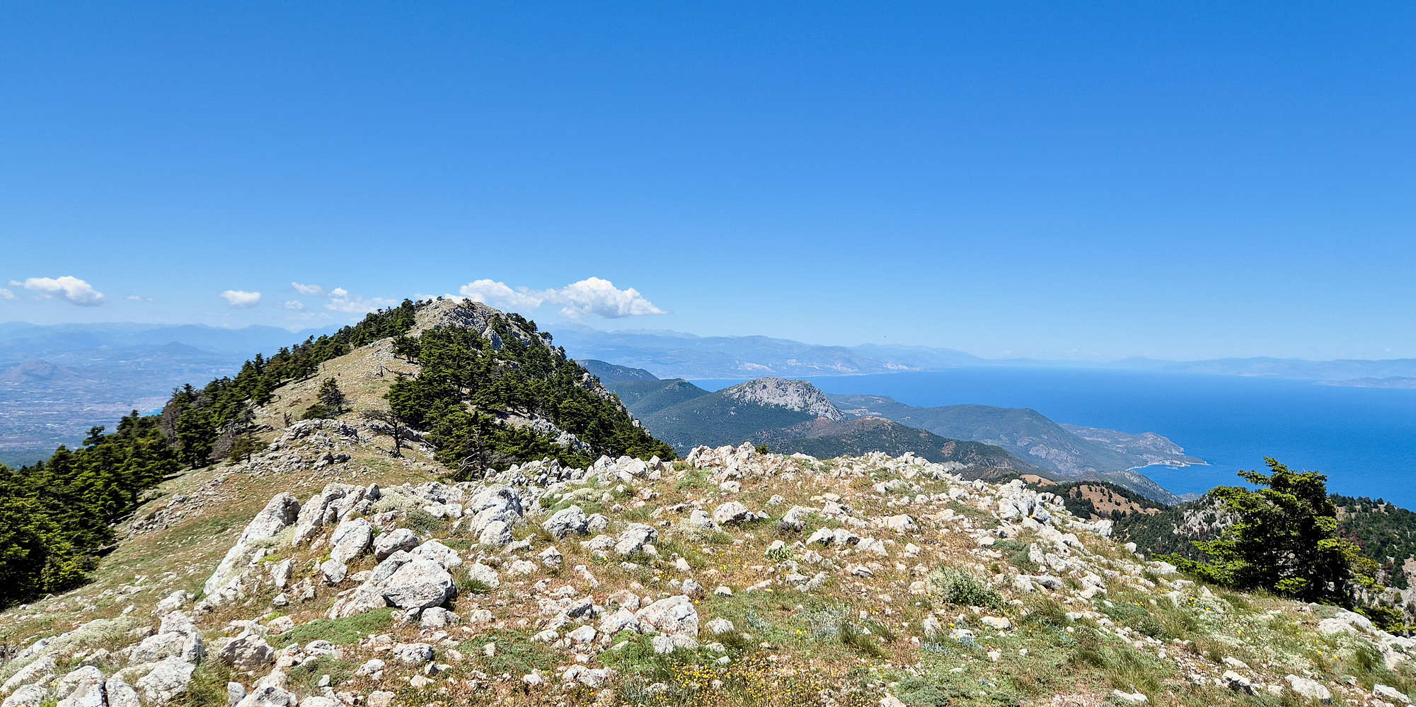
A view of Makriplagi summit ridge looking SW.
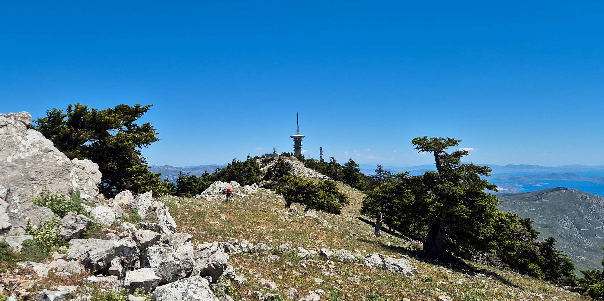
View of Makriplagi telco. tower from the ridge, looking NE.
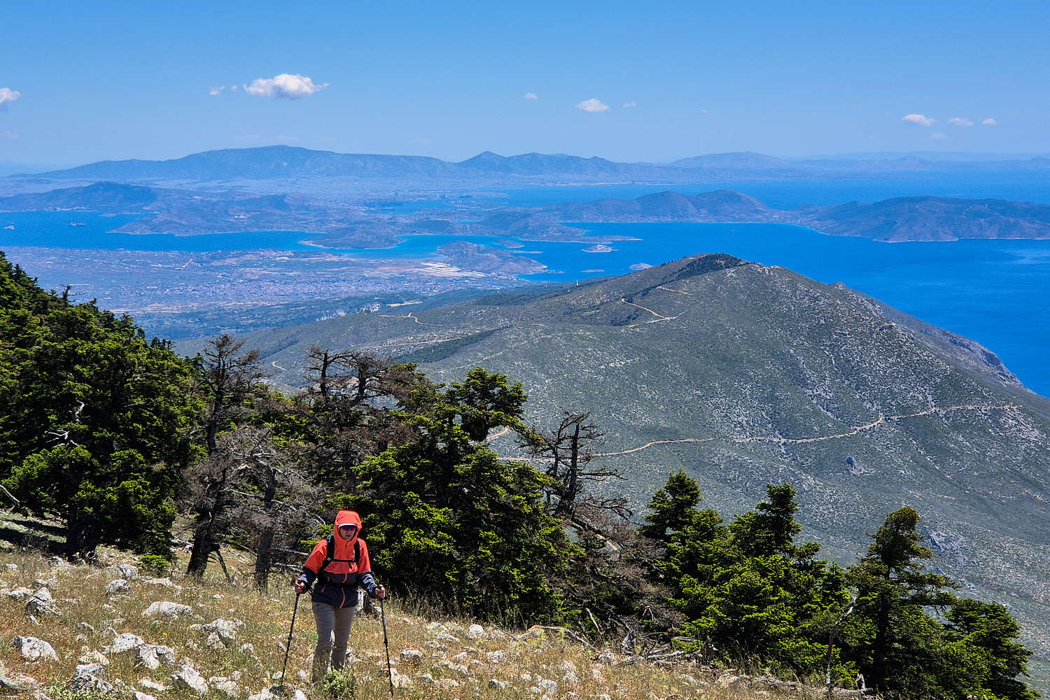
Breaking into the of Makriplagi (1,369m) we were at once again transported into a different realm as the shinning blue sea surrounded >280 degrees of view: the Halcyon Bay, the Corinthian Gulf, and the Saronic Gulf, just an arms reach away. Isn’t prominence a beautiful thing. Up here the forecasted winds finally hit us, and were a welcome feeling under the hot sun of the ridge. With extended views 100s of kilometers away we continued SW through the hilly but manageable ridge. Breaking over the enumerable crests of the ridge the sight never failed to surprise as one had a few more seconds to look around. After 4 hours we finally gained the trig point and the rounded true summit, almost a precipice, dropping steeply into Ntarntiza (650m), where our car was, and highly exposed to winds.
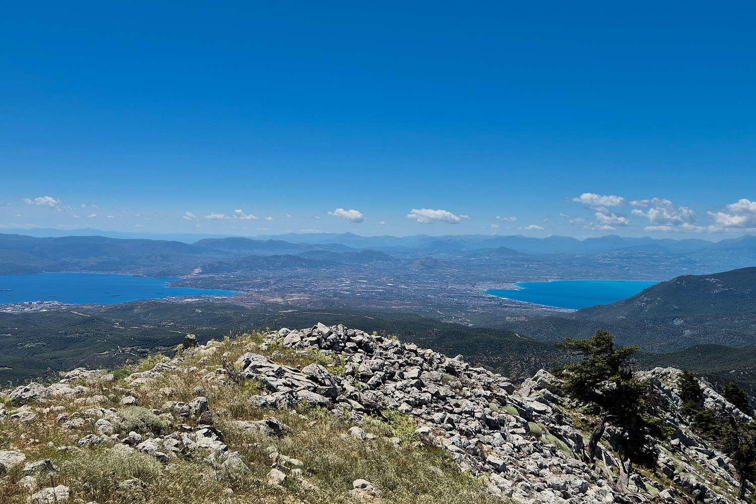
The Isthmus of Corinth as seen from above.
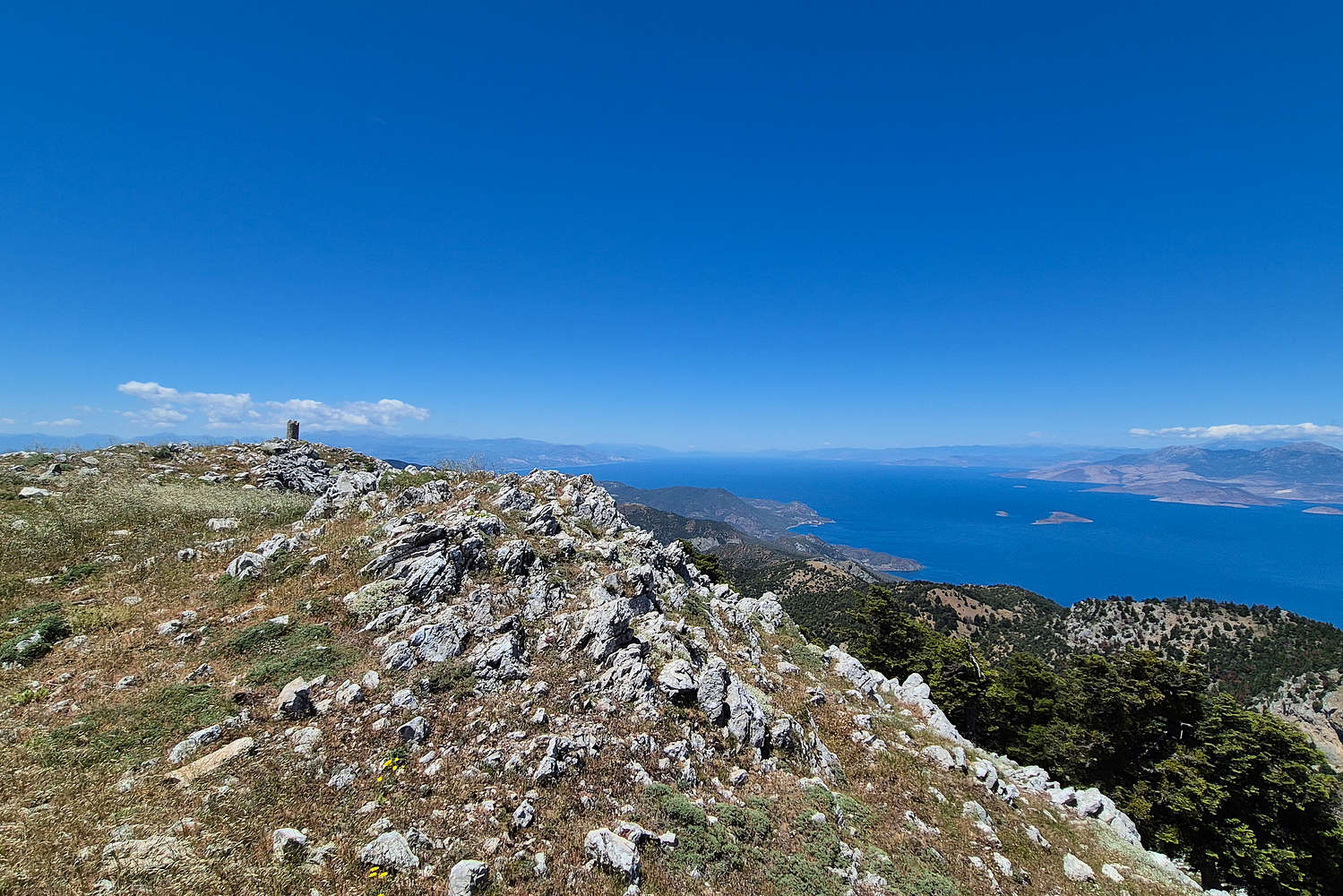
Makriplagi trig. point and the Corinthian Gulf.
Settling behind an outcropping on the ridge, maybe half way between the true summit and our route top-out, we enjoyed a longer break, took in the breathtaking view on this gorgeous clear day, contacted our loved ones, and of course had something to eat. Soon the long descent would be upon us, and worse yet, during an especially hot time of the day.
Part V: A Descent into Madness
Leaving behind the ridge we focused on the business at hand, following the sparse top section of the marked trail, which surprisingly descended a very steep and loose scree; confirming the improved approach on our ascent from further NE. The first section of forest yielded somewhat easily with the steep grade enabling us to lose elevation rapidly. Difficulties in route finding were present at passes, such as the crux (Class I-, 7m) whose entrance could not be discerned from above. Overcoming these few navigational problems we linked up the scree traverse and made it to Tries Portes Pass (1,047m) in just over 1 hour, making our return seem increasingly easy. But as we descended from the Pass and into the bush of the gully below things began to change.
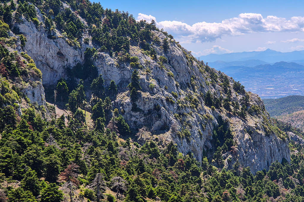
Spectacular NW wall of Makriplagi.
Descending Ntarntiza Gully during noon.
The navigation looking down-slope was extremely difficult with trail tracks abruptly cutting into dense vegetation. The mapped GPX track was of little help, and I resorted in following our ascent route by referring to my GPS every few minutes. The going was most difficult in the upper section where the low laying brush met the larger pine forest below, here detour after detour we progressively made our way down, past the upper and steepest parts of the gully, and onto its slightly inclined “bed”.
As we entered into the deep vegetation, often walking on the creek-bed itself, the navigation became incredibly complex, with passages through trees almost invisible at a down-slope angle. We made our way further down with the tried and true method of GPS back-tracking. Although not under direct sunlight the days heat had permeated inside the steep creek making the going arduous. Slowly but surely known formations passed us over head, first Makriplagi’s imposing NW wall, then the volcanic hoodoo like form, and finally the end of Makriplagi’s ridge, far above us, ones we would probably never seen again. As we approached towards the spring and known trail markers reappeared the going became longer than ever. Stepping in and out of the creek bed the descent seemed to go on forever; another turn, another change of bank, another GPS stop. With my partners incessant questioning of whether we were “on trail” - having well established the nature of the route on our 5+ hour journey so far, I grew quiet and focused on just navigating, fast and consistently. Finally after passing the narrow “gate” of the creek we were at the run out, almost to the car, but even this went on forever, the longest 200m of my life; so far. The route took just over 6 hours, all in.
Part VI: Epilogue
Having set out with a “thesis” on a project, and attempting a relatively unknown route on a nonetheless extremely scenic and challenging objective as the first one is always a hit or miss, but in this case the success tells a lot more about Greek mountains and their nature.
Hiking the ridge with amazing views of Megara, Salamis, and Athens.
Hiking back to the telecom tower on the return.
In Geraneia (1,369m), a place so close, deliberate policy choices, and the randomness of tourism trends, has served to foster a true mini-wilderness, one which is amplified by the inherent rugged nature of the mountains themselves. In many ways the draw of the “exotic” in outdoor activities has also left its mark here, allowing the mountain to subsume any attempt at taming its remote corners. I believe that this route felt spectacularly secluded and remote, even with a paved road leading to the ridge. It would be correct to suggest that the road is in of itself a futile attempt at taming this mountain, and offers little if any help to anyone on foot. Finally, in many ways this route brings a lot of the exotic with an engaging long approach, varied geology, travel through 3 (!!) vegetation zones, and amazing airy sections with world class views.
These are some of the many reasons that this routes can easily be called a true Attica Classic, well and truly providing a true days’ adventure, a stones throw away from Athens. But like on every mountain, the best story is the one you write yourself, so if you find your way in Athens, and are highly experienced with unmarked brush and high temperature terrain, don’t skip this 5 star classic!
And if you are for whatever reason confined far away from our beautiful peaks, I hope that this adventure serves as an inspiration to explore your local mountains with routes and ways that envelop you in their wildest aspects.
Interactive Map
Logistics
Self organized logistics since it is a day hike from Athens. Ntarntiza Trailhead (630m) is generally accessible to most car but the dirt road can be especially rough after heavy rain.
Nearby Peaks
Notable nearby peaks.
Pateras (1,132m) [P-500]
Oneia Ori (581m) [P-300]
Salamis Island (365m) [P-300]