Erymanthos (2,223m) [P-1200]
Summited On: July 25, 2026
Region: Michas-Tsapournia, Achaia, Peloponnese, Greece.
Rating: ★★★★★
Partners: Terry Raissi
Overview
Erymanthos (2,223m) [P-1200] [”Ερύμανθος”] is a major, remote, and rustic mountain range situated in the Western Peloponnese, Southeast of the city of Patras (”Πάτρα”), it is the region’s most prominent and least developed mountain. In Hellenistic myth it is closely associated with Heracles (”Ηρακλής”), the demigod hero who killed the Erymanthian boar as part of his twelve labors[1]. Yet, such a storied massif had remained almost entirely undeveloped until the mid-20th century, perhaps it was this aspect of inaccessibility which piqued the interest of the ancient Greeks; as it did for us. With the majority of the route above 1,750m and many kilometers from any of the nearby desolate villages, the sense of isolation is profound.
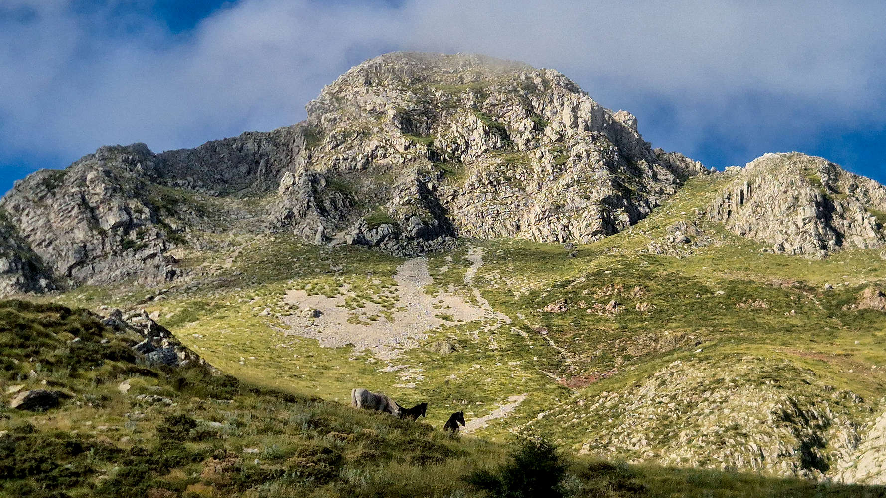
Horses grazing below Megali Mouggila (2,169m).
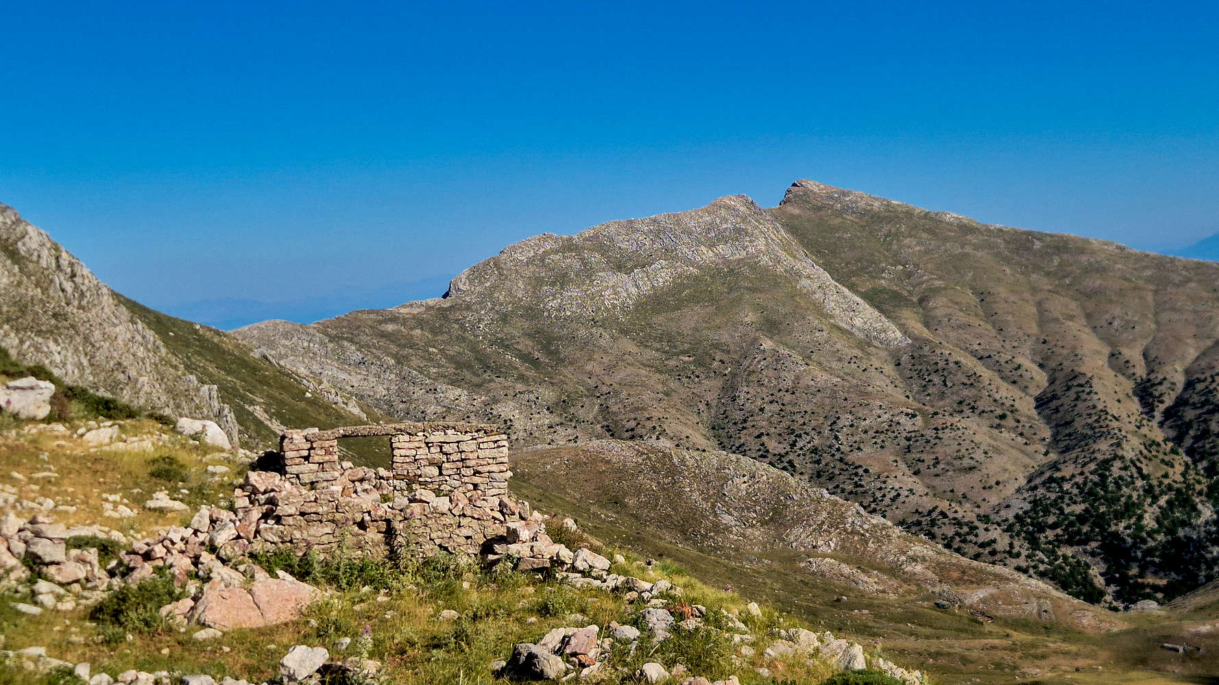
Old shed (Γρέκι) on Olonos Plateau (c. 1830m).
Erytmanthos is frequently mentioned in Hellenistic myths and epics. Besides Heracles and Artemis the most notable reference is that of Callisto, whom was turned into a bear by Hera, and as a result was hunted down by her own son Arcas on the massif. To avoid matricide, Zeus transfigured him into a bear too, and sent them both into the night sky, forming Ursa Major (Callisto) and Minor (Arcas)[2]. Homer also mentions the mountain in the Odyssey when describing Nausicaa, who was said to stand apart from the girls accompanying her since:
“… [She] goes over the mountains, either very high Taygetos, or Erymanthos, taking pleasure from the boars and swift deer, and together with her the wood-dwelling nymphs […] share in her play”
The representations of Erymanthos in antiquity are varied, often relating to animals (boars, deer, bears), but also perhaps including themes of the wild, untouched, and remote. Most curious is the association with dolphins, which is considered by some to relate to Heracles[2]. Certainly however, the lack of archeological findings on the upper massif betrays the fact that this was a truly wild and uninhabitable land.
To learn more about the ancient historical ties of Greek mountains, check out Prof. Jason König’s exceptional project Mountains of Greece and the great new podcast “Mountain Stories, Mountain Futures”.
Route
The ascent to the highest peaks of Erymanthos can begin either from Michas (”Μίχας”) to the Northeast, or Alepochori (”Αλεποχώρι”) to the Southwest, with both offering similar distances and elevation gains. Given that we found accommodation at Michas, that there is dirt road access up to 1,350m near Gkremistos (”Γκρεμιστός”) waterfall, and that the route remains at higher elevations throughout, it seemed like an obvious choice.
The cold air of the night still lingered among the Cephalonian Firs (Abies cephalonica) while the peaks above bathed in the golden glow of dawn as we made our way up the dirt road to the trailhead. Parking on a small clearing besides Roumeliotiko Spring (”Ρουμελιώτικο”) at 1,350m we geared up, allowing the morning to settle around us. Tasos (”Τάσος”), one of the shepherds, was already out, and passing by his cabin our calls got no response; we begun the uphill slog. Passing through the lower forest, an initial exposed section (T3) proved to be an adequate introduction to the route, then followed by pleasant hiking on a well marked forest trail (T2). In no more than 20 minutes we reached Lapata Spring (”Λάπατα”) at 1,450m and began the traverse below Mikri Mouggila (1,900m) [”Μικρή Μουγγίλα”].
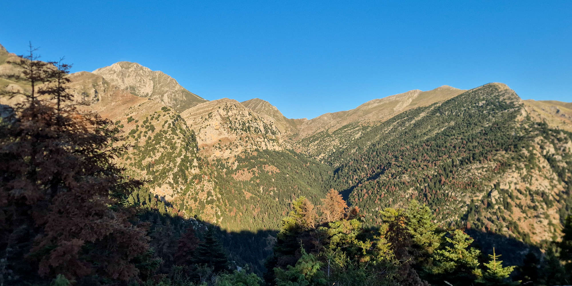
Olonos valley as seen from Roumeliotiko in the morning.
The sound of goat bells gave away Tasos who was gathering mountain tea (Sideritis) in the couloir above; we were glad to avoid his dogs as we continued along the route. Reaching its NE ridge, the trail ascends slightly up to 1,630m and provides incredible views of Megali Mouggila (2,169m) [”Μεγάλη Μουγγίλα”] and Olonos (2,223m) [”Ωλονός”] still far away.
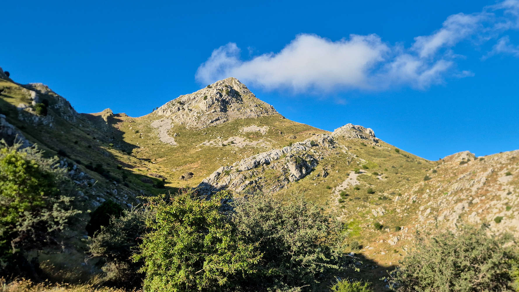
Mikri Mouggila (1,900m) where Tasos could be found.
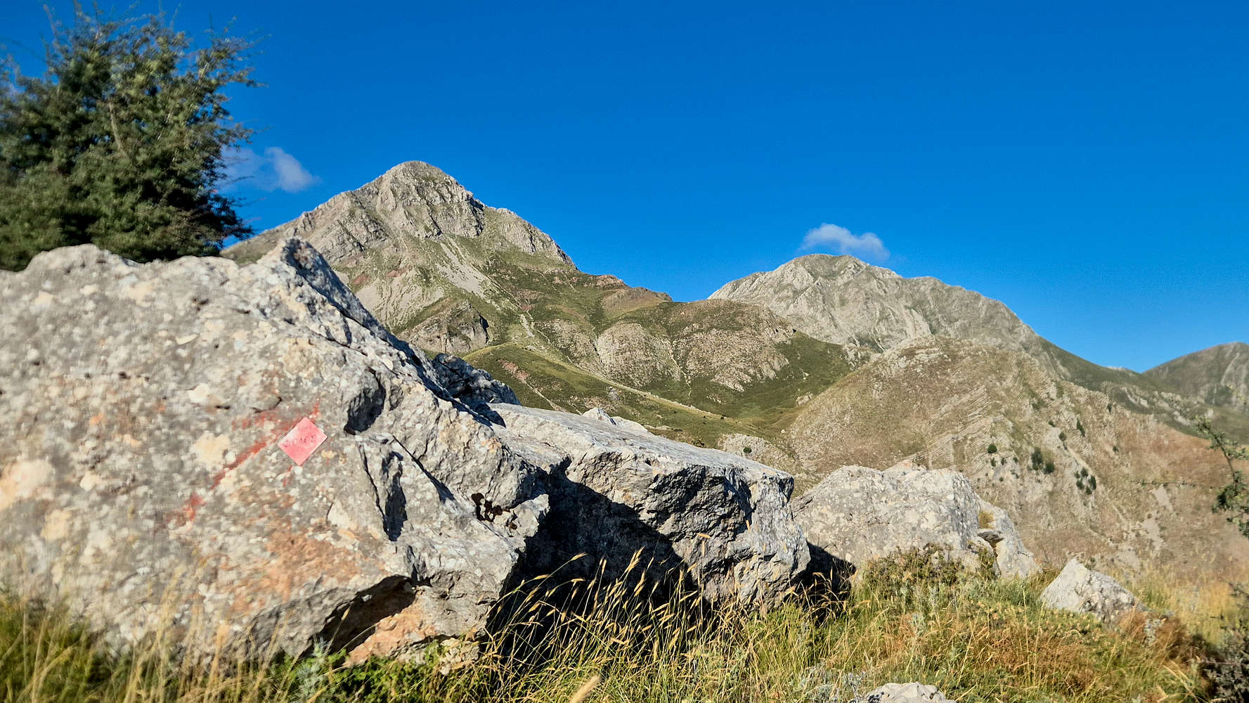
Megali Mouggila (2,169m) and Olonoa (2,223m) from the traverse.
Heading now slightly SW below Mikri Mouggila (1,900m), we reached the complex of larger sheds (”Γρέκια”) proudly standing below the glacial cirques after 1 hour.
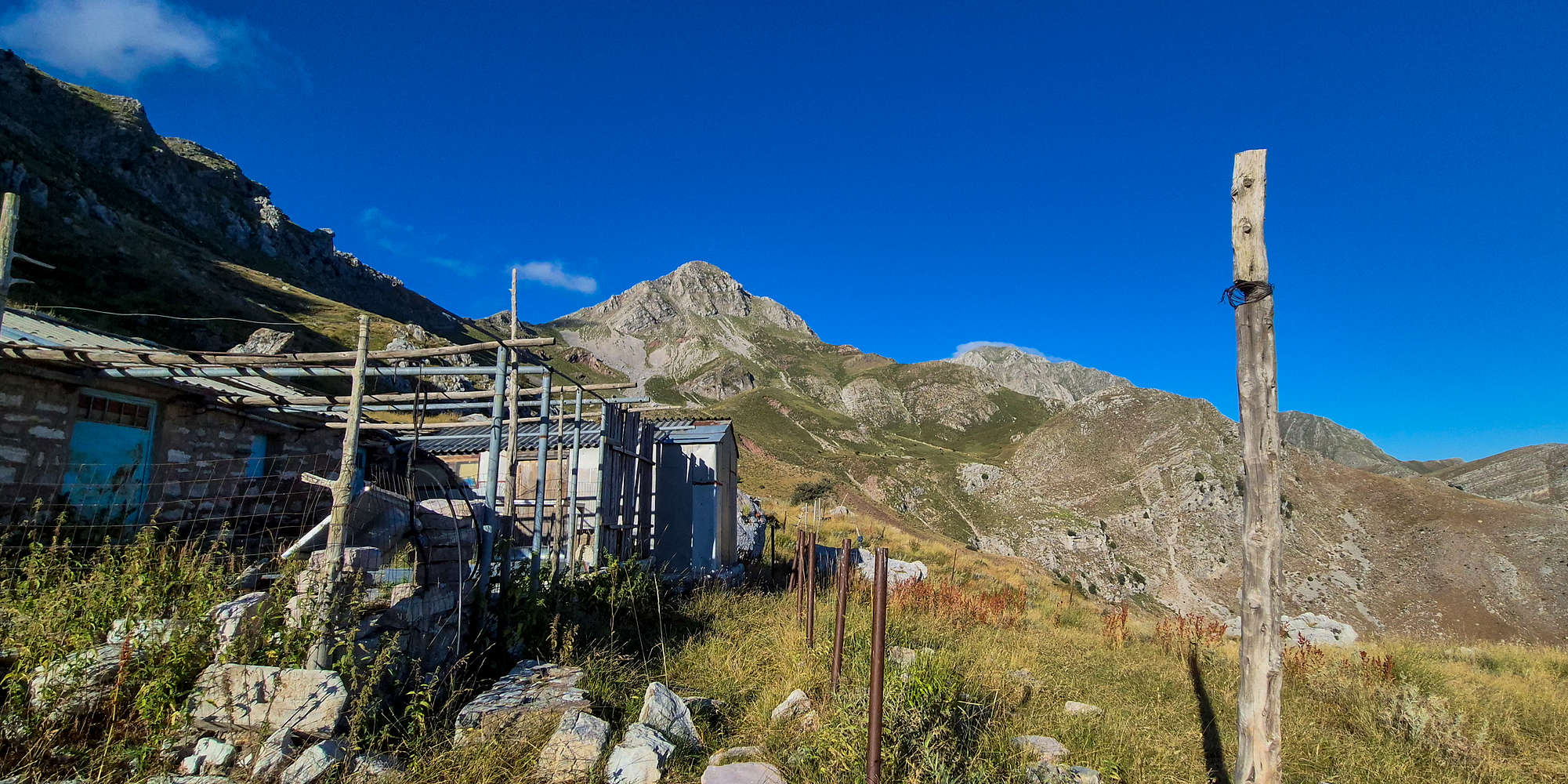
The large sheds below Mikri Mouggila (1,900m).
Continuing along and reaching the Col. between the Mouggila peaks we arrived at the route crux, a collapsed slope, requiring a delicate traverse of dirt, choss, and debris. While fixed ropes have been slung across it, the first — and most exposed — passage was unsecured, deserving a grade of T4-X. Not having had any breaks so far, we stopped right after, and just below the imposing North Face of Megali Mouggila (2,169m).
While the ropes may be repaired by October, this section is currently very dangerous and any loss of balance would result in death.
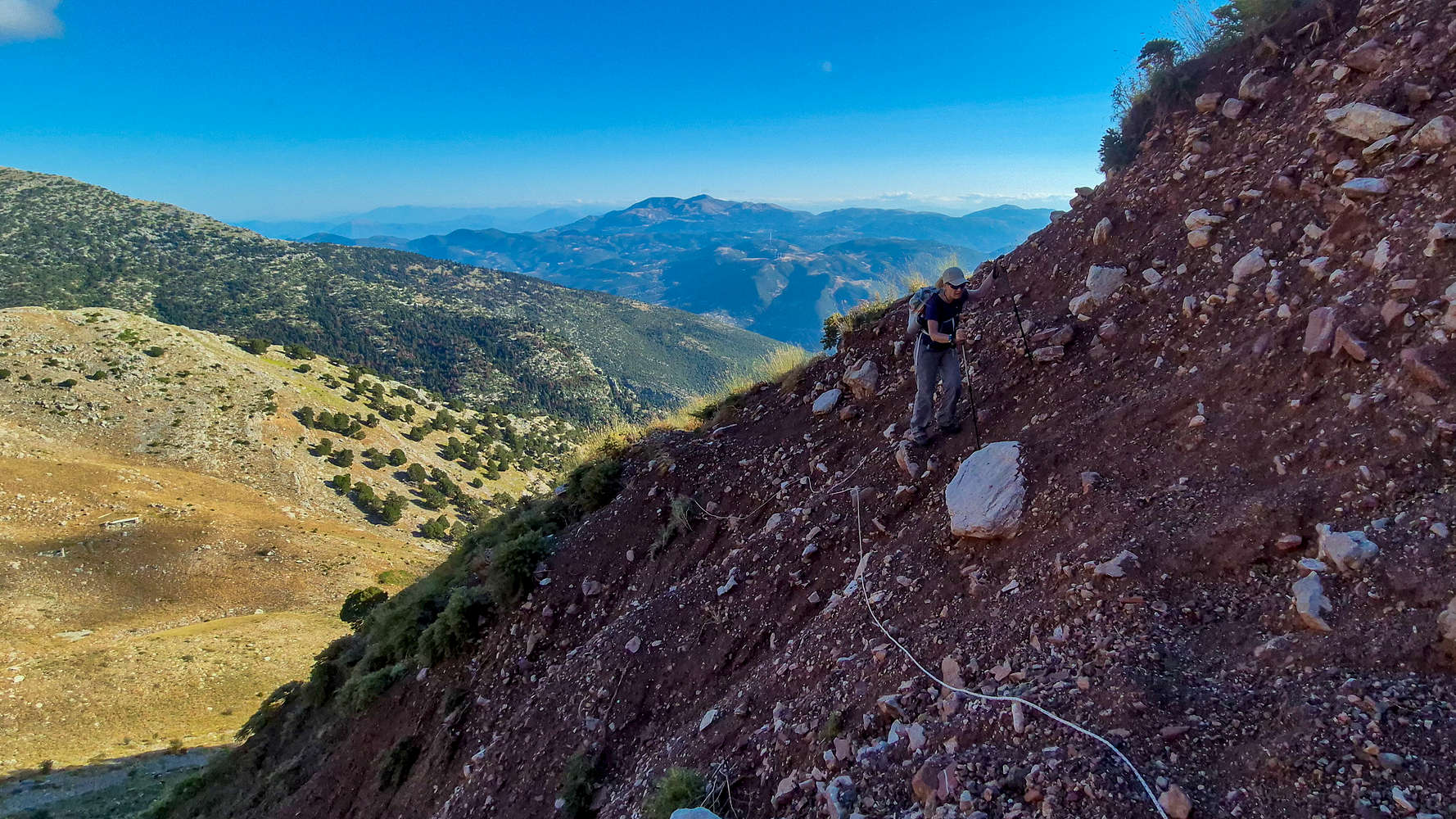
Terry crossing the crux section.
Horses grazing below Megali Mouggila (2,169m).
Another pleasant ascent on a well marked meadow trail (T2) led us to 1,800m where the final traverse to the sub-summit plateau begins. From its top we enjoyed our first full view of Olonos (2,223m), a massive rocky peak, rising 400m from the plateau like an impenetrable fortress; of whose defenses we would hopefully soon challenge.
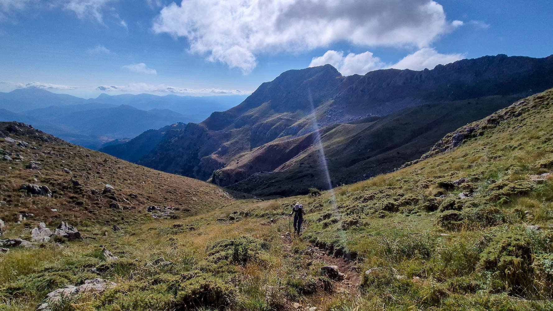
On the final ascent before the plateau.
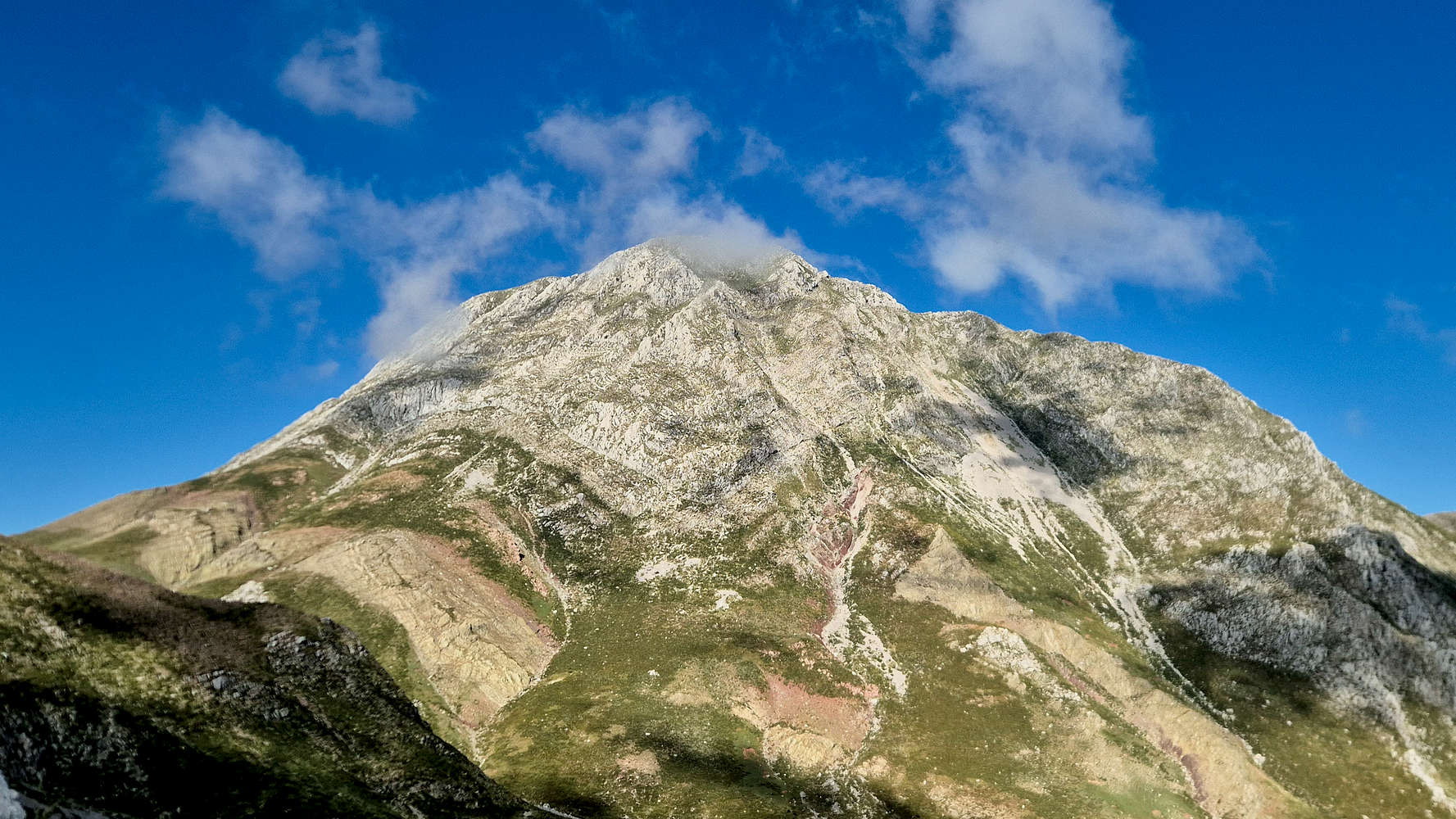
Olonos (2,223m) from up-close, finally.
We descended into the plateau quickly, reached the first of the old stone houses, and found a large flock of sheep without a shepherd. We stopped in their vicinity and let our sweat waft in the air expecting the dogs to pick up on arrival. Instead the three sleepy fellas were startled and got on our tail, barking and growling. We backed off, and exploring our options we decided to traverse far above the plateau hoping to avoid them (T3). Terry insisted we turn back, yet an absence of effort is a worse fate than being mauled by dogs. So on we went.
Old stone shed at the plateau edge.
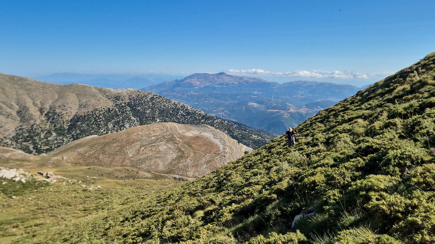
Traversing to avoid the dogs, Panachiako (1,924m) behind.
Having wasted about 45 minutes since our arrival at the plateau, we rejoined the trail below the summit, following a pair of hikers whom had come up from Alepochori, and who did well to distract the dogs. Next came the summit cone itself, first with a steepening ascent of a grass slope (T2), then loose scree through a broken outcrop (T3), before reaching a small shoulder where goats and friendlier dogs were waiting for us.
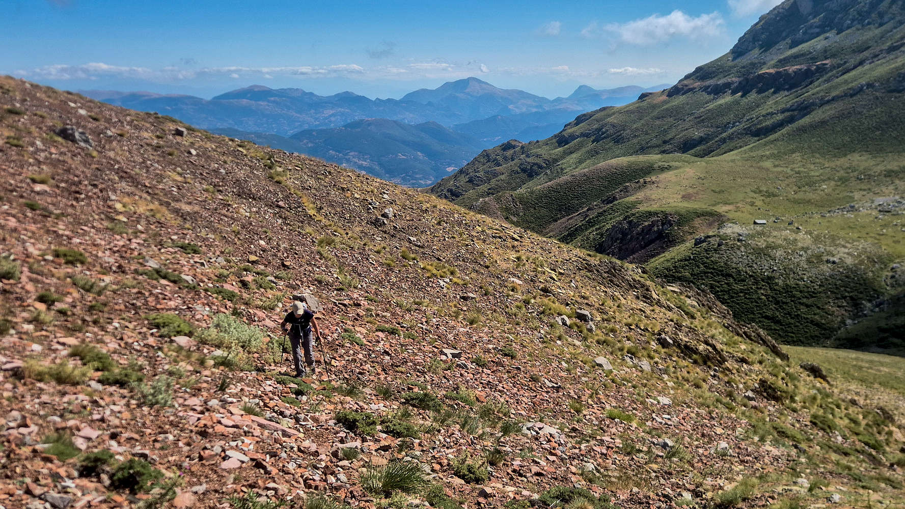
Dealing with scree at the start of the summit section.
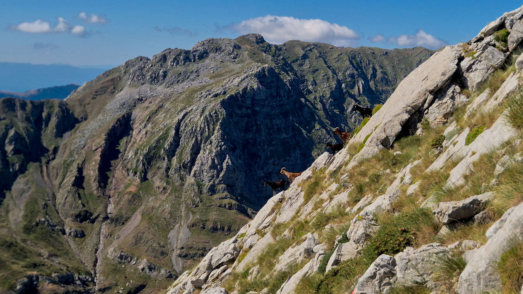
Goats enjoying an aerial position, Psili Tourla (1,950m) behind.
The scree is soon replaced with mixed-quality limestone which can be surpassed via a well marked trail on its right (T3). Instead, inspired by the goats which descended graciously along invisible ledges, we followed a direct line up the outcrop (II, 10m). Next, a system of large ledges beckoned us to traverse right (N), while offering expansive views of the cirque of Psili Tourla (1,950m) and assorted ridges to our South. Hundreds of meters below us, the sheep grazed quietly in various geometric shapes, following the shade of passing clouds, while the dogs slept. We finally felt welcome.
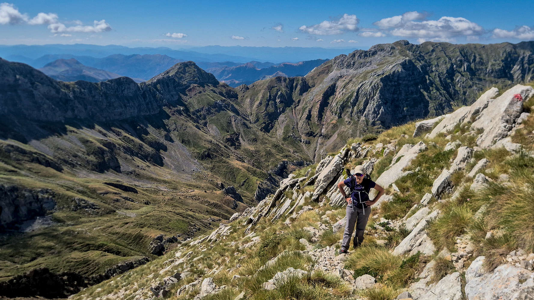
Traversing the ledge systems below the couloir.
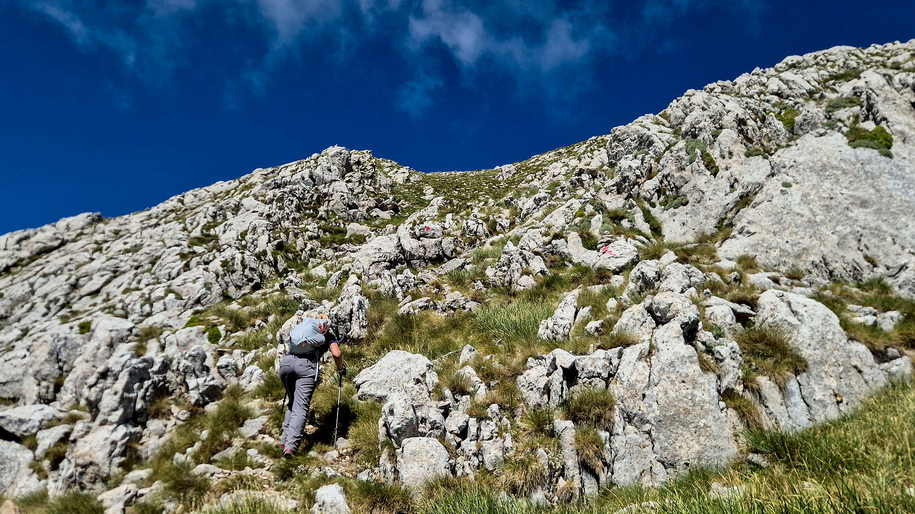
Navigating towards the pre-summit bowl.
We continued through a small couloir (T3), which I skipped by climbing a chossy pillar to its left (II+, 15m) in good style, then topping out within a bowl. Here we ran into the two hikers we had seen earlier and learn they were Czech, out for a day-hike coming from Kyllini (”Κυλλήνη”). They recommended we scare the dogs by picking up rocks and we exchange wishes as we continued onto the summit.
While Shepherd dogs will likely back down once you pick up throwable items, it is easier to simply keep your distance, and if they approach, talking to them calmly often does the trick.
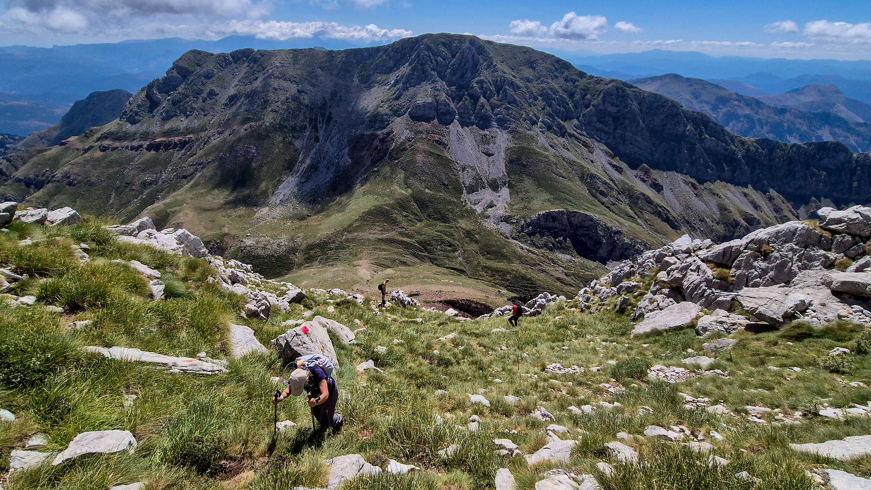
Exiting the bowl, with the Czech hikers behind.
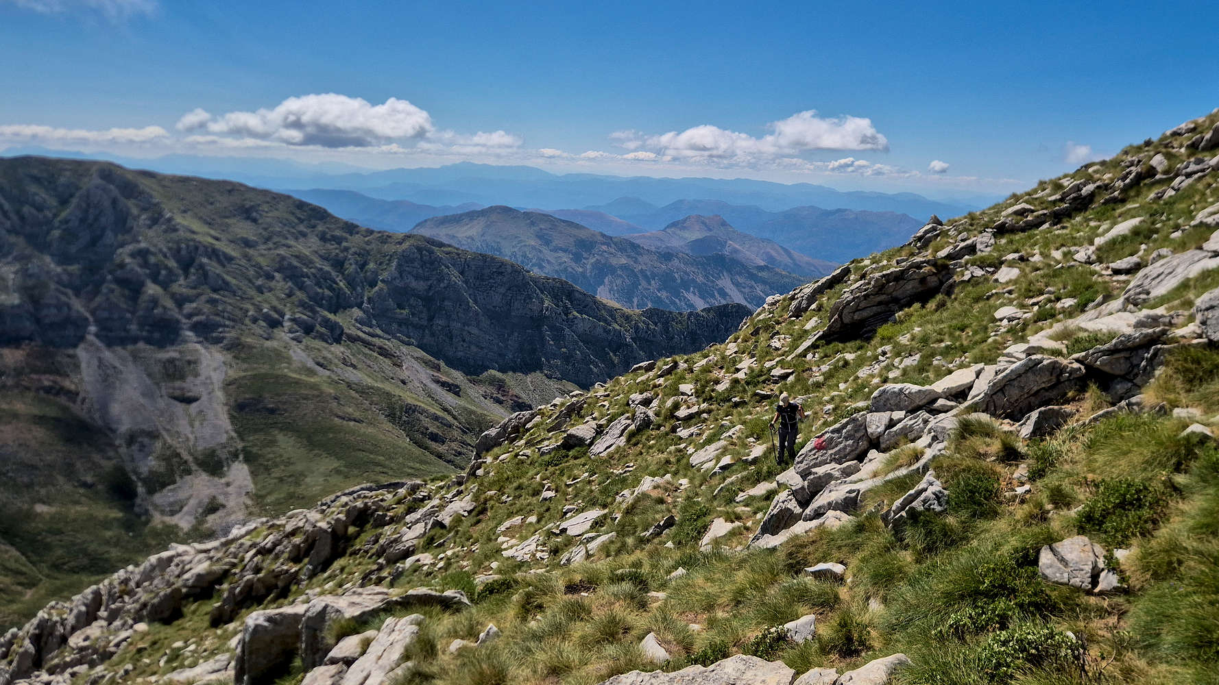
Traversing below the summit ridge.
The bowl narrowed into a funnel before reaching the ridgeline. With it taking a rocky but easier cresting line on the East (T3-), a complete view to our W is kept as a surprise. Instead the feeling of remoteness, height, and an appreciation for the terrain around us came to the forefront. The final ascent to the wide summit itself was pleasantly easy, a deserving finale of this 4:14 hours-long ascent. The summit cone required 1:30 hours.
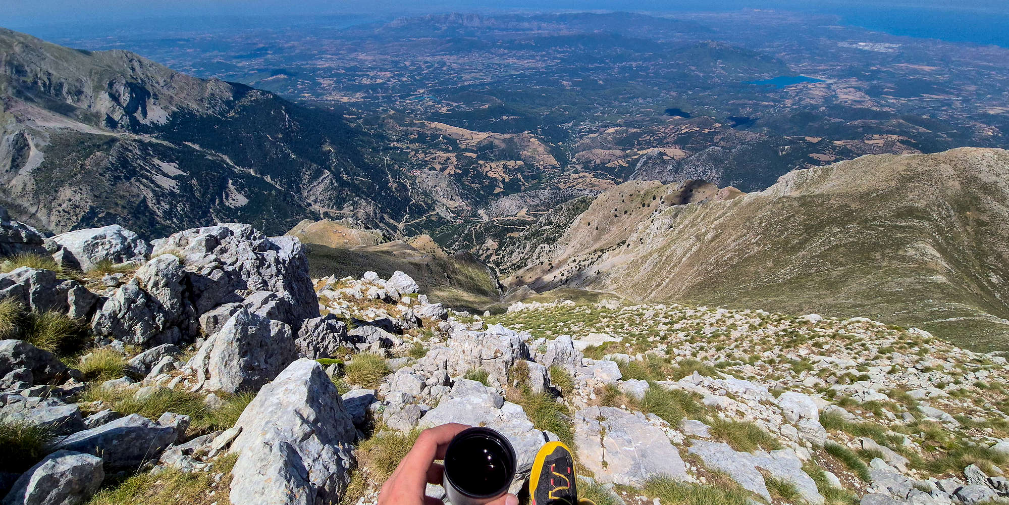
A cup of mountain tea with 2,000m of air below my feet.
The sprawling panorama to our N and NW was spectacular, with the plains of Achaia (”Αχαΐα”) more than 2,000m below our feet. Far across the Corinth Gulf, the mass of Varasova (914m) [”Βαράσοβα”] could be seen shining, along with the numerous reservoirs near Patras. In the distance, Zakynthos, Gkiona (2,510m), Mainalo (1,981m), Taygetos (2,405m), as well as Kalogria (”Καλογριά“) beach, and the hill of Toumbi (248m) [”Τούμπι”] where we would climb the next morning. Around us however a greater spectacle unraveled, as the wild peaks and ridges of Erymanthos (2,223m) stole the show. From our perch, the limestone walls, cirques, jagged ridges, steep grassy slopes, and lush forests all seemed to protect the plateau and summit. This massif, seemingly impenetrable from below, now took on a sweet and homely quality.
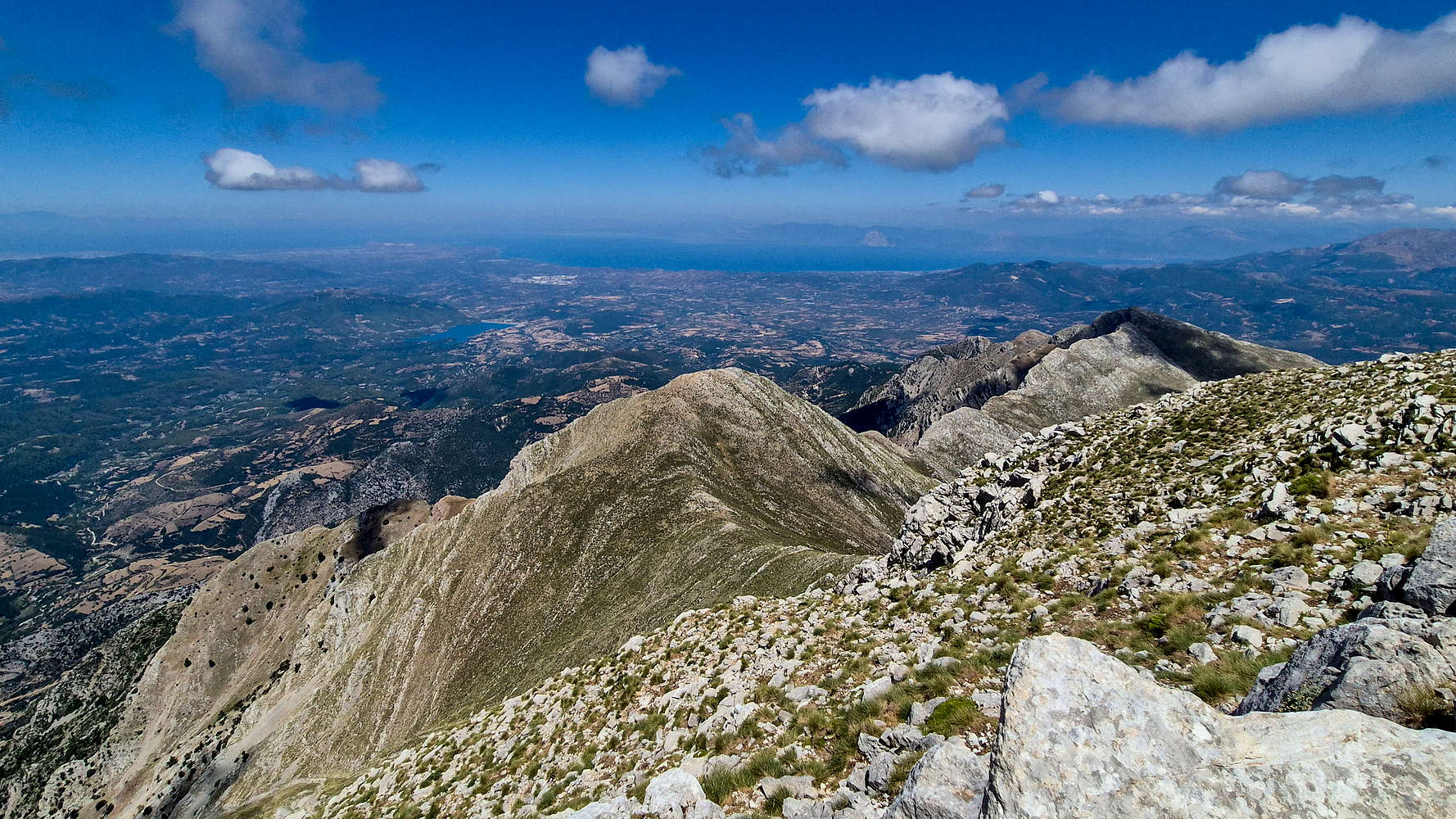
The Northern ridges of Erymanthos and Achaian plains.
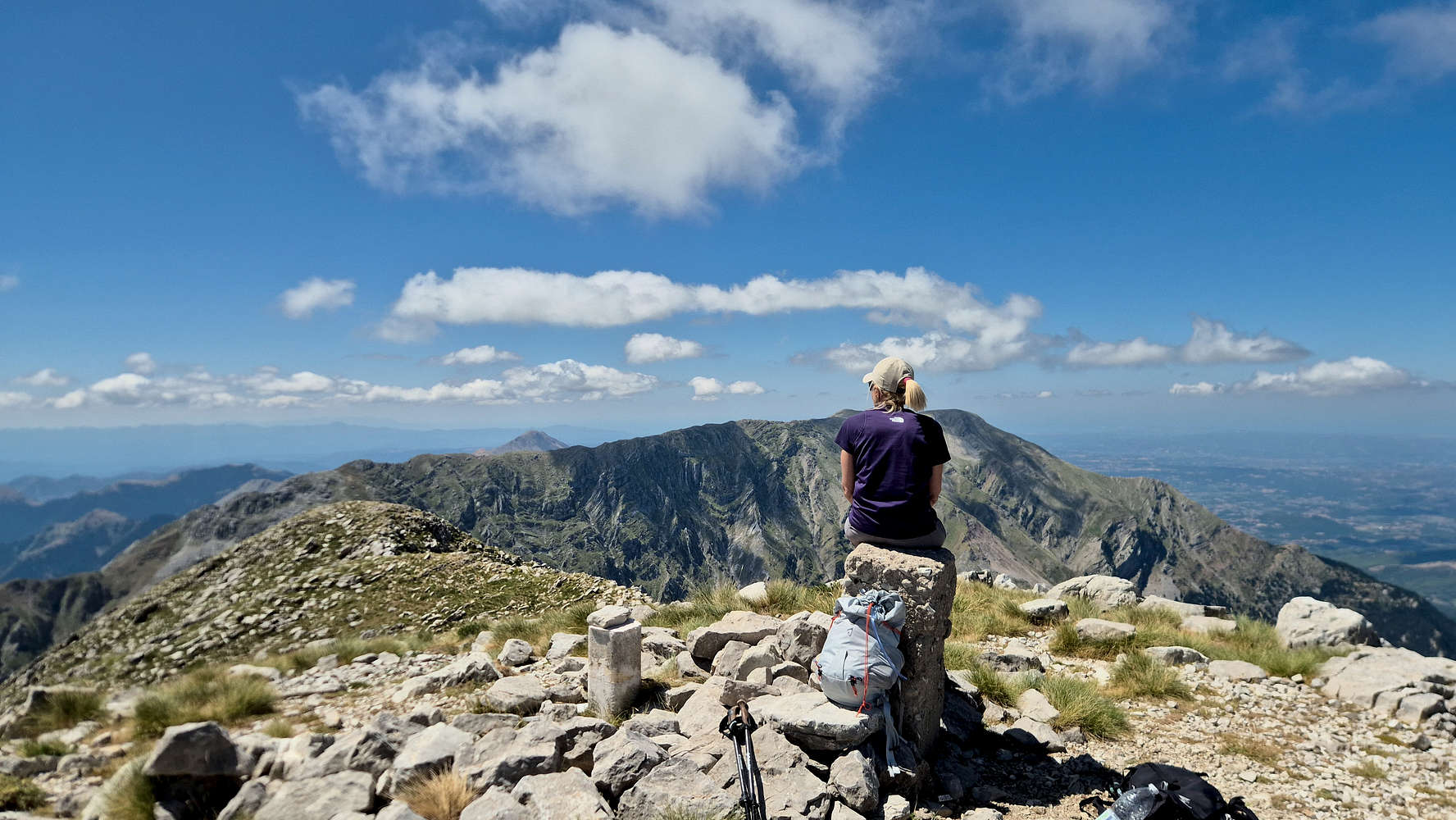
Terry admiring the views to our South.
Having stayed an uncharacteristic 40 minutes on the summit, we decided to begin our equally long descent. Although often this can be daunting in such steep peaks, the plethora of ledges and grassy slopes kept our spirits high. However, our own stupidity got in the way as we descended into the wrong couloir, having to perform a delicate and exposed traverse (T4); but we did spot an amazing crack about 10m tall, which simply begs to be climbed. Getting back on the trail, the going was much quicker, and the majority of the descent was possible with poles and no use of hands — unlike Kaliakouda (2,099m). The sweet dog tending to the goats seemed to like us now, and we exited onto the slope of scree.
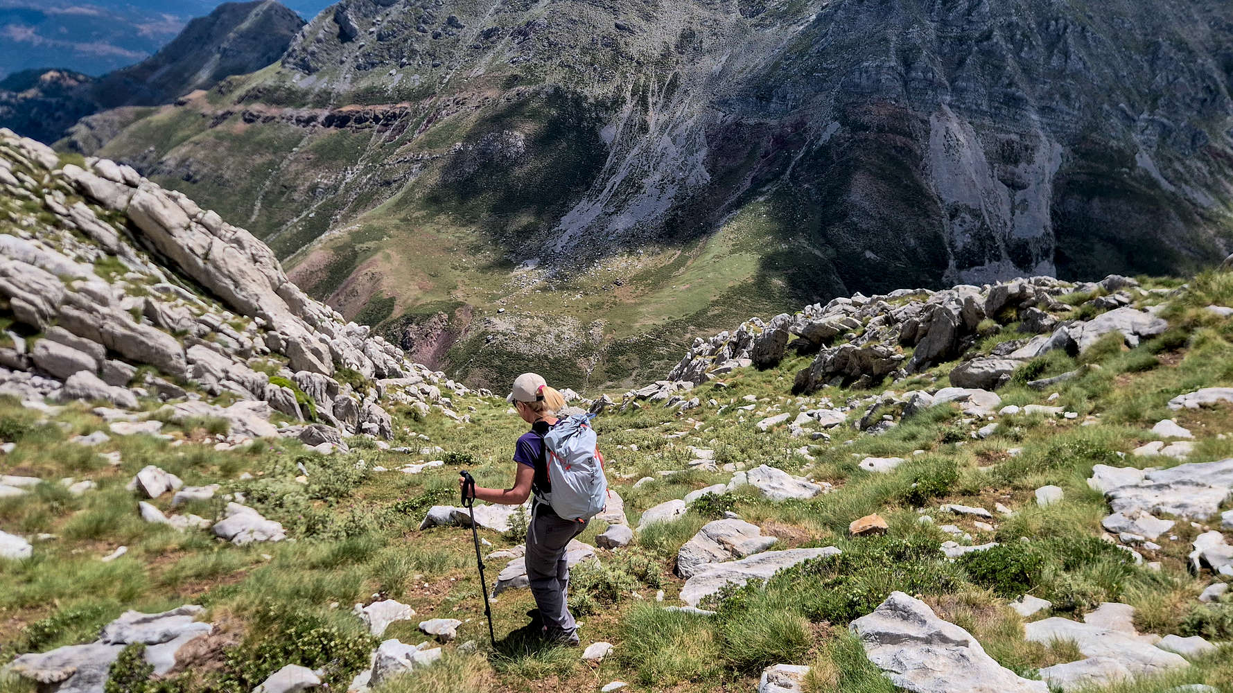
Terry descending the wrong couloir.
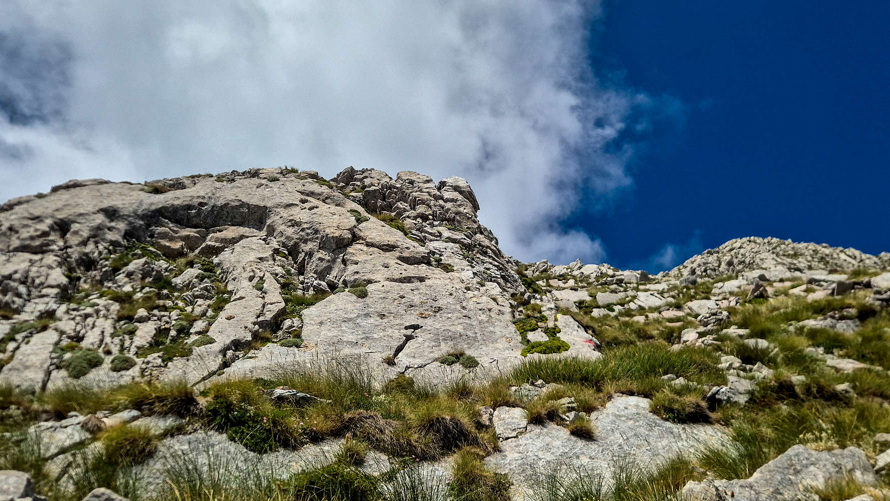
The pillar of the middle couloir (II+, 15m) image center (outcrop right).
The Last Shepherds
Near the bottom of the summit slope, slightly worried about our impending meeting with the dogs we saw a figure moving along the plateau. Panagiotis (”Παναγιώτης”) greeted me with a curious look and an apology as I joked about Terry being unreasonably scared. We introduced ourselves and he offered to walk us to the plateau edge. He explained that he spends summers in a hut towards Alepochori at 1,700m, and his days grazing and tending to hundreds of sheep and goats, something his family has done for generations. Once, he said, dozens of shepherds lived in the now collapsed stone huts on the plateau[3]; today there are only four. He admitted his affection for the cute dog which herded the goats, and whose sweet bark I also noticed, and he invited us to his hut, if only it was in our way, and seeing as it wasn’t we were forced to part ways. I wished I could stay.
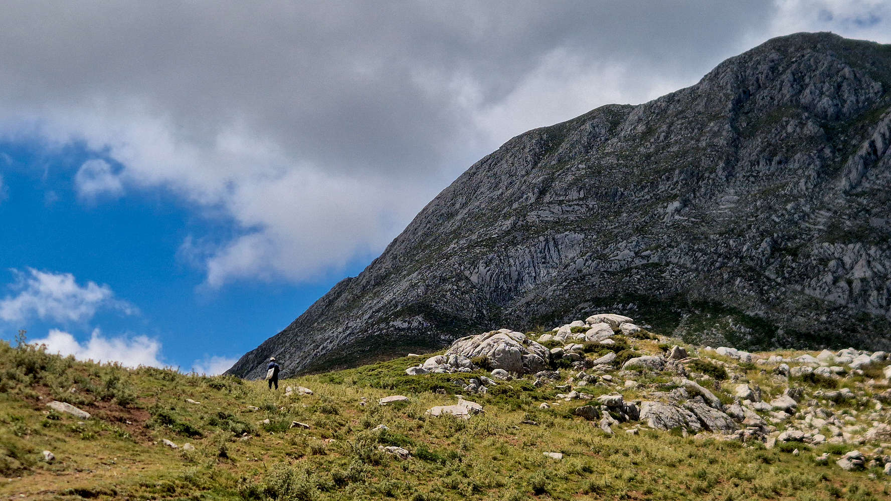
Panagiotis walking to his herd under the shadow of Olonos (2,223m).
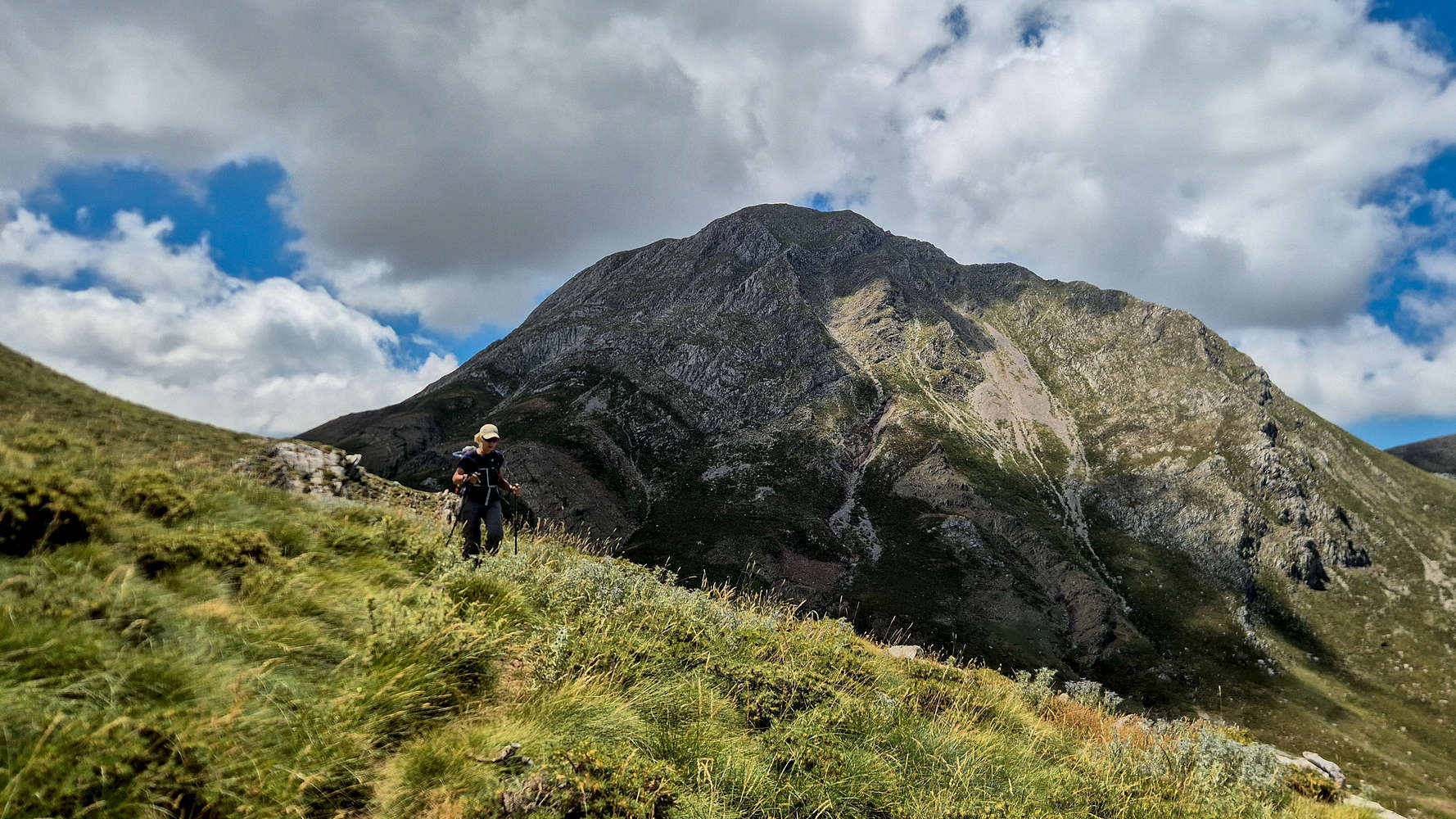
Terry traversing away from the plateau, Olonos (2,223m) behind.
The melancholy of the long traversing descend was only counteracted by the sheer beauty of it all. Under the noon sky and its passing clouds, the rocky precipices shone white, the wildflowers punctuated the air with an unmistakable aroma, and a pair of Lesser Kestrels (Falco naumanni) danced along the thermals. We kept moving, having been informed that Tasos, the shepherd below was aware of our impending arrival. The horses distracted us before the crux, as they grazed on the cliff-edge. We descended quickly and efficiently, now past the 7:00 hour mark, and although we got slightly lost exiting from Lapata we quickly found our way to Roumeliotiko.
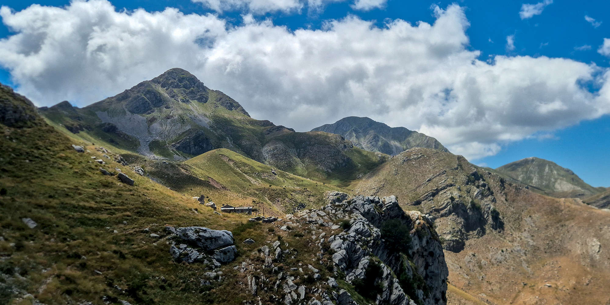
An alpine panorama of Erymanthos (2,223m) under the noon clouds.
After 7:30 hours of hiking we were glad to have found Tasos working on his cheese and doubly so as he invited us to sit in his garden. We were offered dried Feta, produced by his goats and drying next to us, followed by strong local Tsipouro (”Τσίπουρο”). He told us about life on the mountain, the practical aspects of transhumance, and his animals. Treating them like his children, they provide his livelihood and he tends to them by milking, grazing, and mating them. Once, like others he had a larger herd, including sheep, but his age required him to scale back, now only spending a few nights on the mountain. He is planning to leave his summering hut behind and stay in the village year-round; making for just three shepherds on Erymanthos next summer.
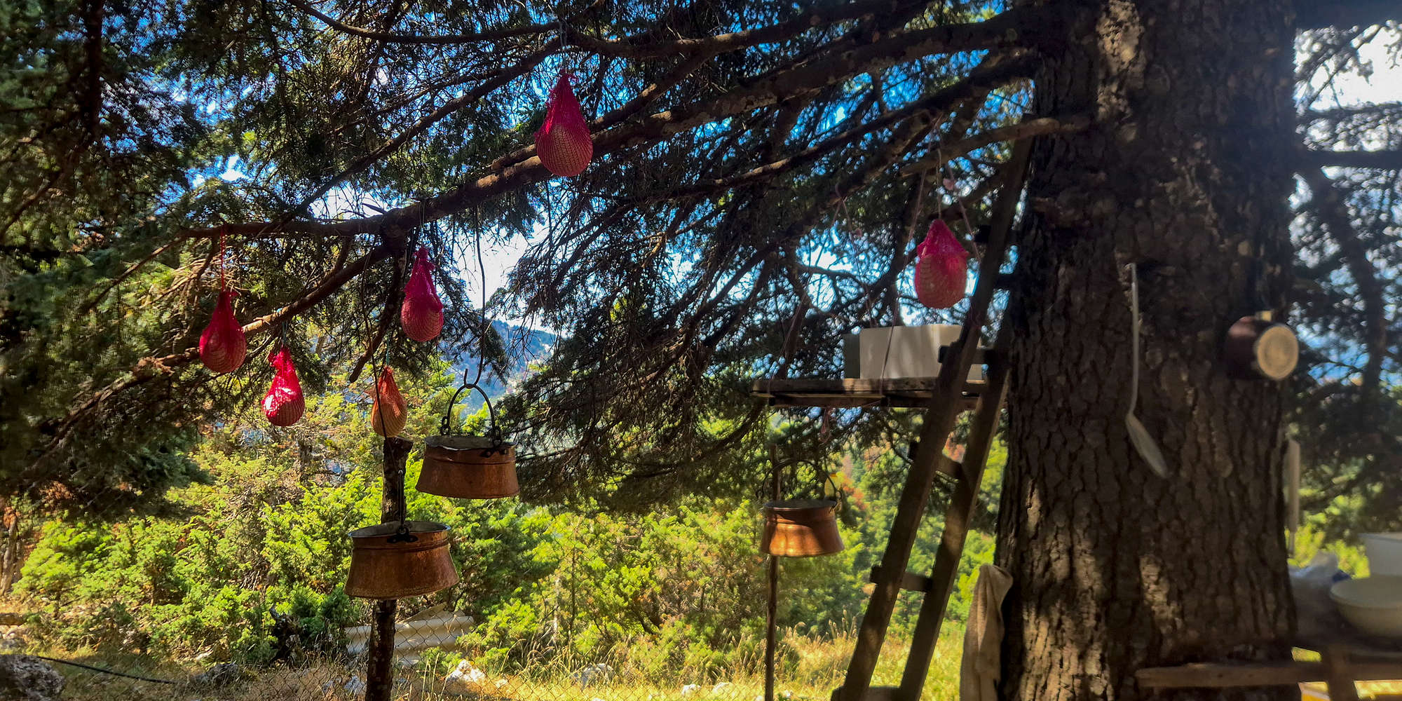
Traditional cheesemaking of Mizithra and Feta at 1,350m.
Tasos lamented the lack of interest of younger generations in tough traditional professions such as shepherding and masonry, after all who would wake up at 04:30 to deal with the animals all day? I thought of that intriguing proposition, if only I could say yes. We discussed the benefits of traditional agricultural practices, and he urged us to avoid industrial meats while we nibbled on more of the handmade spicy Feta under the shade of a Fir. Our discussion turned to society and politics and I was surprised to see such nuanced opinions, which were naturally followed by another round of Tsipouro. After an hour and half of good conversation it was again the sad time to part ways, with us having to decline yet another round of drinks and good company as we exchanged our farewells.
“ Turning and turning in the widening gyre
The falcon cannot hear the falconer;
Things fall apart; the centre cannot hold; ”
— The Second Coming, W.B. Yates, 1919.
As we walked the few meters down to the car I was overwhelmed with great sadness, realizing that much of what we have been blessed to experience will soon be lost. The four shepherds who call Erymanthos home are most certainly the last of their kind on the entirety of the Peloponnese; a dying breed of men who have remained steadfast in their traditional ways, persevering against all odds. Their continued existence serves as a pure form of resistance, against centralized governance and industrial modernity, and for which they paid a hefty price in the abject loneliness of the profession; but time is the biggest equalizer and one from which none can escape. Soon enough, no shepherd dog barks will echo on the plateau, no sheep or goat will graze freely under the sun, and the few structures still standing will be abandoned and turn to dust. Nothing lasts forever[4].
For those interested in themes of conflict between tradition and modernity, I recommend a reading of “Things Fall Apart” by Chinua Achebe (1958).
Interactive Map
Logistics
This ascent was made as part of a weekend trip from Athens, requiring very little logistical planning besides the hotel, and itinerary. To access Roumeliotiko spring we drove (4WD recommended) about 15 minutes on a good to medium quality dirt road from Micha - Tsapournia. Learn more about what else to do in the area of Erymanthos (2,223m) in the trip report below:
Trip Report: A Weekend in Erymanthia
Zacharakis Hotel
Situated centrally in the settlement of Tsapournia, Zacharakis Hotel & Tavern (⭐4.9 | +200) is the primary accommodation for visitors to the village. It is generally open during Spring - Summer - Autumn, and features relatively new and well kept rooms. Our two bed standard room was large, with a fridge, an adequate bathroom, and both a large balcony with a great view, and a fireplace. For around €60 per night including breakfast (which we did not get to have), it is also good value. The rooms and common areas are all very clean, and the same goes for the kitchen which prepares excellent home made village food, with large portion sizes perfect for hikers.
