Monte Sobretta (3,296m) [P-835]
Summited On: June 29, 2025
Region: Ortles - Pietra Rossa, Valfurva, Valtellina, Lombardy, Italy
Overview
Monte Sobretta (3,296m) [P-835] is a P-600 summit located between the Bernina, Ortles (W & E) and Gavia (S) groups at the NE terminus of Valtellin in Lombardy Italy. The mountain is awkwardly positioned between the Pietra Rossa mountains, and Ortles, with of half being composed of half of deep red Metabasite and half of silverish Serpentinite. It hosts the ski center of Santa Caterina di Valfurva with a maximum elevation of around 2,950m. The mountain looks like a slanted table having been significantly scarred by the retreat of glaciers, especially on the SE Face. The glacial retreat offers the visitor amazing vistas of glacial lakes, moraines, and other Alpine features.
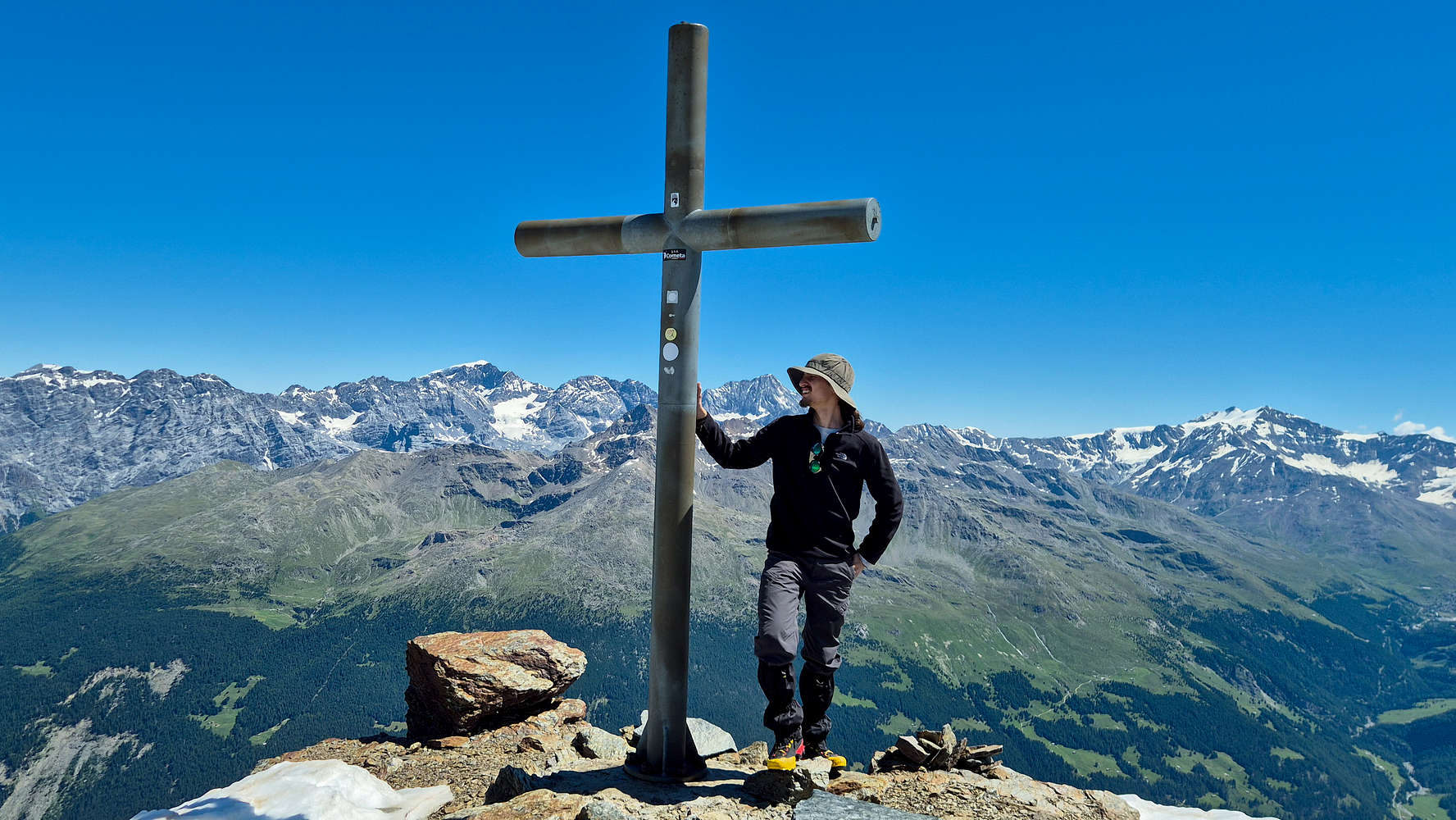
At the summit of Monte Sobretta 3,296m.
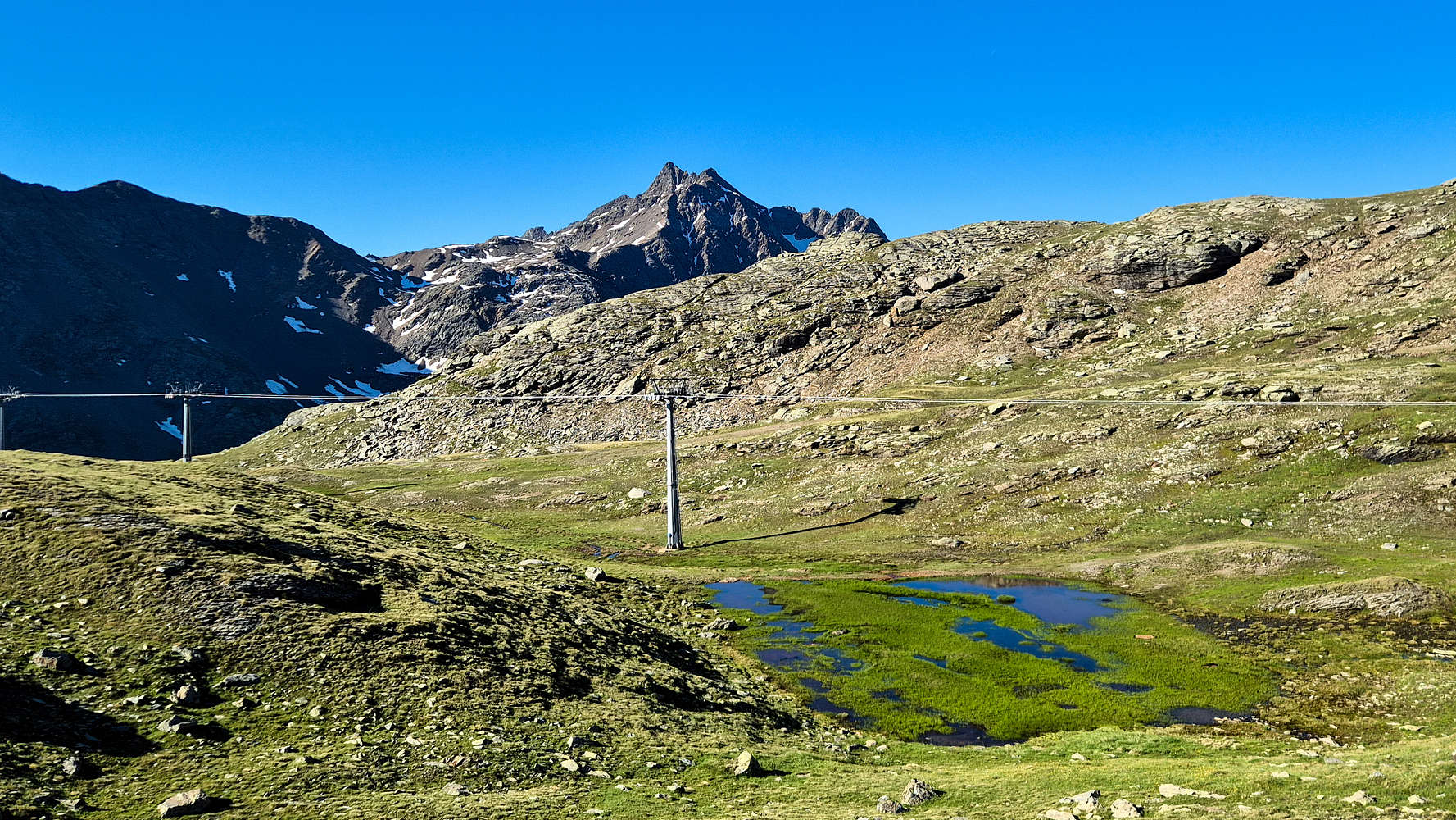
Seasonal lake on Sobretta with a view towards Gavia.
We selected Monte Sobretta (3,296m) as the main objective for our Como & Valtellina June 2025 trip, and our (both mine and Terrys’) first 3,000m peak. With its prominence in excess of 600m, its location in less touristy corner of the Alps, and a non-technical route, it was an obvious choice for us. To ascend Sobretta (3,296m) we stayed at Santa Caterina di Valfurva and drove to Ponte dell’Alpe the next morning for the ~6 hour round-trip hike.
Route
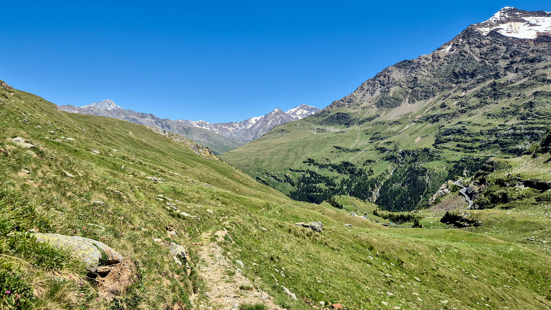
Although we enjoyed a lovely dinner and early sleep at Santa Caterina, the effects of travel and hiking the previous day had taken a toll on us. As such waking up at the scheduled 05:00am was a little intense, and lulled by the pre-dawn cold, we took over an hour to get going from our hotel. Once on the road however, we ascended quickly to Ponte dell’Alpe, even encountering a large rabbit crossing the road! We pulled into the Ponte dell’Alpe as the first car of the day at around 06:30am and quickly started with our long ascent. Time of departure was 06:40am.
Ponte dell’ Alpe
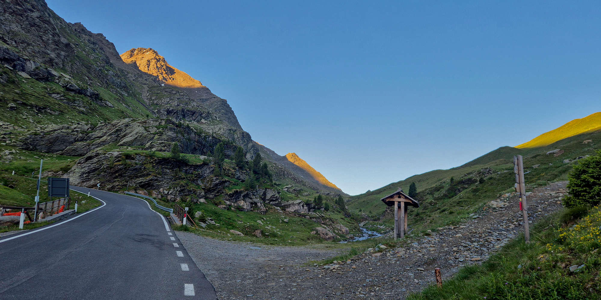
Ponte dell’Alpe looking W between Gavia to the left and Sobretta to the right, at dawn.
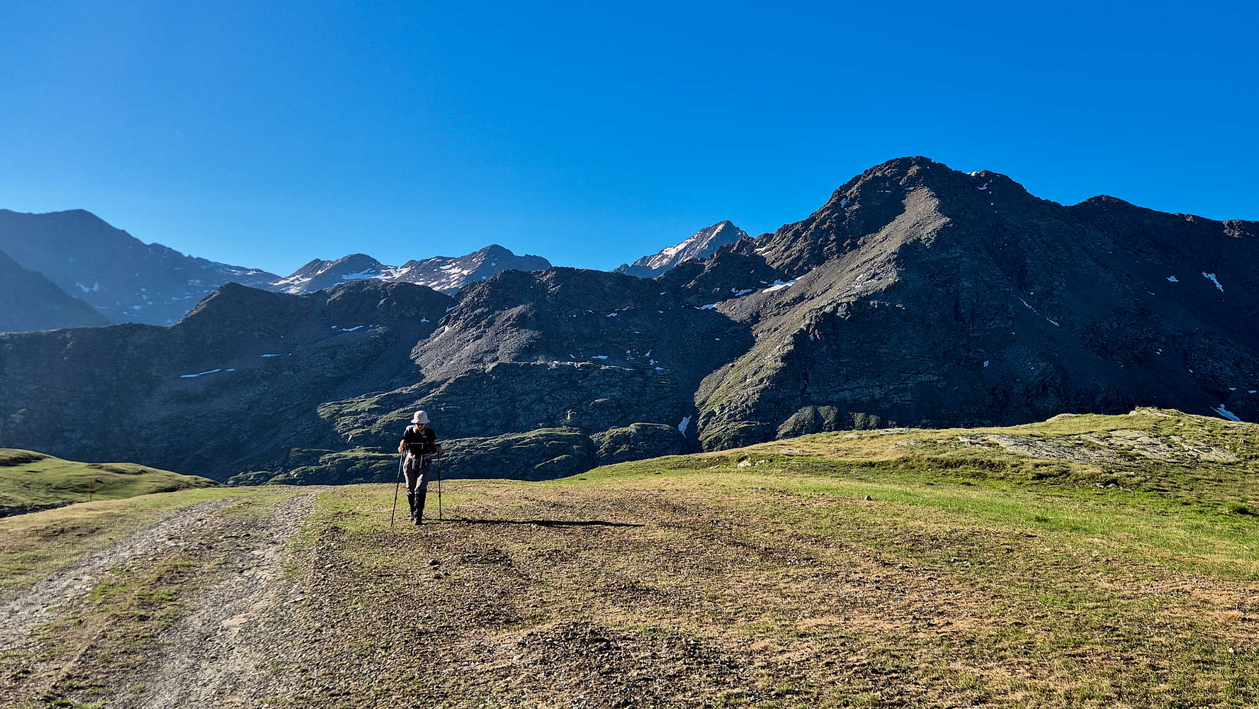
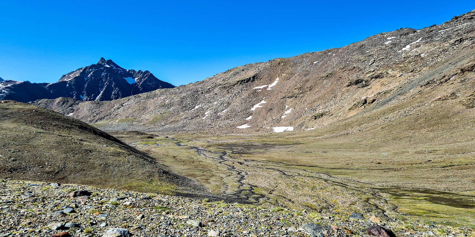
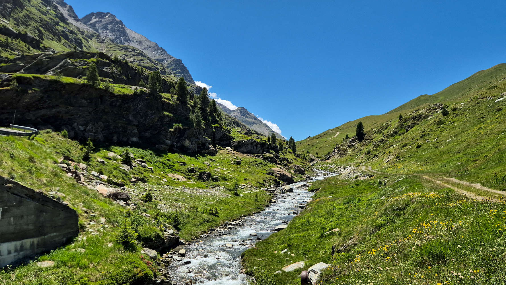
Ponte dell’Alpe (2,300m) could very well be described as a magical place, with Torrente dell’ Alpe running between Sobretta (3,296m) and Monte Gavia (3,220m), and then descending through a narrow gorge towards Ponte dell’ Vacche (Bridge of Cows?!) below the imposing Pizzo Tresero (3,594m) of the Forni Group. We followed the faux-dirt road a kilometer or so towards the W, following along Torrente dell’ Alpe on trail 563, before finally turning right to begin our ascent towards Refugio Sunny Valley. The dirt road section is easy and inoffensive and kept us in the cool shade, right up until our actual ascent begun. Following the signs towards the right and up the obvious slope (heading N) we continued, observing the curious 4 legged residents of the lower valley; freaking, Marmots! Having visited Alpine countries before I knew of their existence but was taken by surprise actually seeing and hearing the chubby little fellas, who were quite alarmed by our presence.
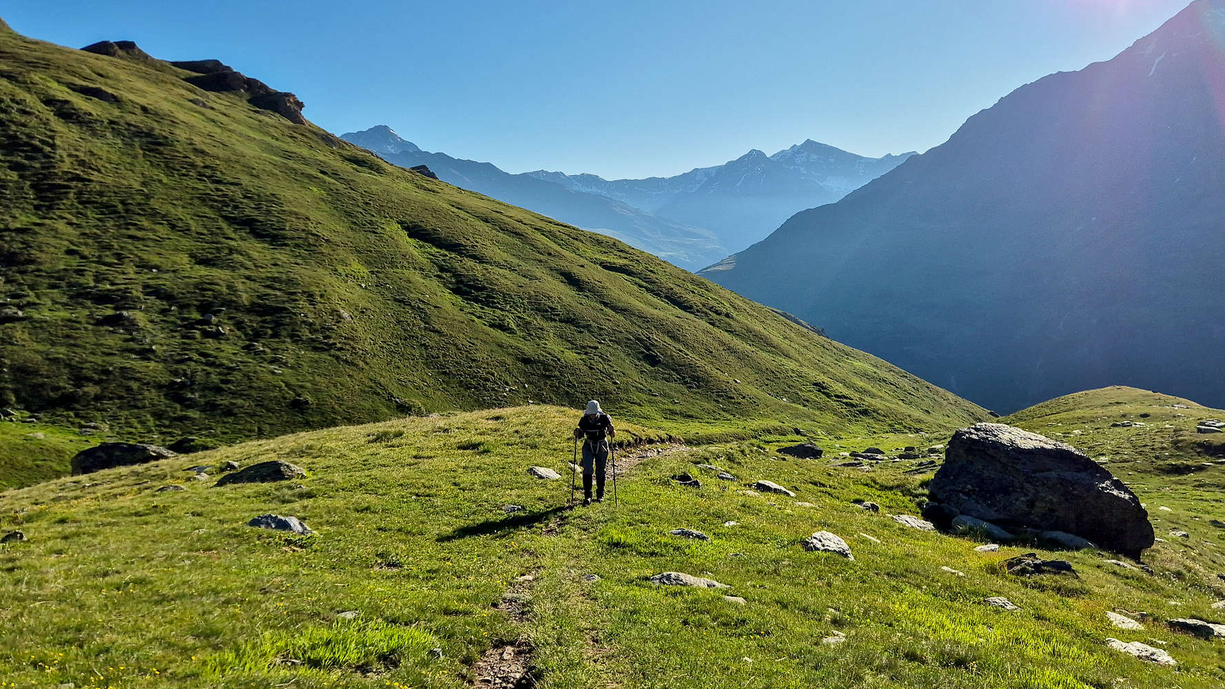
Terry hiking up towards Sunny Valley in the morning light.
Hiking towards Refugio Sunny Valley with the Gavia behind.
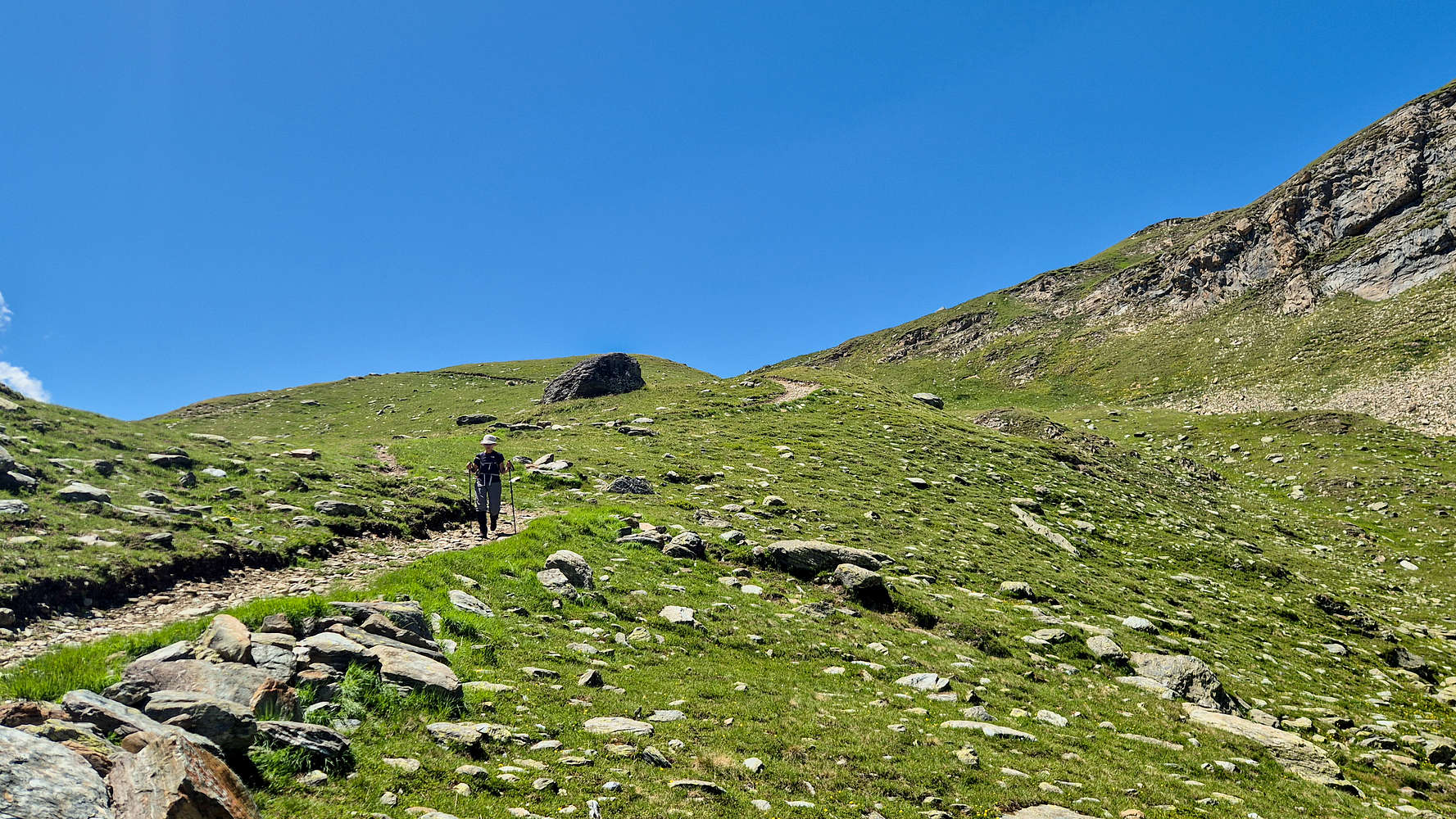
The cool morning air persisted under the first light, and with our first views of running water Terry burst into song; some tune from the Sound of Music — a Nieve favourite. I took little time to ruin the mood by reminding of the toils we were yet to face, but maybe I felt like the Marmots; someone was ruining my morning peace and quiet. We ascended under the mornings sun the section towards the Sunny Valley Intersection (563/01); only right before the top did it get steeper, although not challenging in any way. This top-out almost marked the 1 hour point from the start of our hike. Throughout we were treated to lovely views of the green slopes & Cima di Gavia (2,987m) across Torrente dell’Alpe off our backs. Here we met with the ski slopes/dirt roads heading towards Refugio Sunny Valley. After another few minutes heading up the slopes we reached the vista of Refugio Sunny Valley, and sat down to rest by the cabin-lift top-station. It had taken us about 1:15 hours and we settled for a timed 10 minute break.
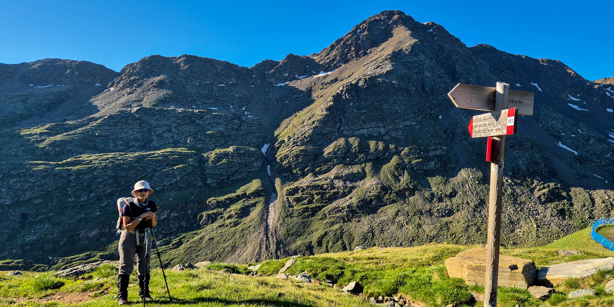
Terry at the 563/01 intersection with Cima di Gavia behind.
Sunny Valley
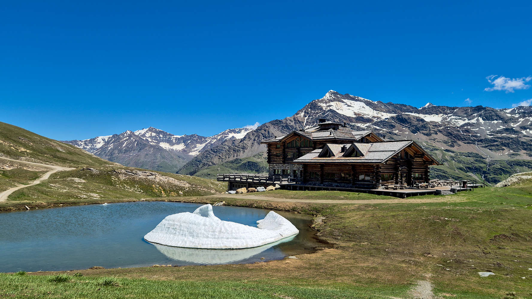
Laghetto Sunny Valley at mid-day, where we took our break.
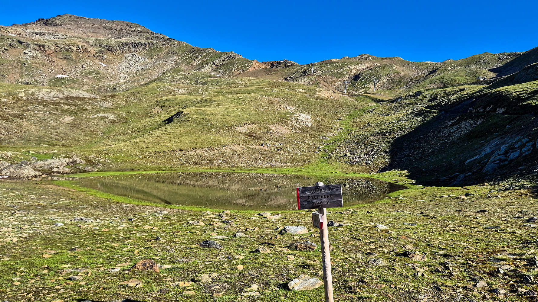
Laghetto dell’ Alpe at 2,740m, the first of the upper lakes.
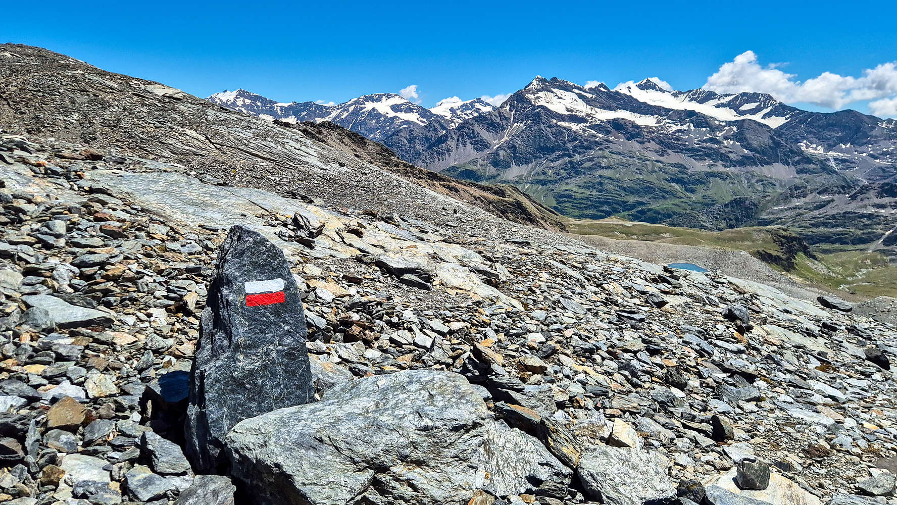
Our 10 minute scheduled break went by quick after some water, sunscreen, and map-checks, so we were soon back on our way. This time we exited the ski-road right across the lift-cabin through some obvious markings to the left (W). We went towards, and then under, the Val dell’ Alpe chair lift with the goal of not dropping elevation - as would be the case if the road is used. Here the terrain turns a bit more mountainous, with the slopes littered with boulders and the trail hidden at times. After 20 or so minutes of ascent we broke at the Col. at around 2,720m and headed directly N towards Laghetto di Alpe (2,740m), at which point we were finally rewarded with good views of the rest of the route. Having overcome this first low-low moraine just past Refugio Sunny Valley we were now on a long traverse of the slopes of the NE ridge heading towards the middle of the SE Face. We reached Laghetto di Alpe (2,740m) in good spirits, seeing the first of the printed route-cards on the sign-posts (!).

The Val dell’Alpe waterfall of the Upper Moraine, the trail on the right.
We continued past the first lake only to run into a much larger seasonal one on our left, a lovely sight in the otherwise barren mountain. Here we begun to lose elevation as we headed down towards the Lower Moraine at 2,750m. The trail was well marked and wide, with no steep or exposed parts and ample views towards Val dell’ Alpe. Best of these views was the exceptional seasonal waterfall originating from the summit area and dropping down the imposing Upper Moraine. At the base of the Lower Moraine we crossed a tiny stream springing from the right (NE). We continued on the moraine itself where the scree was of good quality and the switchbacks rather long. Upright rocks and red/white markings guide the visitor well. We broke out above it and got a great view of the Upper Moraine (steeper), and lost some altitude towards its base. Here we found a shaded rock, and having been hiking for about 1 hour from Refugio Sunny Valley, we stopped for another 10 minute break.
A seasonal lake below Laghetto dell’ Alpe, Monte Gavia 3,220m visible.
A view of the lower moraine on the descent.
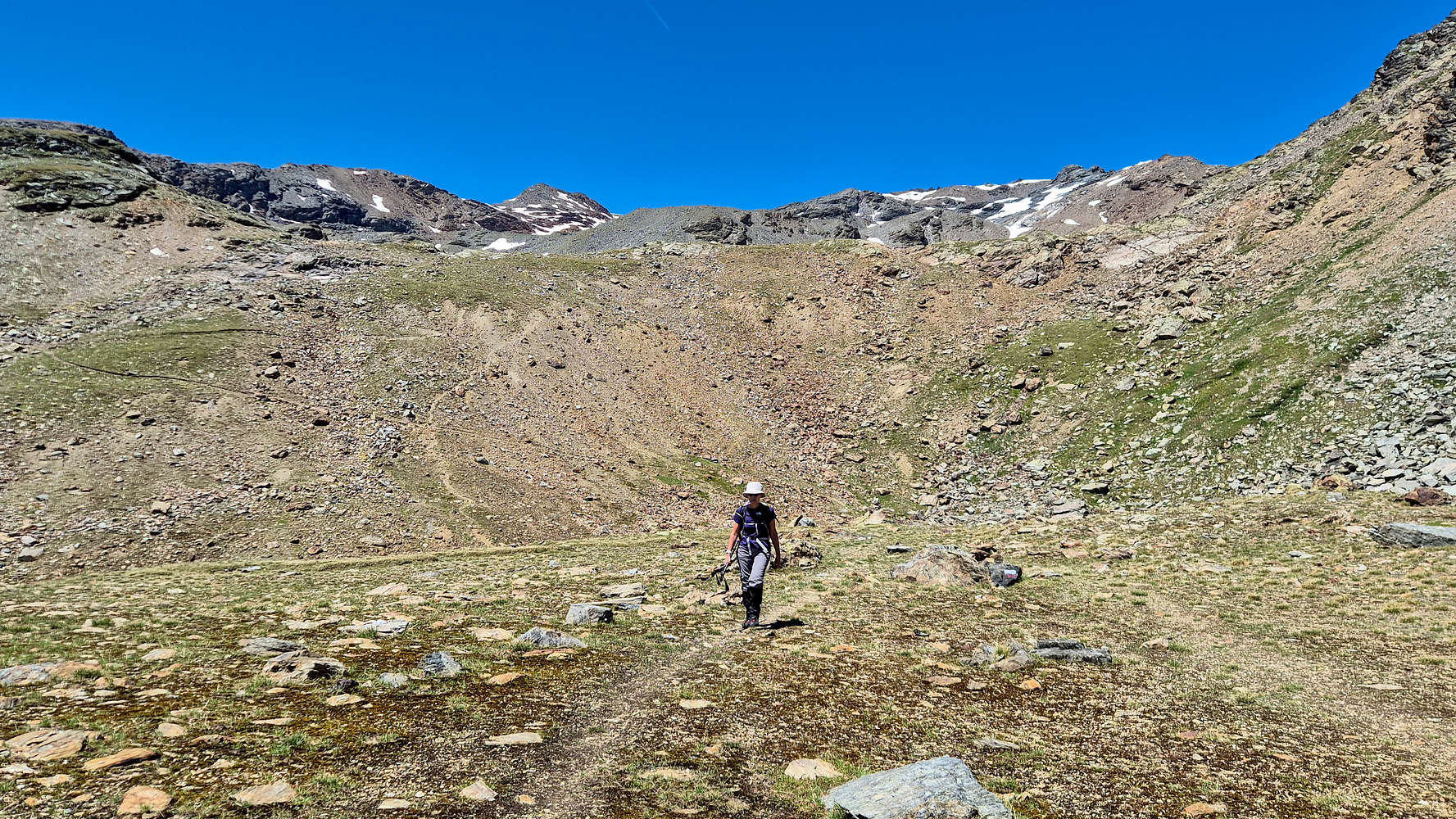
The Upper Moraine
First view of the upper moraine, about 50m high.
Terry ascending the top part of the upper moraine.
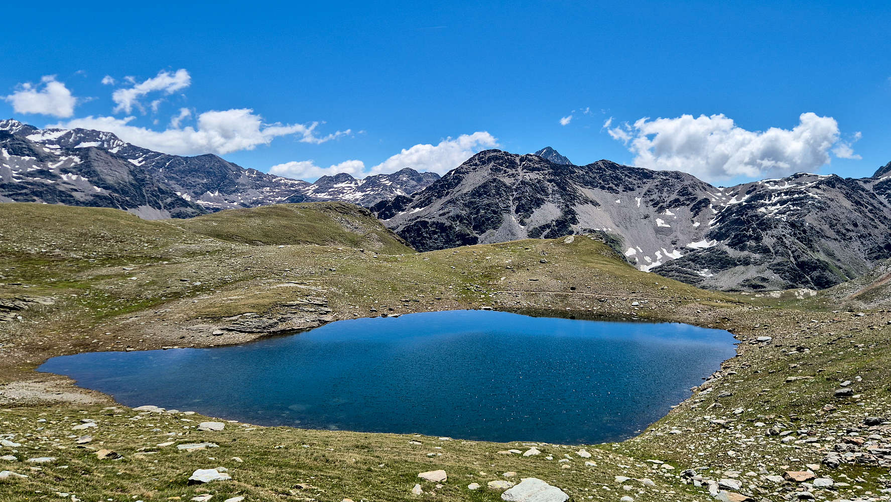
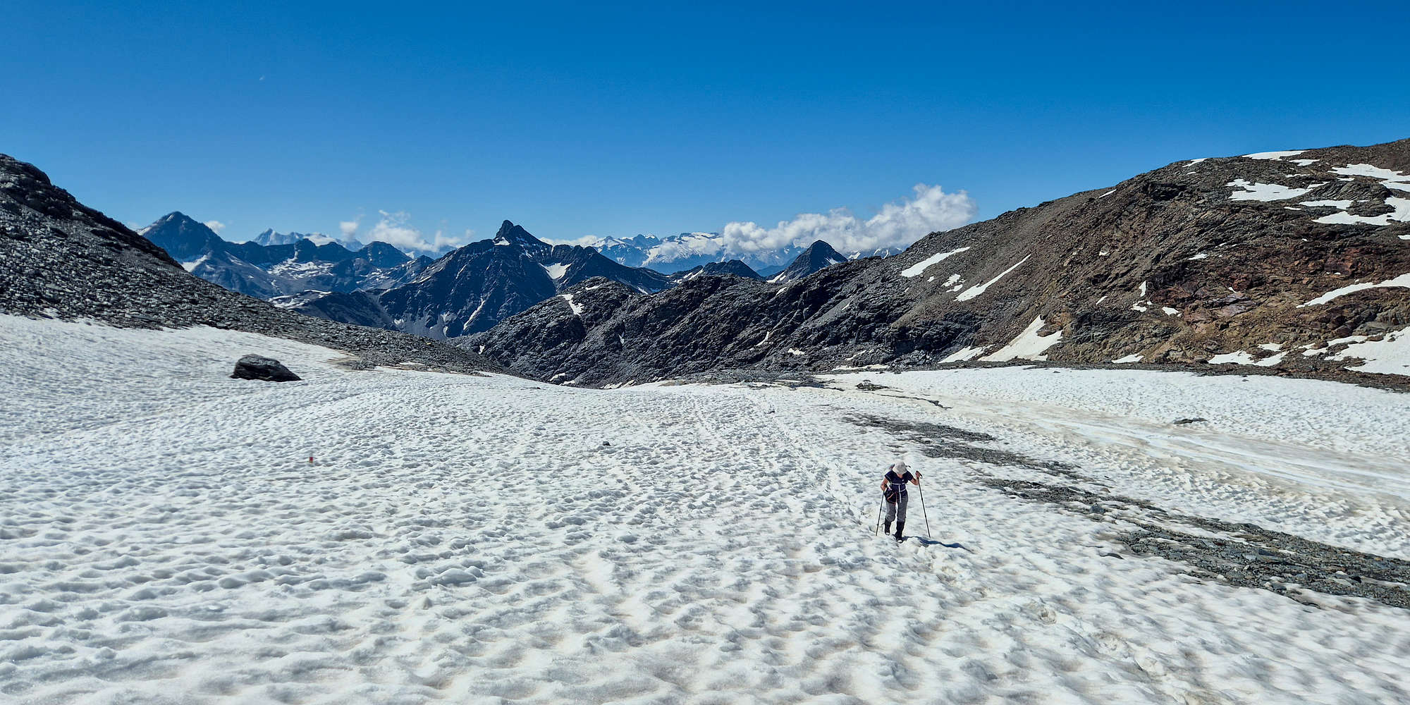
Having enjoyed a quick break with some Salami and plenty of scenery photo opportunities at 2,800m we begun our ascent of the Upper Moraine, the steepest part of the hike, gaining 100m past the first section and another 100m on the second section; in between sits Laghetto 3,000, a large glacial lake. The trail although initially seemed intimidating, is not too bad, with a rather wide track on stable scree. The ascent first follows the foot of the scree-flow up the moraine then cutting a sharp left (W) and traversing the moraine at a slight incline. Here the exposure is around 70m but this is never really felt; soon the first section tops out with a little depression at 2,900m. The trail here was clear of snow, but small patches made their appearances, while we enjoyed a better look towards the summit ridge. At the second switchback we surpassed 2,918m, the highest elevation we had ever attained up to that day, on Olympus (2,918m) almost 9 years previous. Although tired our small win propelled us to reach the flat section of the lake faster. Here we finally begun to feel the effects of altitude (or the heat?), and our pace begun to slow down sharply. Finally we broke out above the moraine and next to the glacial lake.
Val dell’Alpe from the foot of the upper moraine, view of Monte Gavia 3,220m.
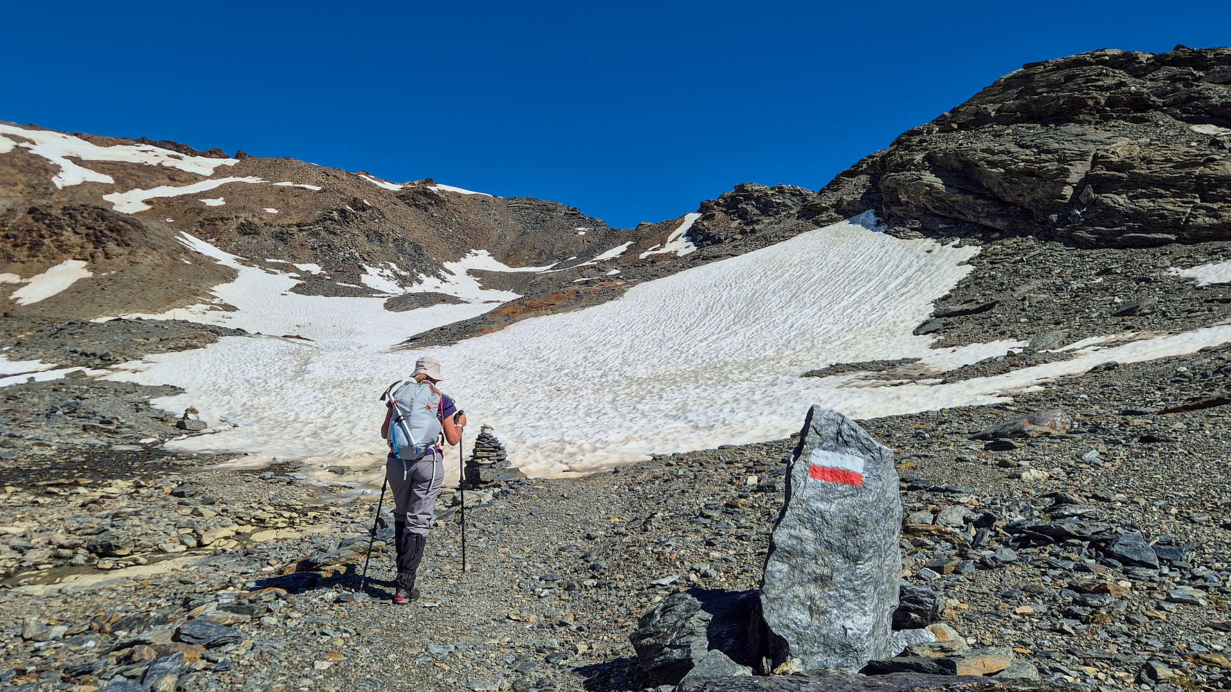
Here well over 2 hours in, we encountered our first “en’ route” snow, which we crossed to test our gear. It would have been maybe easier to avoid the snow altogether by going to the left via a rocky bump. Alas the scenery and change of terrain into proper alpine was a nice change, and a great sight in late June. Up here the melt-water of the snow-patches became even more obvious as it often simply appeared beneath our feet, or running by next to us. We continued past the lake and set our sights to the next switchbacks, and the 3,000m point.
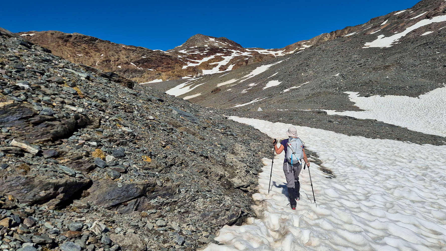
Terry crossing the first snow near Laghetto 3,000.
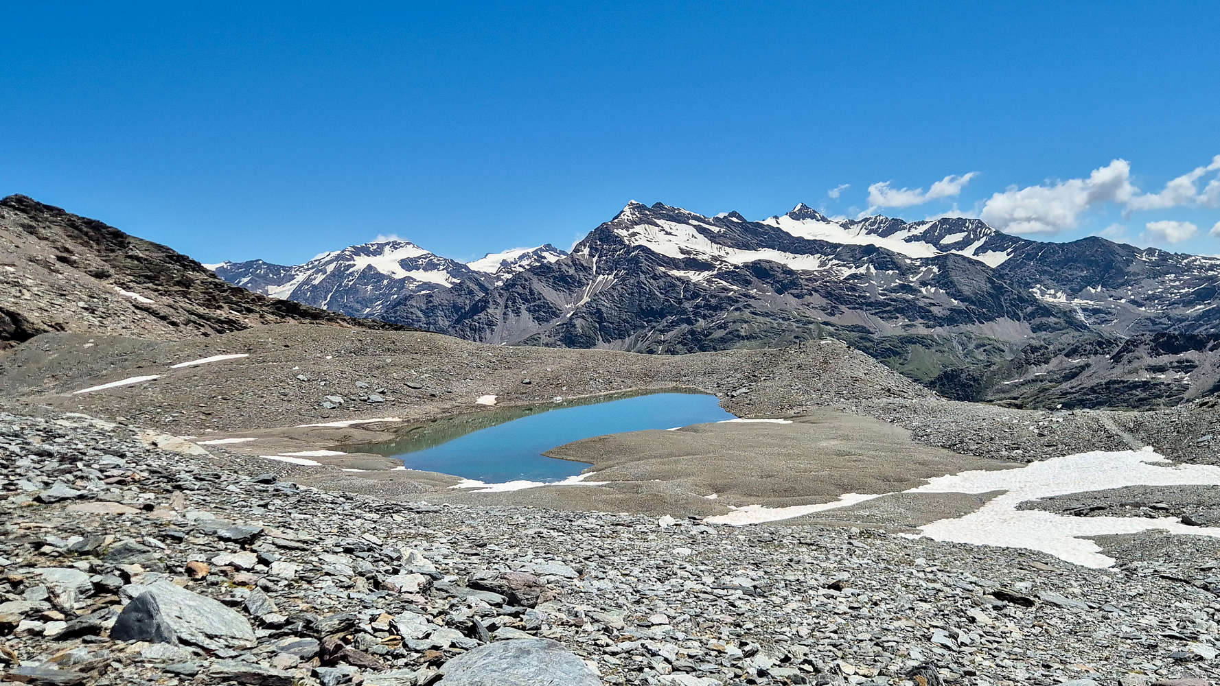
Laghetto 3,000 with a view towards the Forni Group.
At 3,000m
During the planning phase of the trip I noticed that Sobretta (3,296m) featured a lovely marker at the 3,000m point, carved out of one of the large boulders by the trail. It felt almost like fate to be on this route for our first 3,000m summit, and we wasted in continuing our ascent of the switchbacks above the lake. The trail once again was a of good quality and while the switchbacks were sharper the did not pose any sort of challenge, while the views to the S were exceptional, with the lake and the Gavia Group and its high-point, Corno dei Tre Signori (3,360m) now fully visible. We surely were quite high up, and almost out of nowhere we reached the 3,000m marker. Increasingly exhausted and with another 300m gain to go we took a couple more minutes to take photos and enjoy the view. Terry joked about how these photos would be handy if we didn’t reach the summit, but I didn’t have time for silly thoughts, we were still well on schedule.
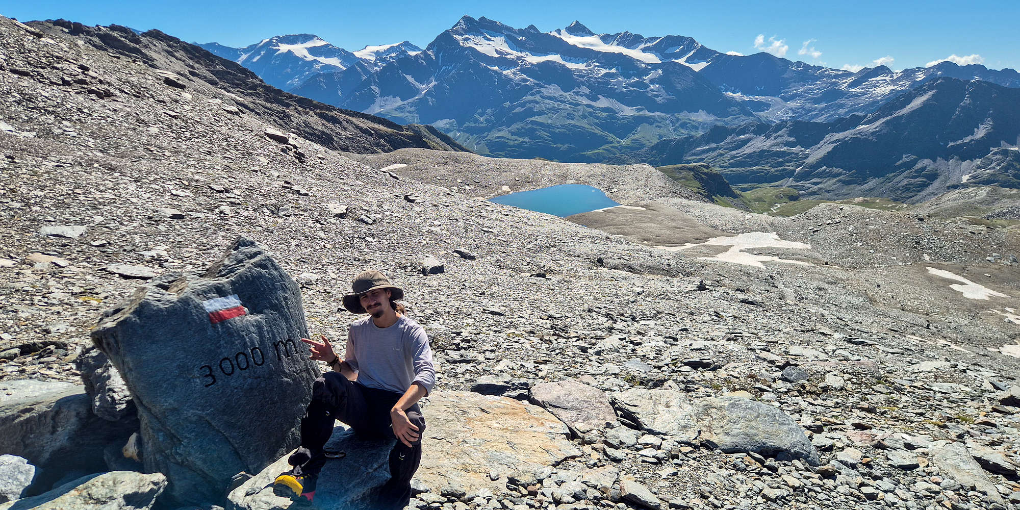
Yours truly chilling at 3,000m. The Laghetto and Forni group in the background.
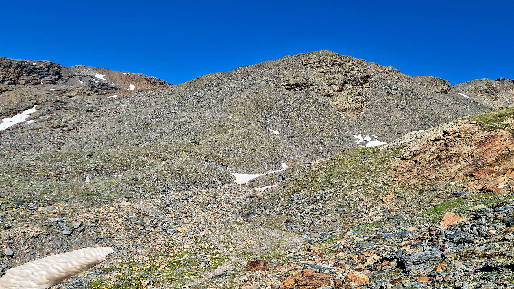
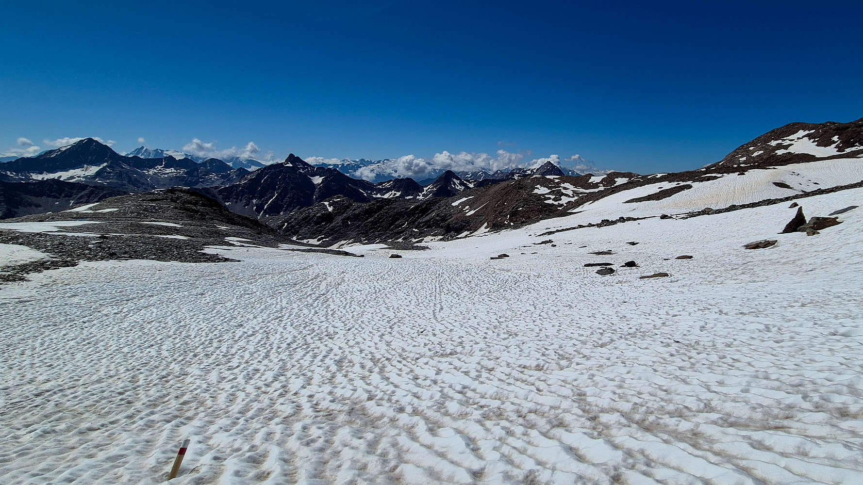
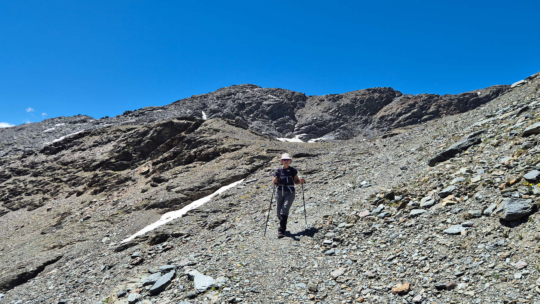
Leaving the 3,000m marker we continued up the well marked and snow-less slope, again now through even shorter switchbacks. The route prep called for a very curious set of slabs, at this level. Soon these were reached but were nothing note-worthy, other than the fresh water running down them. The slabs proved to be of no technical difficulty and were quickly surmounted. At their top and right on the largest slab, some steel bars protruded out of the rock, probably betraying the presence of some long gone installation, maybe a hut, or sensor station. Here the incline finally begun to smooth out since the start of the Upper Moraine. We broke out into a large snowy flat with ample views towards both N & S summits. We followed a single track of rocks towards and elevated position at the foot of the field and sat down.
A view of the glaciated Adamello Group, and Monte Gavia.
rail markers around the easy slabs.
Summit Push
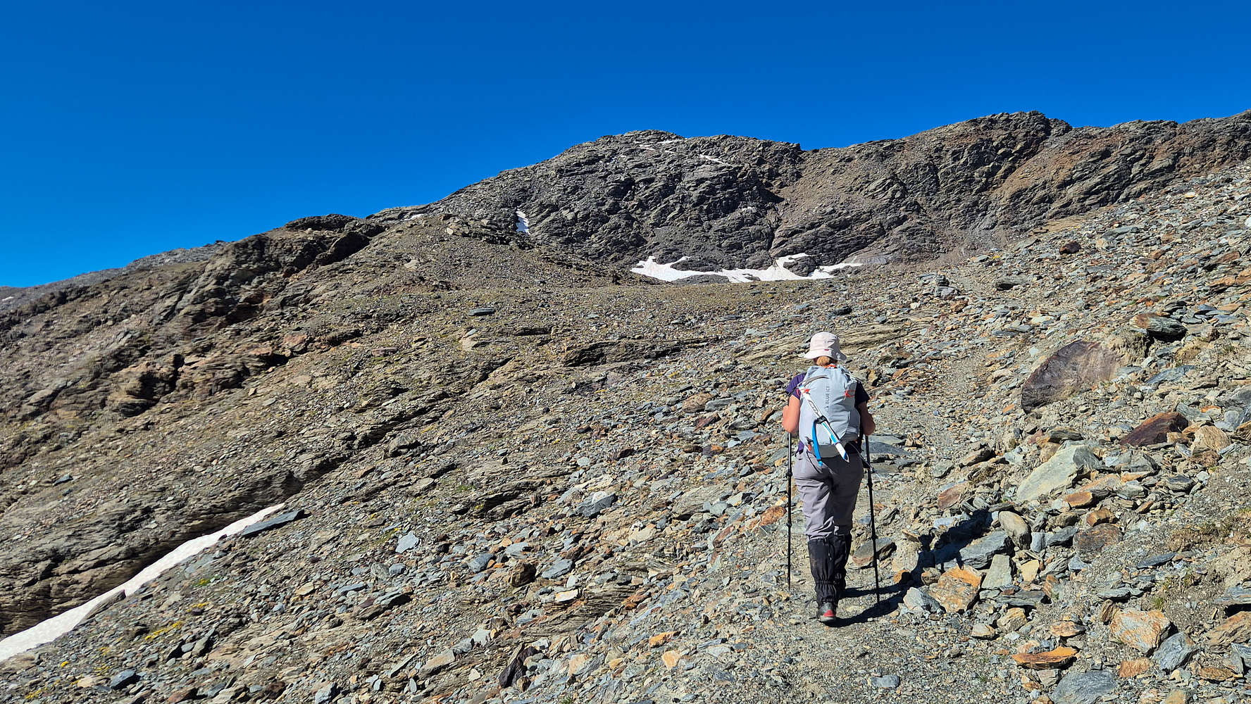
Terry starting on the upper snow field.
The summit from the upper part of the snow-field.
Most probably greatly affected now by the high temperatures and beating sun we took some time to rest before making the final push. Here, at the edge of the large snow field ample water ran down towards the moraine and we enjoyed endless views of the Alps to the S. Due to the fatigue we took some time to get going, but we were thrilled to be in the alpine zone of our 3,000m objective, with the snows still holding-on strong on the upper slopes. Our spirits were buoyed by the faint sight of the summit cross, finally! We followed the obvious track heading through the snow but found the going extremely tough due to the heat. The snow was already melting quickly and its sugary nature was setting us down all the way to the knees on every other step. Nearing the now the separating moraine of the snowfield just below the summit, and ready to tackle the switchbacks after 20 minutes on snow, we turned around to spy another party of 2, the only one we had seen all day. At this point we had just broken above the mini-moraine separating the field into two.
Terry ascending the upper snow-field with Monte Gavia 3,220m behind.
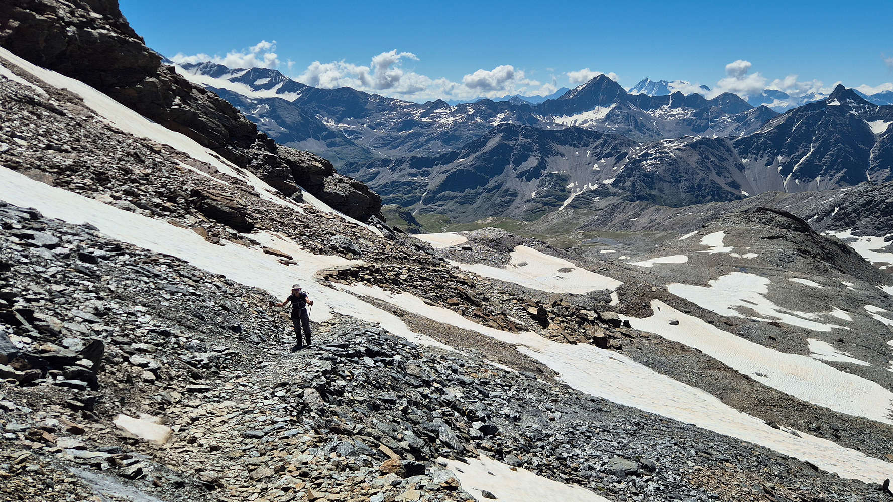
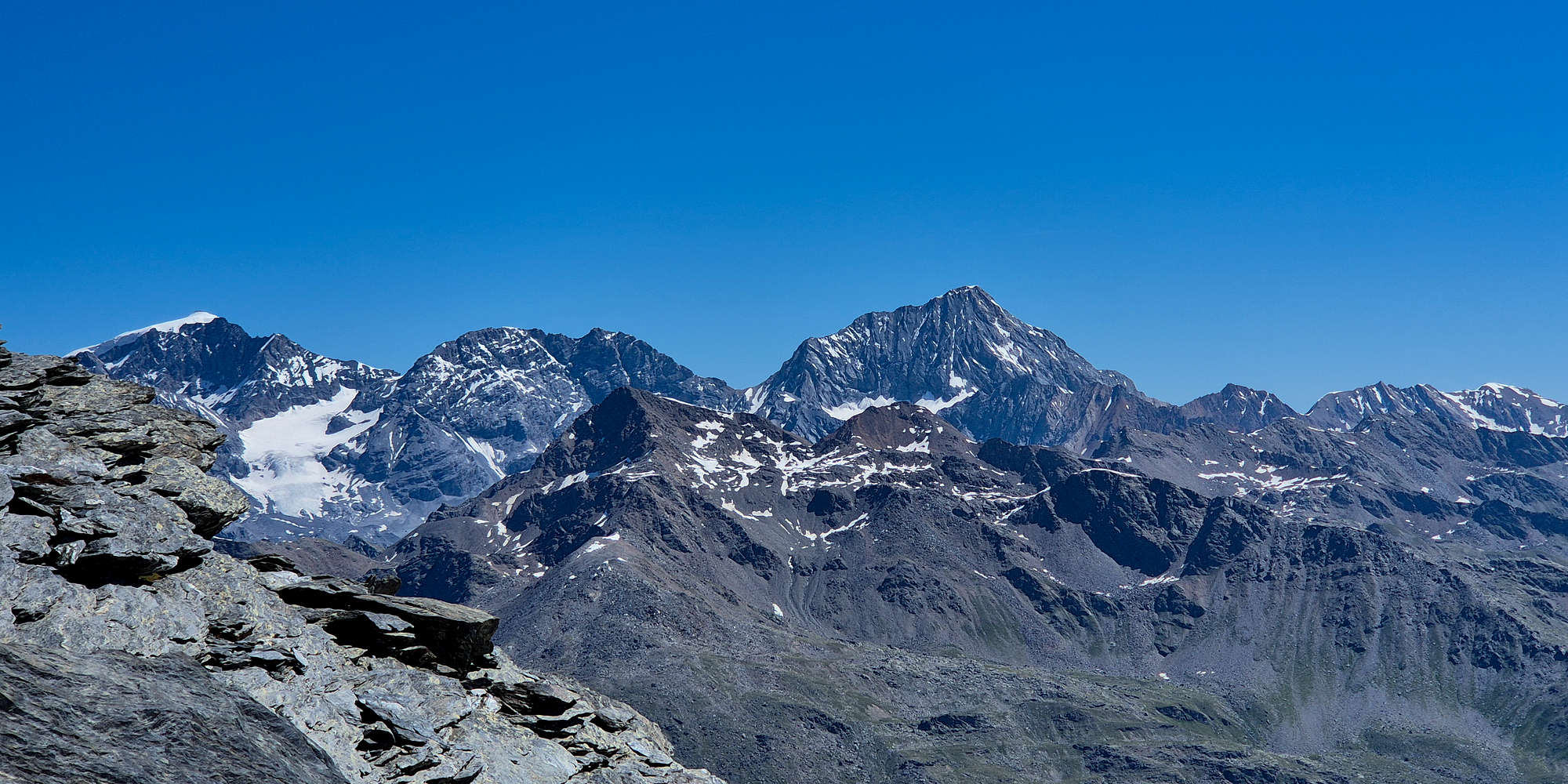
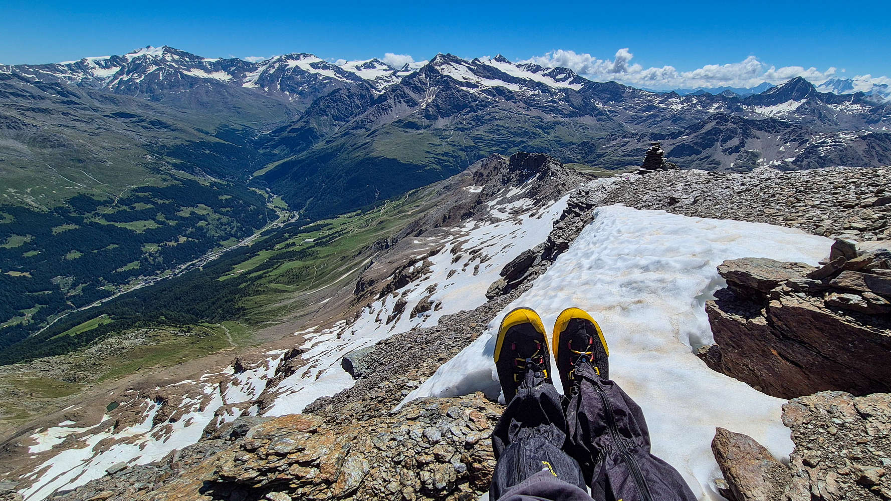
Admittedly we were now moving extremely slow being exceptionally fatigued from the distance, elevation, heat, and gear weight (we had ice-axes with us) we continued up the steeper slopes of the final snow field. Yet again the going was tiresome and we were just at the upper snow-line by the time the others had reached our level from a snow-less ledge to the right. Ascending the steeper switchbacks to the summit — the expected crux — was a rather simpleaffair , with a wide and good track. However, the total trip time had taken its toll and we were now slogging along, especially when having to navigate small patches of snow on the trail. Soon the other party had disappeared above us. It was however hard to be mad at our pace when the scenery unravelled so beautifully around us. Besides the usual sights of Gavia (3,360m) and Forni to the S, Adamello also joined the vista, while once on the 3rd switchback the exceptional Main Ridge of the Ortles also revealed itself. The perfect visibility conditions left nothing to the imagination as the majestic SW Face of the Koeningspitze (3,851m) glistened against the noon sky. From here we also got a clear view of the ice-blue waters of the lake on the ‘glacier’ of the South summit; the only one remaining on this side of the mountain. Now waiting on Terry every few steps I took the time to indulge in capturing of the views and having passed the final switchbacks below the summit I waited for her, such that we would summit at the same time, a simple gesture for the person who financed the trip with few questions and concerns. After 4:30 hours and +1,000m gain we finally stood on the summit of Monte Sobretta (3,296m) the first peak exceeding 3,000m we have ever summited.
The term “Koeningspitze” often translated to “The Mountain of the King” — a testament to the beauty of the Gran Zebru (3,851m) — is actually an mis-translation into German of the word “cunicl” meaning “little drift” in Italian, and related to iron-mining operations in the area during the 18th Century.
The snow field on Sobretta, a trail marker visible at images lower left.
Terry ascending the switchbacks bellow the summit of Sobretta.
Panorama
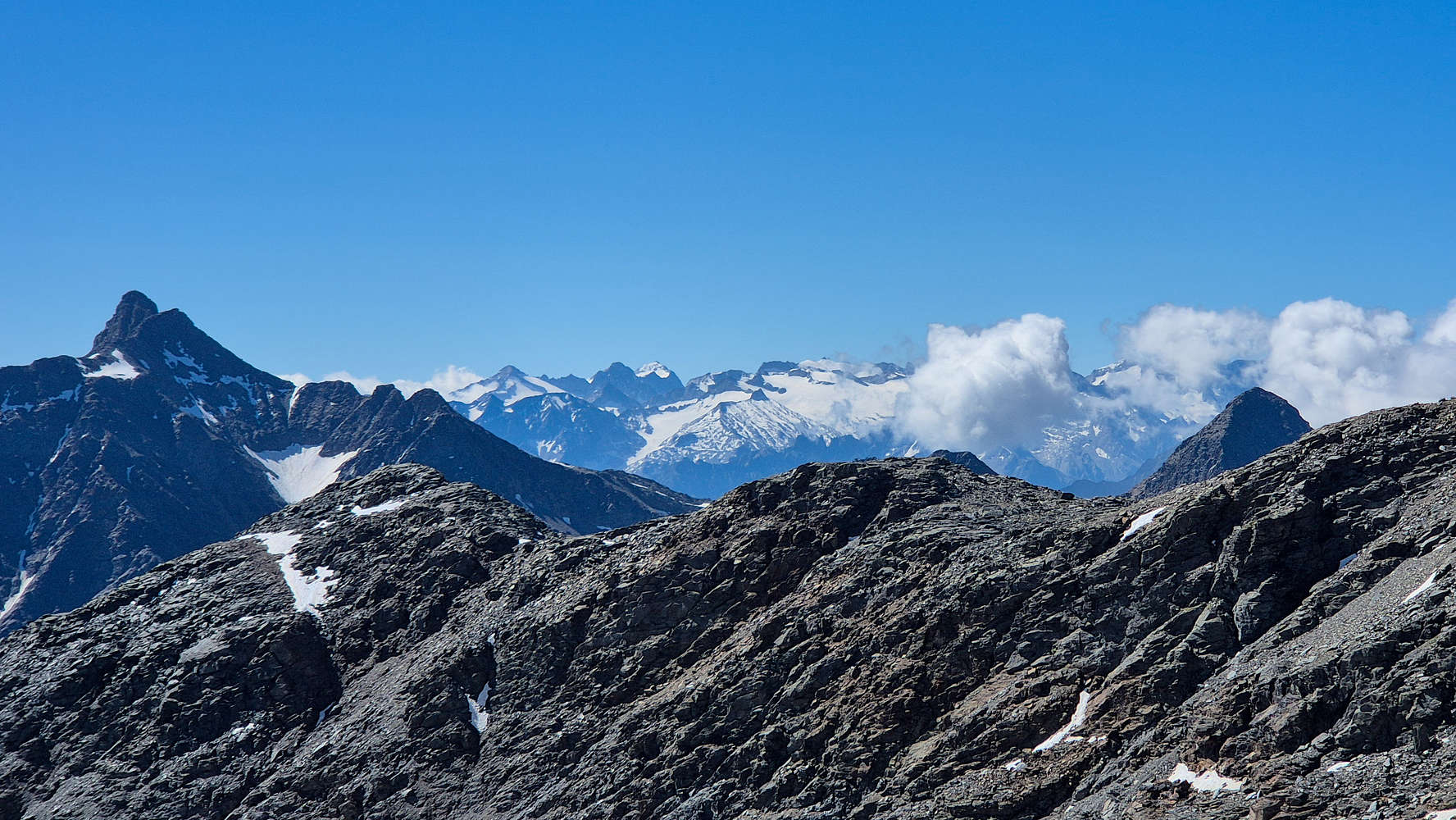
The majestic Crest Principale dell’Ortles as seen from Sobretta NE ridge.
Reaching the summit at around 11:00am on Sunday we were surprised with the clarity of vistas on offer from this “corner summit”. To the NW the gigantic Bernina Group ( ) clearly visible against the horizon, boxing us in, among glaciated alpine masses. The other party remained chatting in hushed Italian as we settled on the summit, taking out our snacks and waters. As they got up to leave we struck a quick conversation with them informing us they are locals for Valfurva, while we told them about visiting from Greece. Myself and the youngish man of the other party discussed the beautiful views, naming the peaks around us in a mix of English and Italian. We said our farewells as they headed off back down. Since we were not locals, we spent some more time enjoying the beautiful views before beginning our descent; we stayed on the summit for 28 minutes.
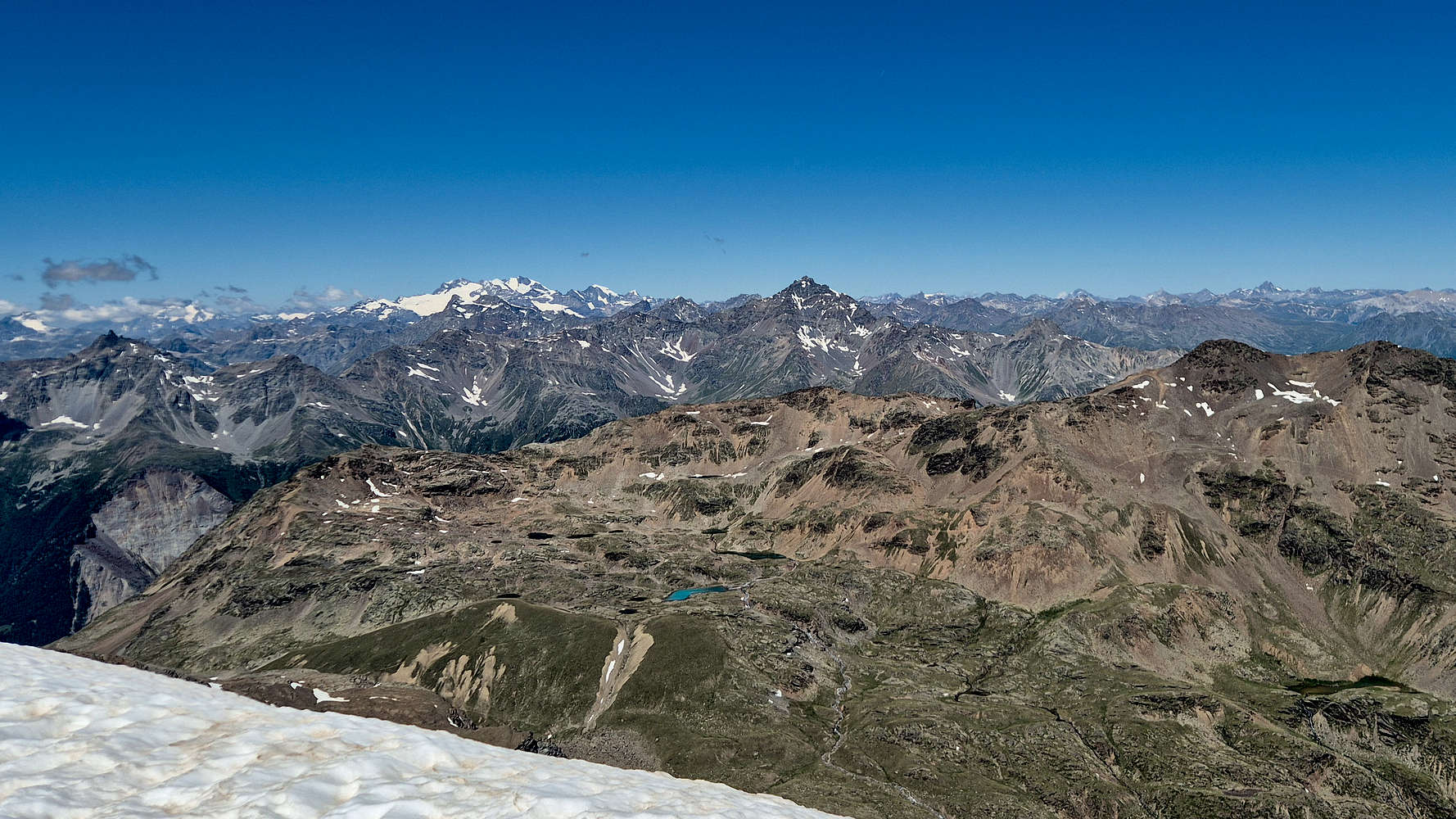
View to the N from Sobretta, Cima Piazzi & Bernina visible.
View S to Cevedale-Forni-Gavia groups from Sobretta.
A Long Return
At 11:40am we had started descending the summit and were quickly back down to the snow-field. With a slight migraine now kicking in I decided to glissade the best I could using my boots. With the snow even more sugary than before glissading was a bit of challenge but it indeed brought me down faster, giving me an opportunity to rest and wait for Terry who was walking. With little fan-fare we found ourselves descending the slabs. It is always a solemn occasion when descending a mountain, knowing that it would be incredibly unlikely you’d ever return, and so we quietly said our goodbyes to the beautiful upper reaches of Sobretta. We made it to the Upper Moraine in good time (35 mins) and started the proper descent; a frictionless experience as every step down meant more oxygen to breath. Once at the foot of the Upper Moraine we were welcomed with the deafening rumble of the Val dell’Alpe Waterfall now flush with water from the fast melting snows. We made our way down towards the Lower Moraine as quickly as possible, trying to escape from the scorching sun, we reached its base after 1 hour from the summit, and found no challenge in doing so.
Terry hiking down the top of the Upper Moraine.
Terry descending past the Sunny Valley cliffs.
We continued on the traverse of the S aspect, passing by the seasonal lake above Laghetto dell’Alpe, seeing a few sights of “civilization” again, as a party of 3 enjoyed their lunch above the lake. We then passed by Laghetto dell’Alpe (2,740m) continuing our descent towards Refugio Sunny Valley. Although the traverse offered little elevation loss, the scenery was exceptional, and our pace was fast, looking to leave the hot ‘pan’ of the upper mountain behind. We arrived near Refugio Sunny Valley after a fast 25 minutes to see a few more people enjoying the sun around the lake. Descending via the road towards intersection 536/01 we ran into another party of 4, ascending perhaps to relax somewhere around Sunny Valley. We reached the descent trail of Ponte dell’Alpe after 30 minutes from the lower moraine only to see signage suggesting 45 more minutes to Ponte dell’Alpe. As such we picked up the pace descending the sunny green switchbacks below Sunny Valley.
The narrow trail on Val dell’Alpe upper rungs.
The beautiful Torrente dell’Alpe on our return at 13:30.
The Marmots were now well asleep with the noon sun beating down, while far above us within the Forni Group, especially on Pizzo Tresero (2,594m), sluff avalanches and rock-slides darkened the steep slopes of snow. It was easily around 25C under the sun even up here at 2,500m, unbeknownst to us the second hottest day in the 21st Century for the Alps (after 2003). We retraced our steps and meaning to turns left farther up the slope, in a bid to lose elevation faster, we took a false intersection. Luckily the slopes were easy and we quickly connected with the trail below. Taking the 563 bike route, a few rungs above the dirt road, we managed the traverse of the lower Val dell’ Alpe slopes easily, although the trail was rather narrow. Soon we reached the pastures above Ponte dell’ Alpe, catching a glimpse of the local cattle. With a terrible migraine I yelled back at Terry that I’d head down fast, and made my way next to the bridge in a bid to relax before leaving. I completed the hike in just over 7 hours, but my migraine had much more to give, especially since the exhausts of bikes driving up and down SS300 “Gavia Pass” echoed next to me.
Interactive Map
Logistics
This summit was part of the June 2025 Como & Valtellina trip with Terry. This was our trips main objective and we drove in the day before from Varese and summited Monte Barro (922m) and Monte Muggio (1,799m) on the way in. We stayed the night in Santa Caterina di Valfurva and left towards Bormio and then Sodrio after our successful hike of Monte Sobretta (3,296m).
📰 Read more about our trip logistics on the relevant Trip Report: Como & Valtellina.
Nearby Peaks
Monte Sobretta (3,296m) [P-600]
Cevedale Group (3,769m) [P-500]
Cresta Principale dell'Ortles (3,905m) [P-1500]