Monte Muggio (1,799m) [P-867]
Summited On: June 28, 2025
Region: Orobie Alps, Province Lecco, Lombardy, Italy
Overview
Monte Muggio (1,799m) [P-867] is rather hidden although prominent peak of the Legnone Group of the Orobie Alps in Lecco, on the right side of SS36. Muggio (1,799m) is situated between Grigne (2,410m) and Legnone (2,609m) and is therefore an overlooked mountaineering objective, mainly due to easy access, mellow grade, and no technical challenges. This however make it a lovely chill peakbagging objective for a sunny hot day, with very small elevation gain needed to reach its summit from Alpe Guimello; the ski resort on the S slopes.
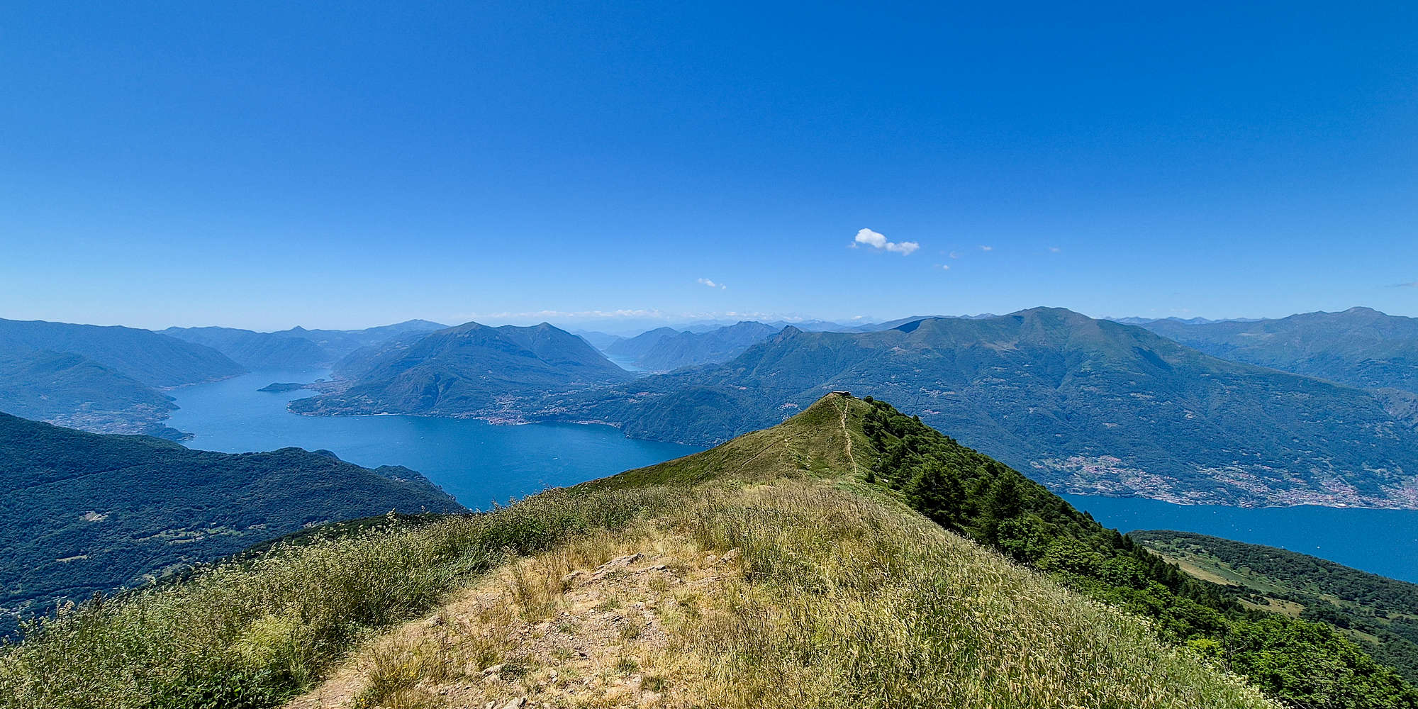
Peak 1754 from Croce di Monte Muggio 1,799m, Lago di Como visible across.
We drove towards Monte Muggio (1,799m) following our ascent of Monte Barro (922m) during a hot Saturday noon. We avoided the traffic driving north on SS36 from Lecco to Valtellina by driving through the quaint Valsassina, on the E side of Grigne (2,410m). The drive through Valsassina was very scenic as we enjoyed views of the sheer limestone cliffs, climbers scaling them, and some returning from their outings. We drove through quaint villages and ascended the steep and winding panorama road of Alpe Guimello, putting our rental Skoda Fabia through its paces.
Route
After parking at Alpe Guimello and sorting out the payment for 2 hours (€3.50) in the extreme mid-day heat, Terry who was already tired from our ascent of Monte Barro (922m) an hour earlier, and of course driving, opted to stay behind, heading towards Ristorio Genio to get a beer. I changed into my brand new La Sportiva Aequilibrium GTX boots and after re-loading on plenty of sun-screen I went towards the mellow slope of the ski resort.
A Hot Pursuit
The trail is immediately visible above the parking lot and next to the parking meter machine at 1,555m and the track is well laid out. I continued up the low incline to the left, heading directly towards a set of trees surrounded by a fence. Right before, a very light track moves right to connect with a direct trail. This trail, in more than 500m, gains about 80-90m towards the ridge, moving N. As the ridge is approached the steepness increases and here slow but steady steps were enough to keep things fast under the incredibly hot sun. Within 10 minutes I had made my way onto the ridge, where the larger track from the E of the ridge is met, here a took a minute or so to recuperate before continuing to the summit. My GPS read 150m delta to the top, but it seemed closer.
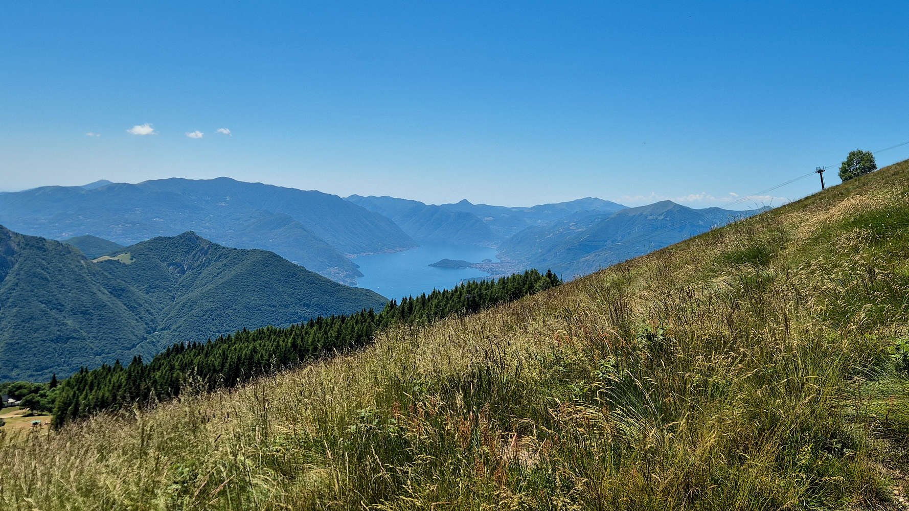
A first view of Lago di Como and Sasso Gordona (1,410m).
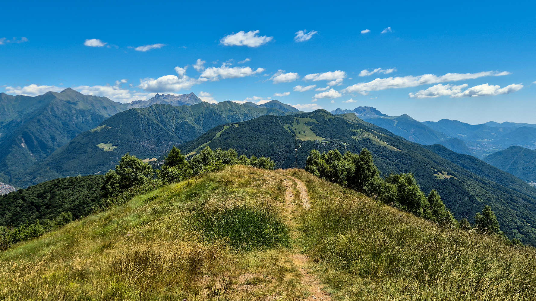
View to the E from Muggio summit ridge.
Picking up the pace under the impression of being close I made quick work of the ridge which at points was rather steep due to the erosion of the path. At this point I was completely alone in the upper reaches with other hiker now having descended to enjoy their drinks and food and avoid the sun. While the heat continued to be a challenge, but the panoramic views towards Monte Legnone (2,609m), Grigne (2,410m), Pizzo dei Tres Signori (2,554m), and Gruppo dei Campelli (2,159m) were a worthwhile rewards. Passing by the lift top station in a snails pace I soon laid eyes to the summit cross, I was >1,000m above Lago di Como!
At the Summit
As usual my stay at the summit was not too long, but it gave me an exceptional opportunity to enjoy the magnificent views towards Lago di Como and Lugano in surprising clarity given the heat and lack of wind. It was not the lakes, nor the nearby giant of Legnone (2,609m) which drew my attention. It was a set of shapes set up much higher and farther on the horizon, confusable as clouds!
To my abject surprise it was the giants of the Western Alps! Right across +150km of terrain I could see, clear as day Gran Paradiso, Monte Rosa, and the Matterhorn; oh what joy! I must have froze in disbelief, assuming that this well proportioned spectre in the distance could not be the Matterhorn; but a quick look on the map verified it. If there is a God he certainly had me on his mind today, rewarding me with such a incredible sight. In a weird way I at once felt welcome within the range, as if my dues were paid, and I had been invited to “sit down” with the peaks of the Alps, share a beer and maybe an adventure too…
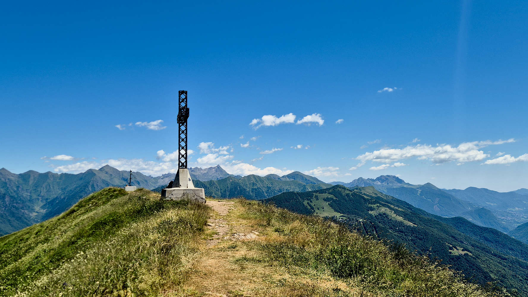
Croce di Monte Muggio (1,799m) and the E view.
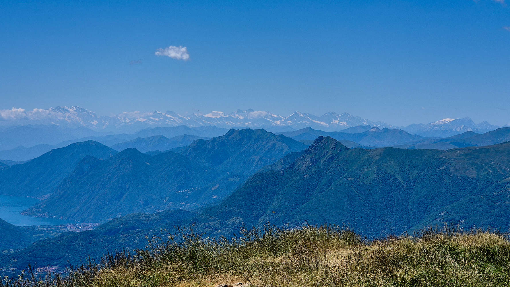
The giants of Gran Paradiso, Monte Rossa, and Leone +150km away.
Towards the Beer
Turning back down with a full heart and optimistic for our prospects during the rest of our stay I put the boots’ “Impact Brake System” to good use practically running down. While this did not last long on account of my knee, elevation was not tough to lose on this direct route. Soon I was back below the lift top station, enjoying views towards the extended Orobie group, Valsassina Valley, and the spectacular rocky Grigne (2,410m). The gigantic and eerily quiet Legnone (2,609m) followed me until I dropped below the ridge. My focus now turned on the curiosities of the ski resort on such a warm Saturday afternoon, with a small water slide, and people tanning on picnic blankets on the slope. The thought of the large cold beer which was awaiting me at the restaurant was overwhelming as I rushed down the flatter slopes at the bottom. Hitting the tarmac running I sped towards the restaurant terrace only to find Terry just now pouring her beer, she turned around surprised “you are back?! its just been 30 minutes!”
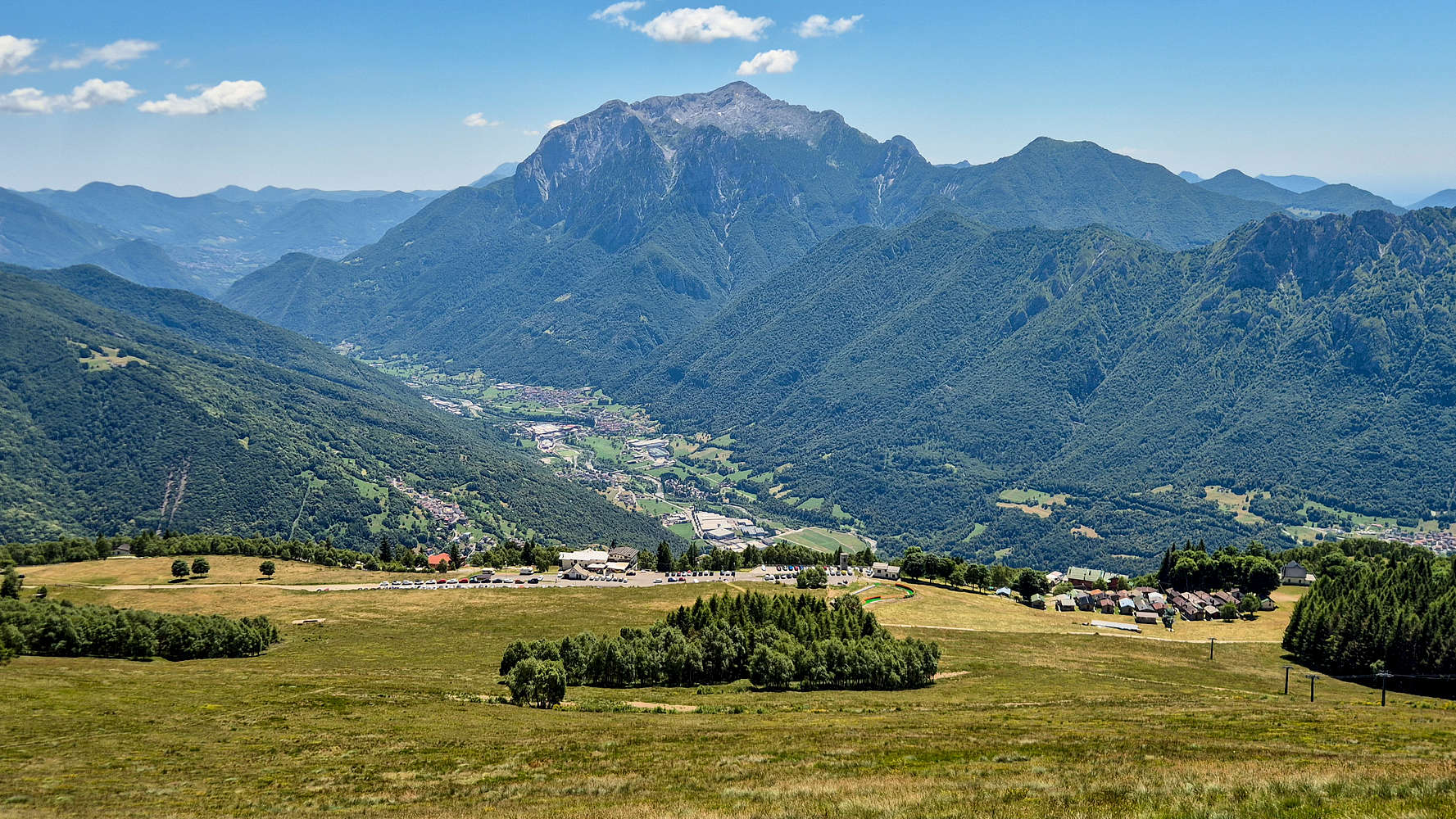
Valsassina, Gringa Settentrionale (2,410m), and Alpe Guimello.
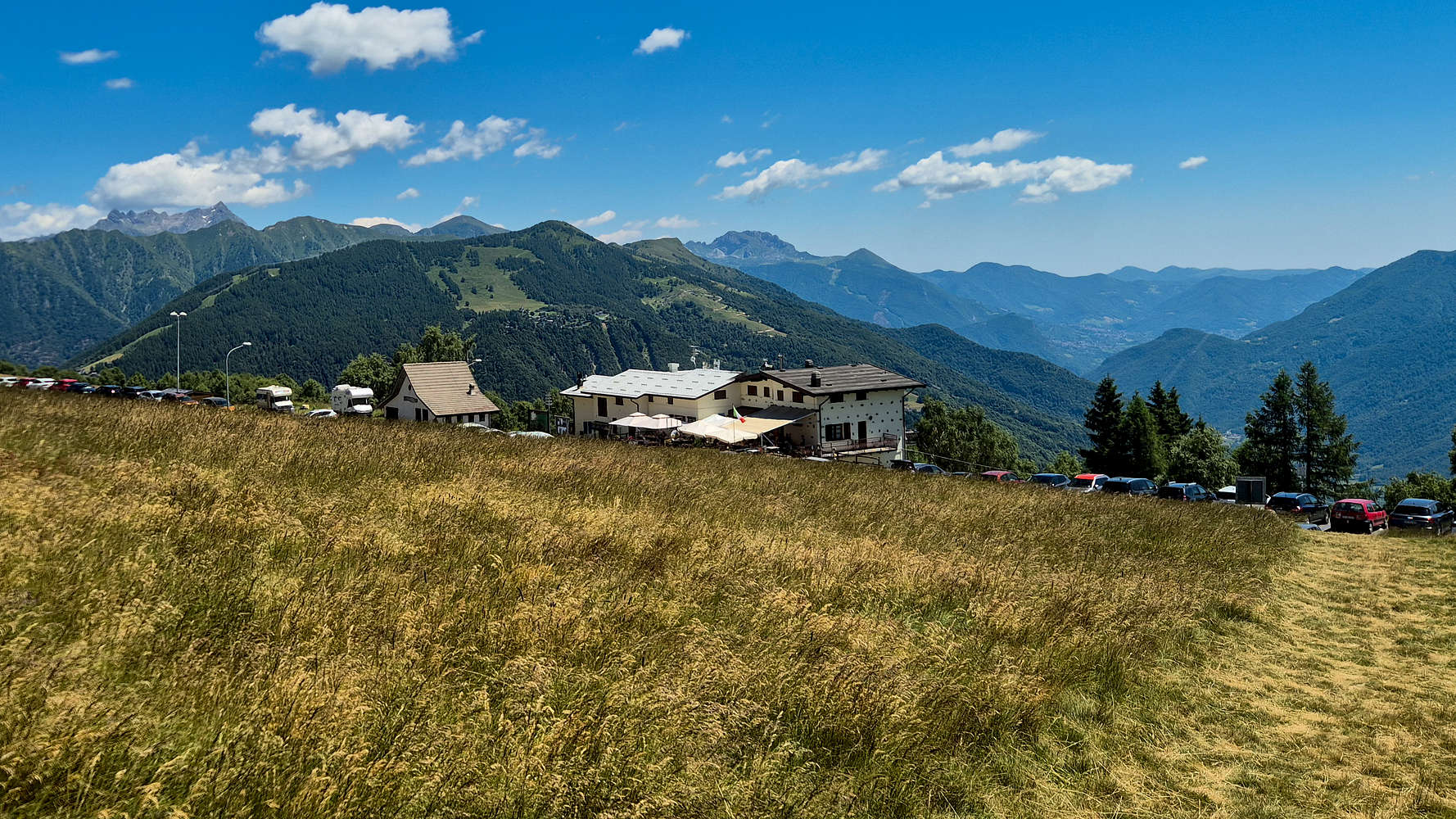
Restorio Genio at Alpe Guimello from the trail.
Interactive Map
Logistics
This summit was part of the June 2025 Como & Valtellina trip with Terry. We drove in from Lecco after summiting Monte Barro (922m) on the first day of our trip. We would drive about 3 hours more, first to Bellano and then to Santa Caterina di Valfurva where we would sleep before our major objective.
📰 Read more about our trip logistics on the relevant Trip Report: Como & Valtellina.
Nearby Peaks
The following are some notable nearby peaks which were either visible during this hiker or are otherwise nearby.
Monte Legnone (2,609m) [P-624]
Pizzo Cornagiera (2,049m) [P-229]
Zuccone Campelli (2,161m) [P-510m]
Pizzo dei Tre Signori (2,554m) [P-401]