Monte Barro (922m) [P-657]
Summited On: June 28, 2025
Region: Pre-Alps, Province Lecco, Lombardy, Italy
Overview
Monte Barro (922m) [P-657] is an arguably small but incredibly steep and prominent peak overlooking Lecco on the Eastern side of the Triangolo Lariano (Lario Triangle) separating Lecco and Como. The mountain is of historical significance having been a base for the Goths, and later serving as a location for lime mining. The peak is imposing and generally noticeable from all directions, boasting a rise in excess of 600m on all 4 sides. Due to its status as a park, and the existence of the Eremo (Monastery), access to its highest sections is generally a simple affair. The peak should not be underestimated as it features very steep and rocky sections near its summit, although the normal trail is easy.
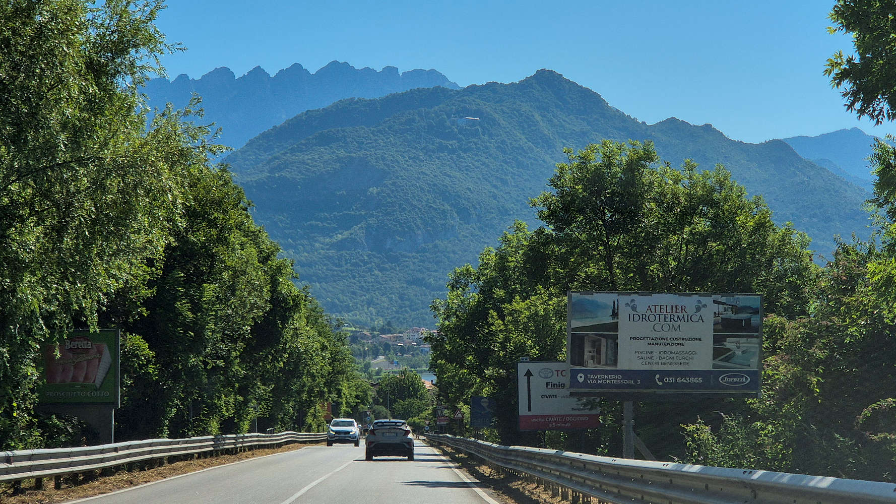
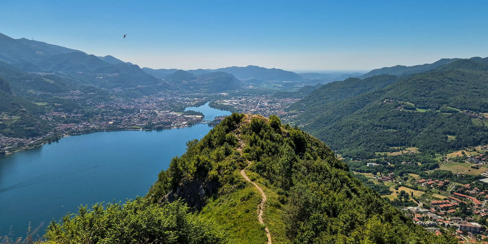
Monte Barro 922m as seen from the road towards Lecco.
Our ascent of Monte Barro (922m) begun after a 1 hour drive from Varese making it our first summit of the June 2025 Como & Valtellina trip; an excellent introduction to the delights of the area. However, the conditions were excruciating with the temperature well above 30C and very high humidity. Even so we were happy to have reached our first trailhead with little trouble and finding easy free parking at the Eremo.
“Eremo” originates from the Greek “erēmos” meaning desert/ed, a term fitting for a monastery.
Route
Our planned route was an ascent of Vetta Monte Barro (922m) from the SW using the direct route and then descent via the SE ridge route, tagging Monte San Michele (815m) [P-28] and descending towards Sella dei Trovanti (800m) to rejoin the ascent route. I had unfortunately expected this to take less than 1 hour, and had also forgotten to change into my athletics breathable T-shirt.
The Ascent
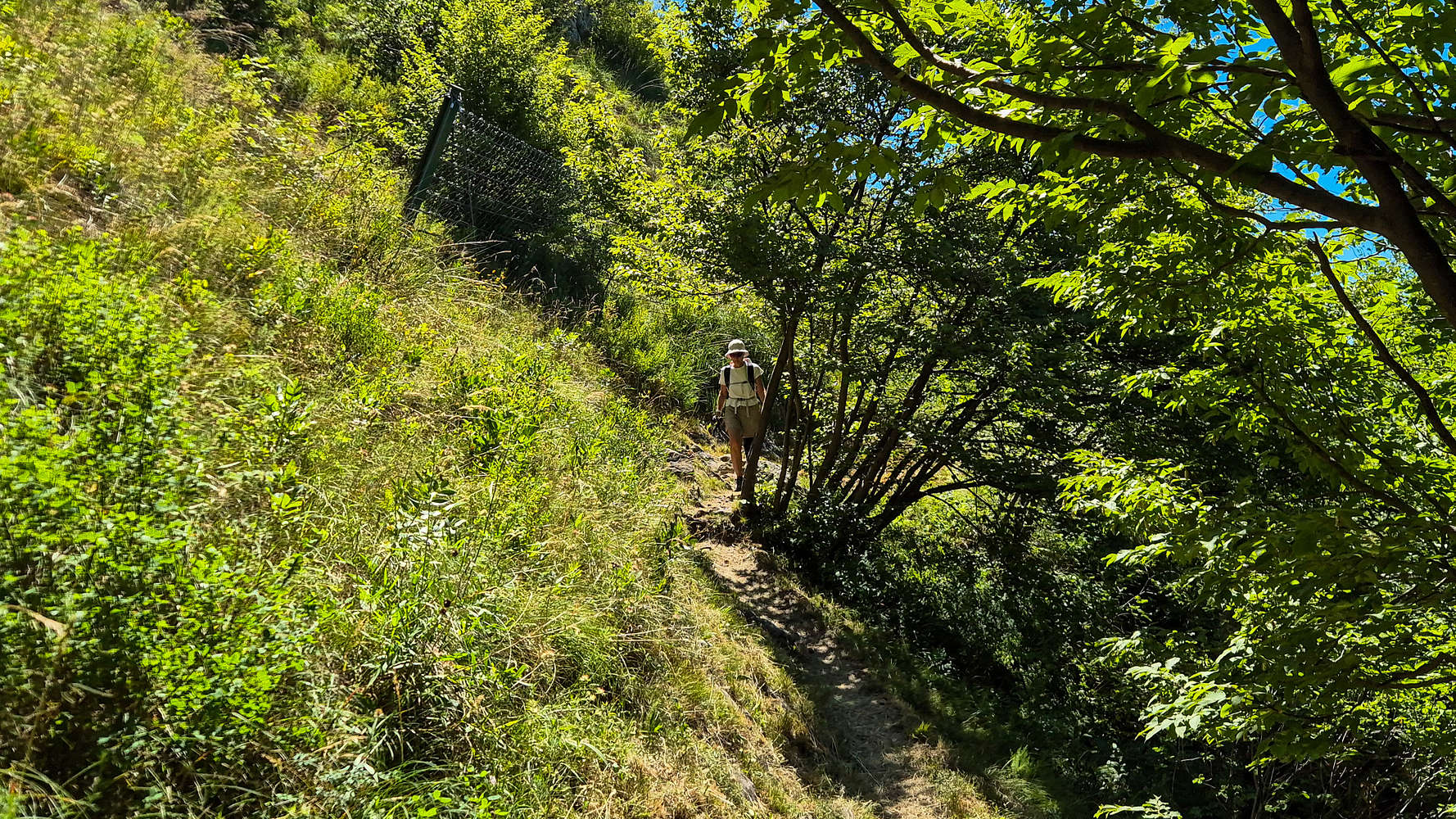
Starting from right outside the chapel we followed the obvious track taking us E and outside the immediate area of Eremo, we continued up the road past the fountain and to the left (N). Here some improvised switchbacks shorten the otherwise winding paved trail. Right above it the ascent follows the track of the Botanical Garden, which contains several interesting species, all with accompanying yellow “cards”. This first section is essentially a nature walk on a good trail with railings on the downhill side. This first section ends at Sella dei Trovanti (800m), was almost reached after 10 or so minutes. In our inexperience we did not follow an obvious sign with the words “Vetta” and instead deviated and climbed the Tovanti Outcrop (~310m), requiring a rough downclimb on slabs for 4-5m. From here the steeper ascent of 122m to the summit cross (croce) begins.
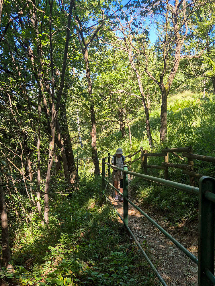
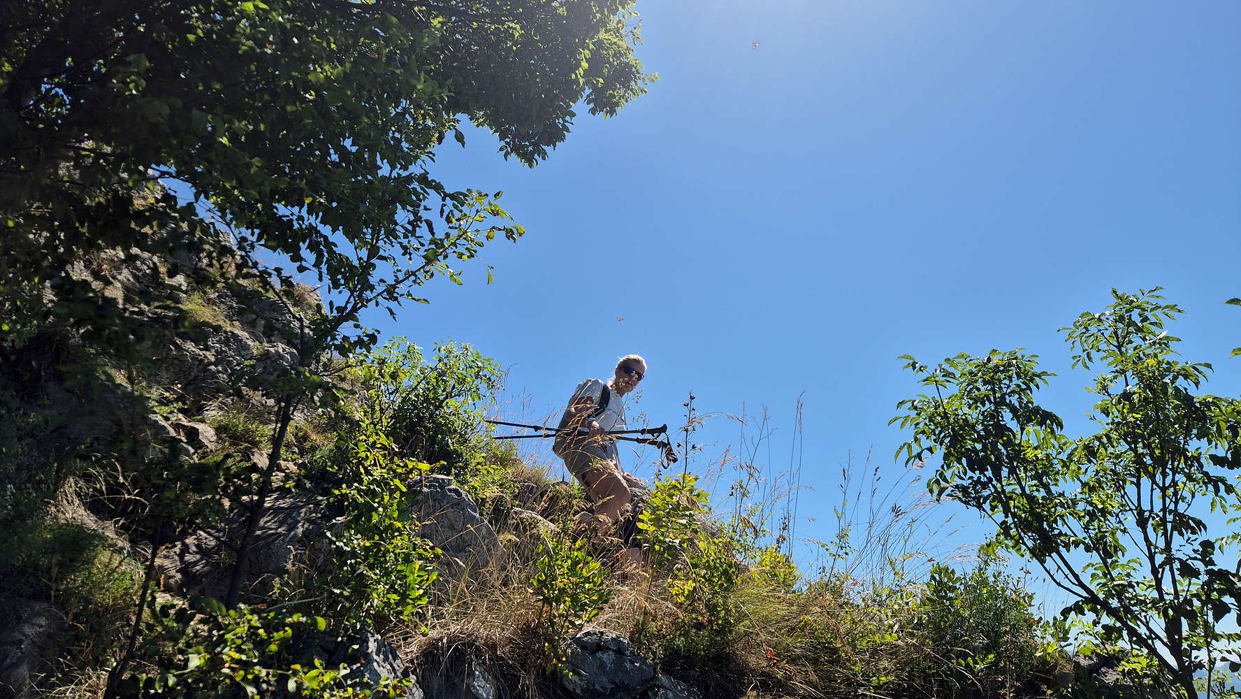
Terry hiking the Botanical Garden section.
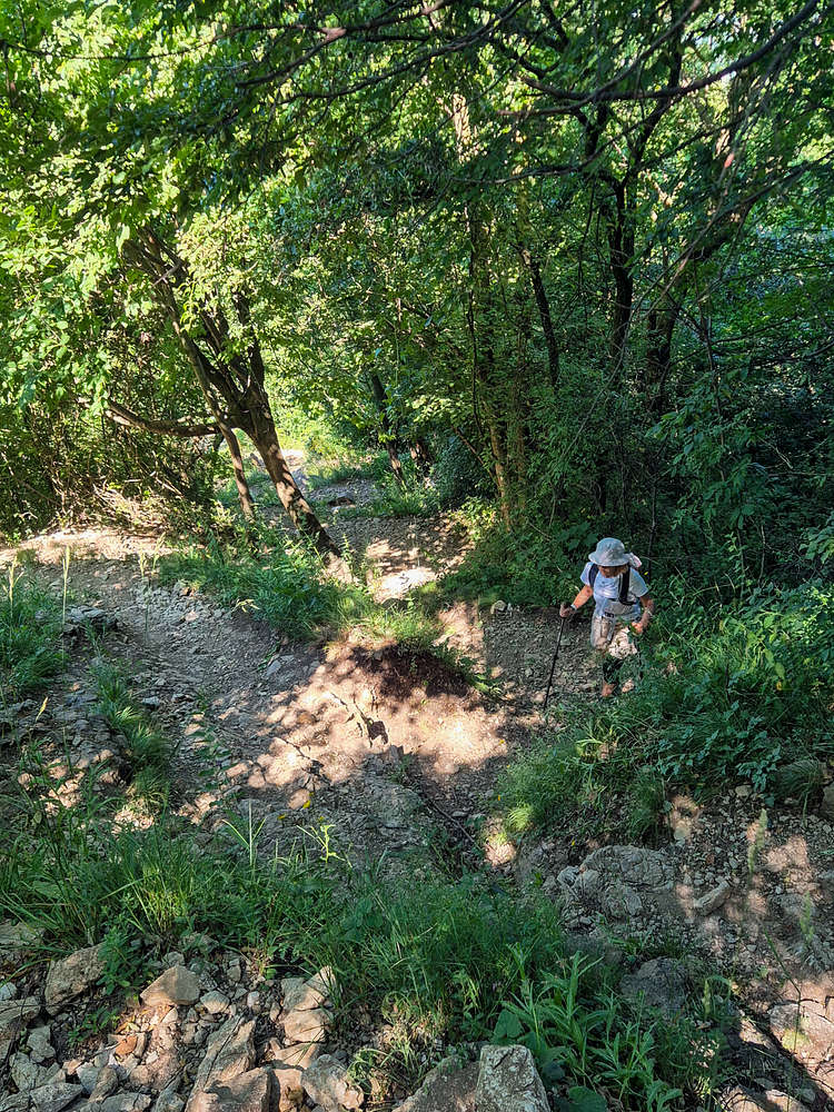
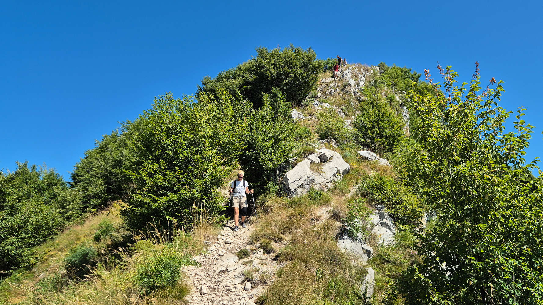
Terry ascending the wide-switchbacks towards the summit.
We continued onwards from Trovanti Col. at 800m following the wide dirt track making its way up. Slowly but surely the insane heat started to take a toll on us and we got passed by all the other parties making the ascent at the same time. Slowly but surely we reached the first limestone slabs, no more than 2-3m tall and not steep, but exceptionally slippery on account of the traffic. Past the slabs more switchbacks continue and are intermittent by two more smaller slab sections requiring some attention. While steep, the trail presented us little challenge, although the heat did. Past the final intersection with the N ridge the forest finally begins to clear and exceptional views towards the 3+1 Lakes of the Triangolo Lariano: Anonne Est & Ovest, Pusiano & Alserio. At this point the scorching sun briefly became bearable again as the summit cross came into view.
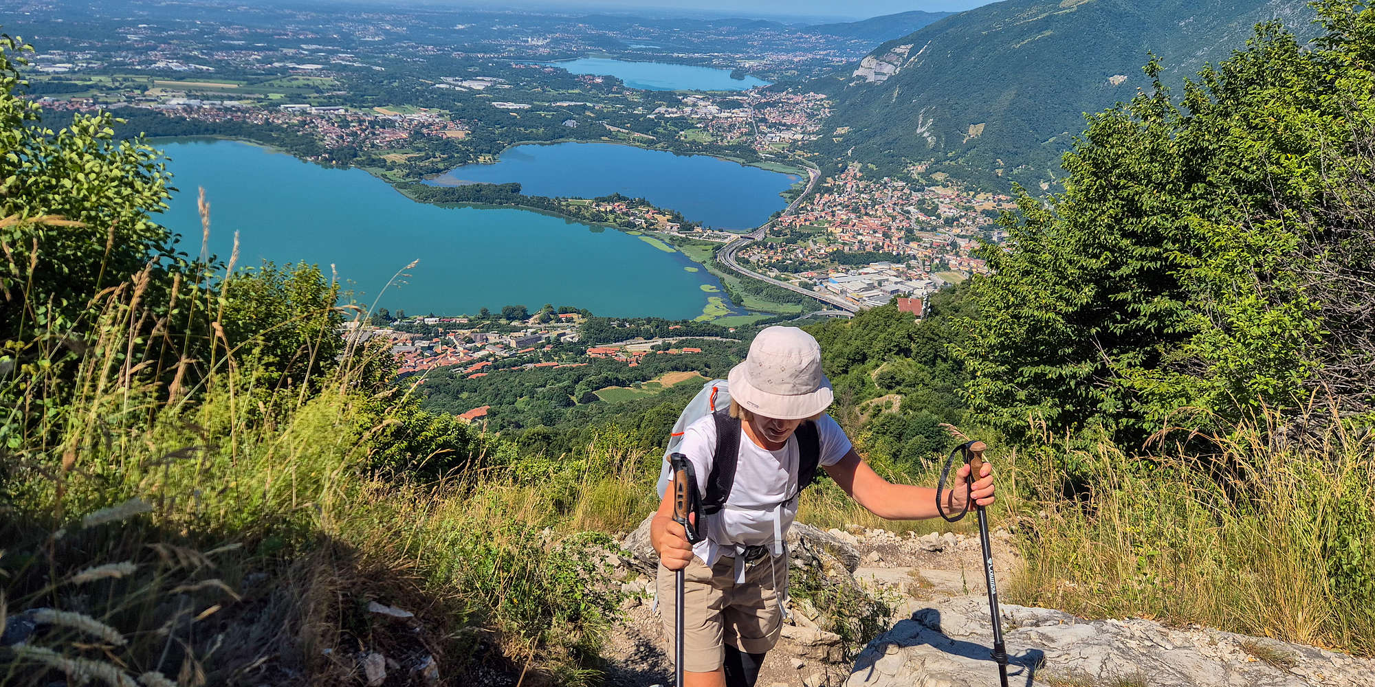
Terry with an exceptional view of the Lariano 3+1 lakes behind.
We pulled up to the summit in excruciating heat, to find a whole number of people which we had seen on trail. Smartly most of them had taken off their t-shirts to enjoy the very minimal breeze which infrequently appeared; I joined in taking off my incredibly wet cotton t-shirt, I would not wear it again. A few words with the other hikers later, some photos, and lots of taking in the view later we sat down to re-hydrate before departing. Our descent would be via the S ridge, which was thought to be a little less steep, and better for our knees.
Down the S Ridge
Eye-catching views towards San Michele 815m and Lake Como outflow.
We were the first to leave the summit and followed sparse markings to the S, almost falling in towards the steep Sella della Pila (787m) and Lake Como. The first few minutes inspired a false confidence and probably also inspired another party of young hikers to follow us. Soon we found ourselves above a steep limestone slab, maybe 3m tall at worst, which required a full hanging drop-down to down-climb. After almost throwing my poles into the abyss, I made my way down, only for Terry to point out that it was a “unpleasant & difficult” move, alas she did it just fine. From here the trail quickly smoothed out into well trodden dirt which although steep on the descent was otherwise fine. At this point we wondered about the whereabouts of the other group, who were still downclimbing the outcrop, alas they also succeeded no problem. With the technical aspects behind I bid Terry a quick farewell as I rushed down to Sella della Pila (787m) with the goal of asending the minor second summit of Monte San Michele or I Corno at 815m.
Terry on the first downclimb of the S ridge.
Terry past the steep section of the S ridge.
San Michele (815m)
Admittedly I went a little too fast, slipping and eating shit twice on the trail to the col, but gained elevation towards Monte San Michele (815m) [P-28] very quickly. This gave me enough time to take a few photos with leisure, as well as catching both Terry and the other party in action — as visible in the photo. At the same time I was able to quickly return back down to Pila Col. (787m) without leaving Terry to bake in the sun for long.
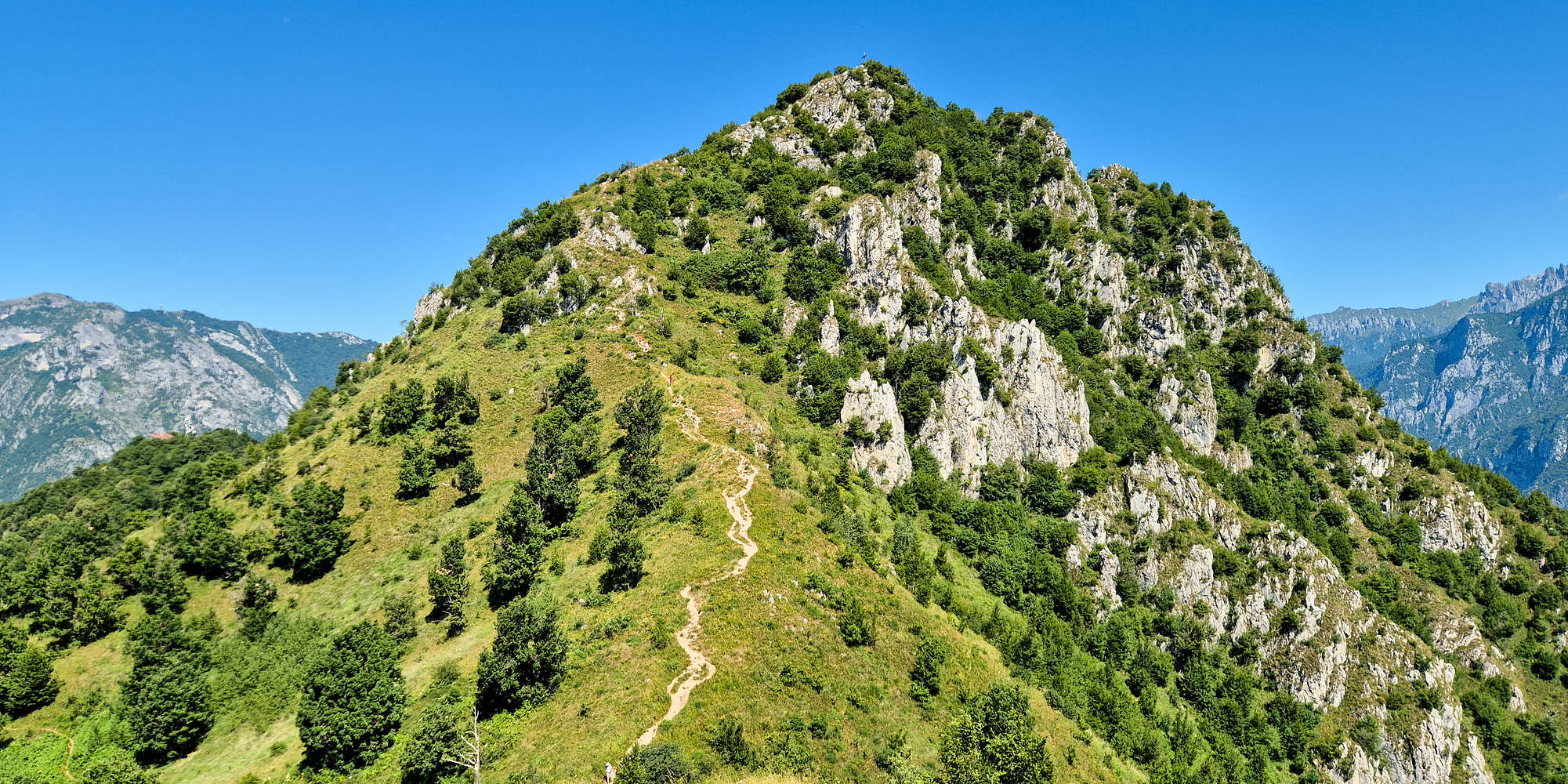
Monte Barro 922m summit cone from San Michele 815m.
An Archeologists Loop
Back at Pila (787m) now, and ahead of Terry I begun the long-ish traverse of the SW bowl of Monte Barro (922m), heading NW towards Trovanti Col. (800m) gaining around 20m along the way. The route extension is very interesting due to the presence of various archeological elements such as a Pestle carved into a rock — most probably a large erratic boulder — and a stone outbuilding, probably an emergency shelter or storage of sorts. We winded through the lush greenery of the slope on the well carved track; which at sections has consequential exposure to the left (downhill). This was not optimal given the intense heat and with both of us feeling a bit woozy. But just as the descent seemed a bit too long, we reached Trovanti Col. (800m) and rejoined the protected track of the Botanical Garden. Unbeknownst to me the trail was busy and so I had to walk past quite a few people shirtless, not a proud hiking etiquette moment, although maybe the conditions lightly excused it.
Terry descending the final part of the SW face traverse.
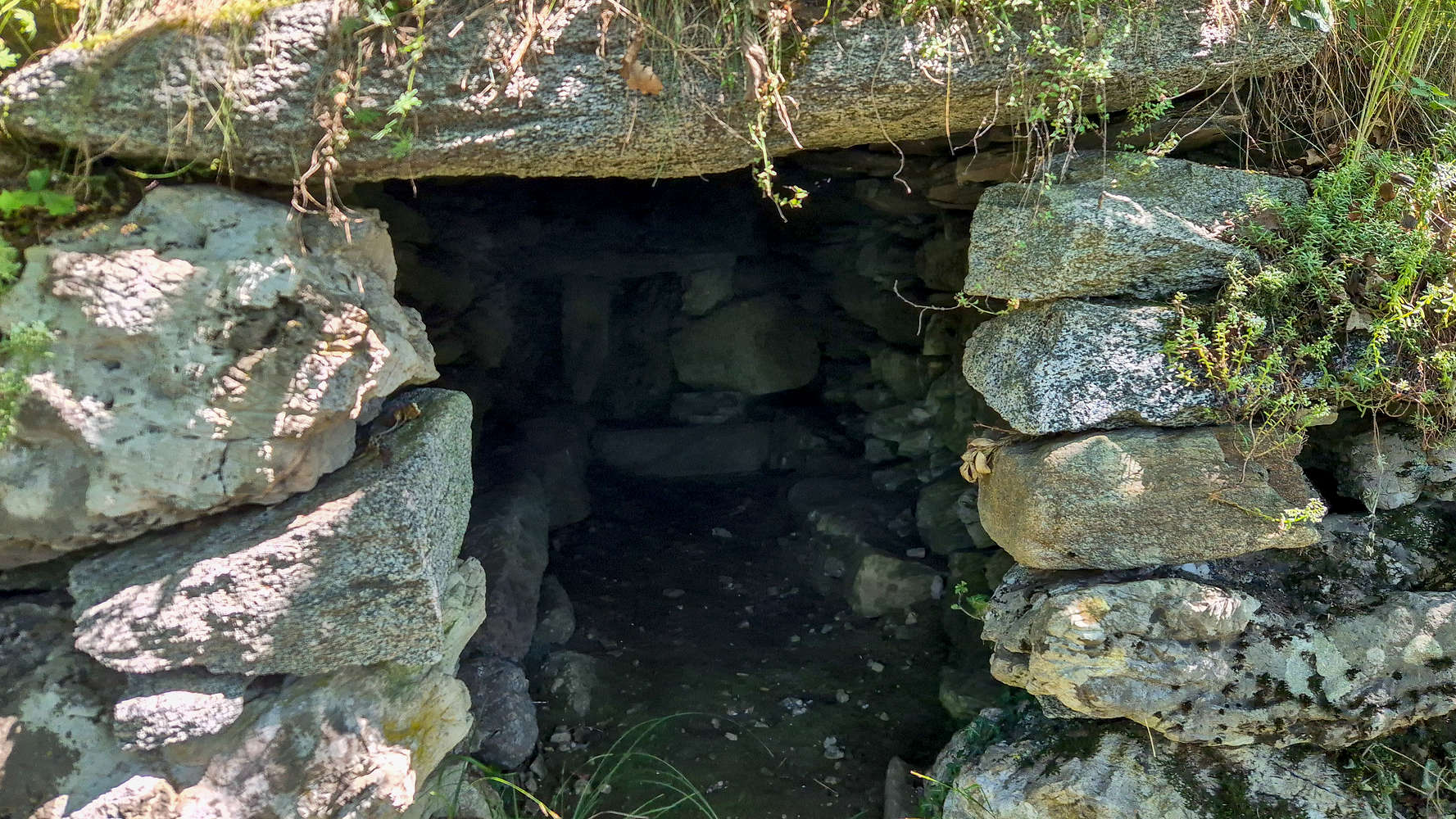
The curious stone-outbuilding on the trailside.
I found an opportunity to wear my uncomfortably wet shirt again by the spring next to the chapel, also taking some time to fill up on water — drink and then fill up again!
Interactive Map
Logistics
This summit was part of the June 2025 Como & Valtellina trip with Terry. We drove in from Varese after out post-flight sleep, and would continue towards Monte Muggio (1,799m) and sleep some 3 hours away in Santa Caterina di Valfurva.
📰 Read more about our trip logistics on the relevant Trip Report: Como & Valtellina.
Nearby Peaks
Some of the nearby peaks and their isolated or otherwise significant subpeaks.
Monte Barro (922m) [P-657]
Corni di Canzo Occidentale (1,373m) [P-875]
Resegone di Lecco (1,875m) [P-727]
Monte di Brianza (889m) [P-518]
Monte Coltignone (1,473m) [P-193]