Moni Island HP (172m) [P-172]
Summited On: May 24, 2025
Region: Piraeus & Islands, Central Greece, Greece.
Overview
Moni Island [”Νήσος Μονή”] (172m) is a small limestone formation SW of Aegina Island (”Άιγινα”) in the Saronic Gulf of Greece, just over 1 hour by ferry from Piraeus. While getting to Moni can be a bit more complex, it is still worth the journey especially on a hot May weekend like the one we chose. In fact Moni and its highpoint were the first stop on our weekend outing from Athens and it would take us around 5 hours from door-to-beach. But the 45 minute hike was an excellent warm-up for a back-to-back sea-to-summit attempt on both Moni (172m) and Aegina (532m) over the weekend.
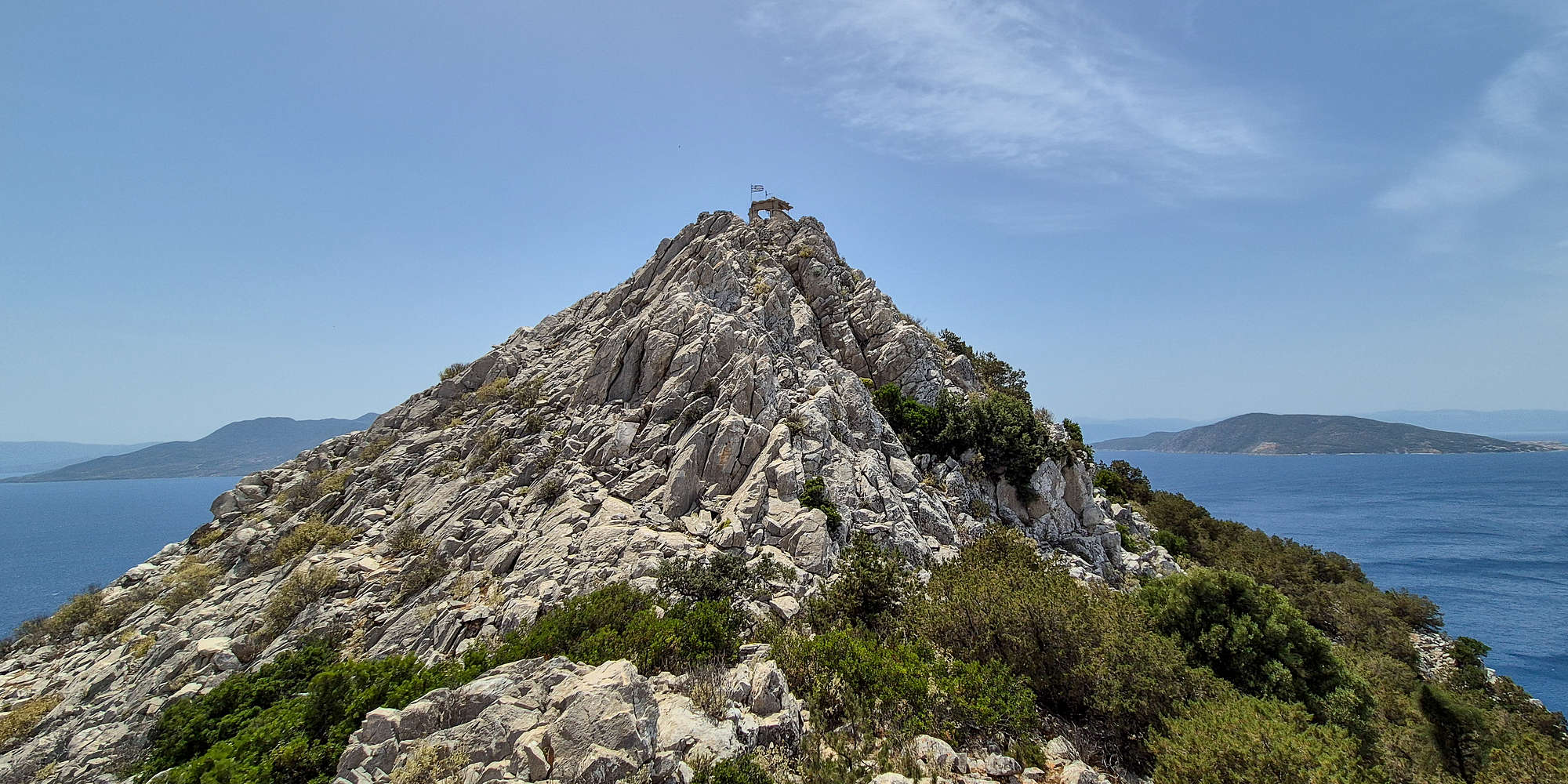
Moni Island Highpoint (172m) a spectacular view above the Saronic.
Moni Island is a “nature sanctuary” allowing only day-time visitors, and is now-days home to many deer and peacocks, which were brought to the island by the previous owners, a trekking society. Besides curious nature, and lovely beaches, the island is also home to a complex of old military facilities (including a now sealed tunnel) built by the Germans during WW2, and briefly operated by Greece. Ascending to Moni’s HP it is clear why this location was chosen as an observation facility!
Route
Doing it all wrong!
Having overcome the difficulties of transportation we found ourselves on the frequent small-boat service to Moni Island from the Aegina village of Perdika (”Πέρδικα”). The 8 minute ride was incredibly scenic especially given the slow approach to the island which exaggerates its features. The scale of something so small can feel gigantic once you are in a 15ft boat and at water level. Alas we docked and left the boat, keeping a good eye on the special red plastic cards we were given for our return (and for headcount). After finding a good spot by the water for Nieve to enjoy I took off almost immediately, already wearing my +25C-hiking kit and with a pouch of chalk.
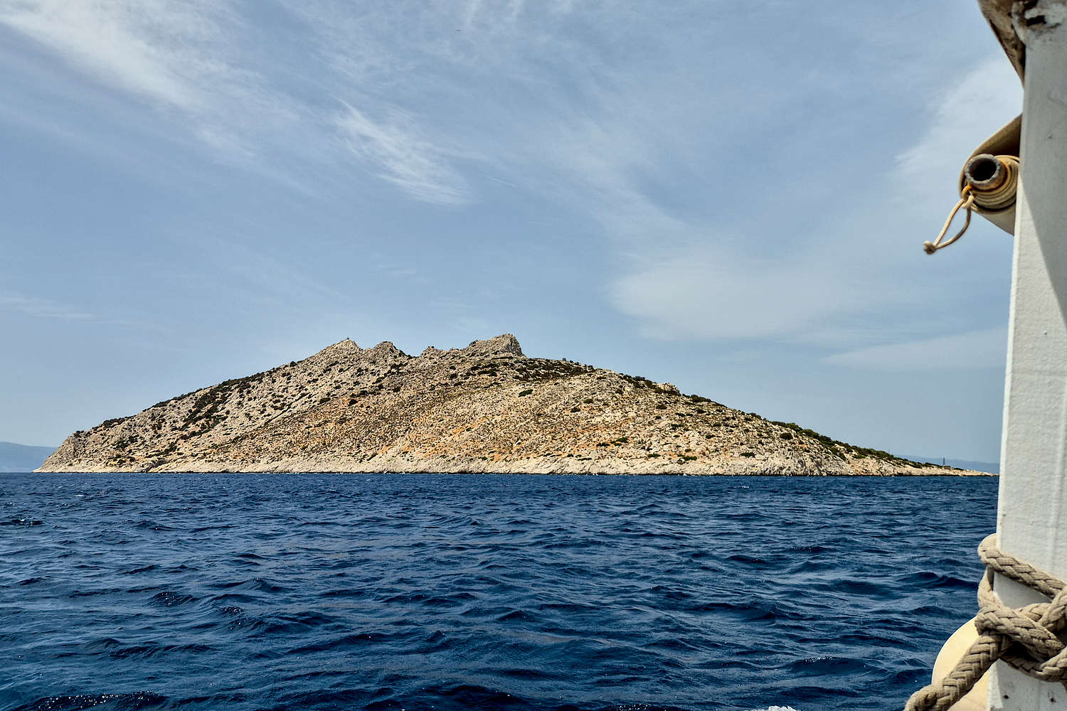
Moni Island as seen from the boat.
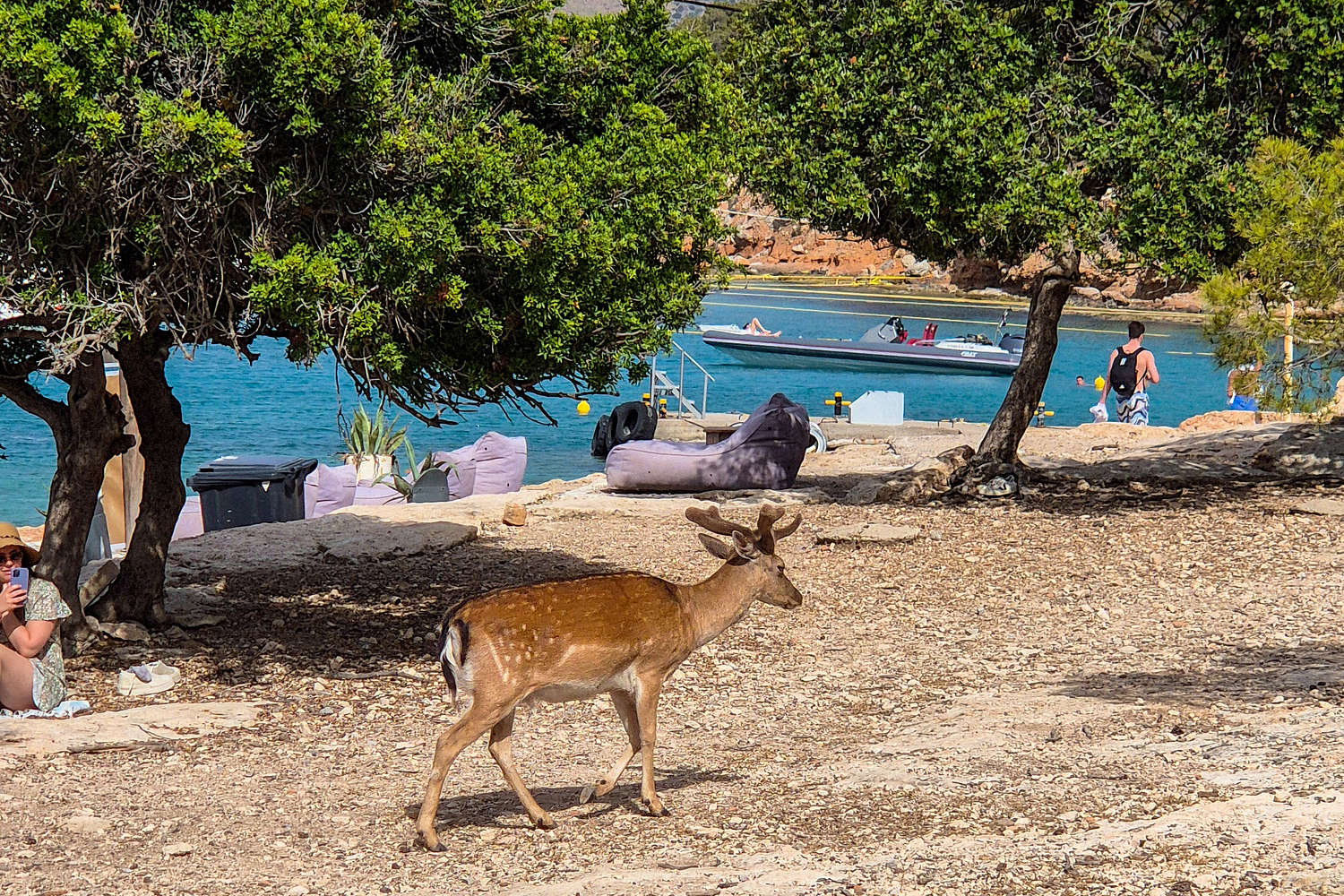
The deer are some of the curious residents of the island.
Leaving the W bay I followed the OSM track but was way off trail, even entering the fencing surrounding the forest from a cut in the fence. There is in fact a gate, and a nice well marked trail for this section but at this point I was oblivious. I made my way up the OSM track and used field navigation assuming I would eventually meet the actual trail, which I did. In these few first minutes my primary worry was running into wilder deer and peacocks which may be startled, however, I overestimated their wanderlust as they were all by the beach “sharing” the visitors food.
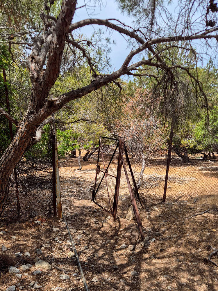
The gate at the trailhead which I missed on the way up.
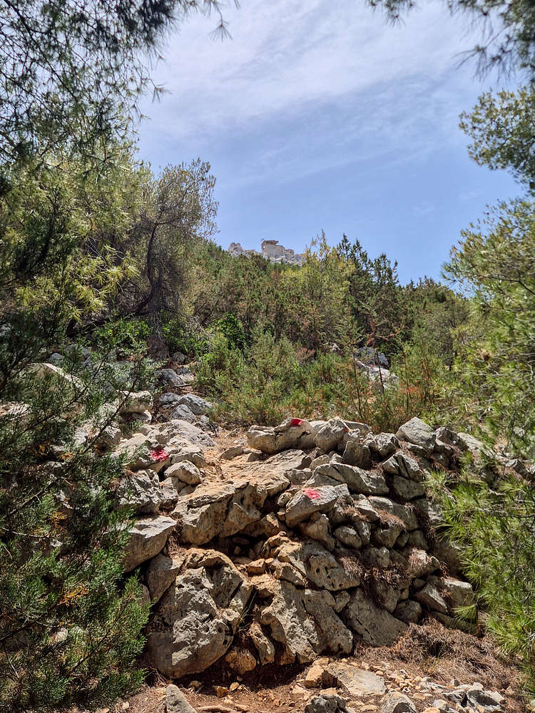
Start of the rocky trail section, watchtower visible.
I will admit that my toils were long as I self navigated for 95m of the 172m total vertical eventually meeting the trail close to the summit. From here the markers were quite useful as the terrain becomes much harsher, with significant outcrops and boulders. The condition of the trail is alright and the exposure is minimal. The trail continues W here skirting past the largest limestone bands, and uses an obvious and well marked section to ascend the upper slope. Past this there is a dense row of shrubbery which must be crossed, and then the summit Col. is reached. Here I was pleasantly surprised to meet two lovely Romanians who were unable to make the summit on account of their sandals. Ah, made the right choice looking stupid and bringing my trail shoes to the beach!
So enjoying the lovely view at the Col. I didn’t realize that it was a dead-end trail with an intersection further back, and feeling inspired I though about trying something new. The summit limestone looked even more appealing from up-close, and the SE breeze was finally cooling me down. So I did the obvious and followed a ledge into the unknown and 150m above the sea. Here I first followed the ledge, ever narrowing, and then gained on the SE face through some ‘steps’. With the seagulls for company and navigating fallen rusted barbwire, the first few steeper moves were easy and non-consequential, other than the chossy overlay of broken limestones on bigger footholds. Now facing the final and steepest section on seeming featureless slab, I chalked up, and was lucky to have found a set of huge flakes starting from this slab making fun ‘ride’ up the final 6m or so. A dusty runout put a close to this scrambling business and I was at the summit.
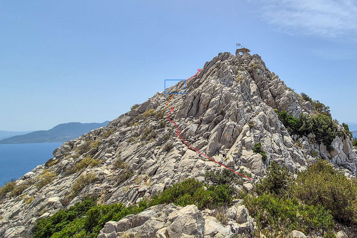
Route diagram for the scramble “Seagull Slab”.
One of the best top-out views, Aegina HP Hellanio (532m) visible.
I took a long break, enjoying the views, a cigarette, and some water, as well as finding the trail down, and being thankful I would not have to downclimb this new GSS Class II+ mini-route, christened “Seagull Slab”.
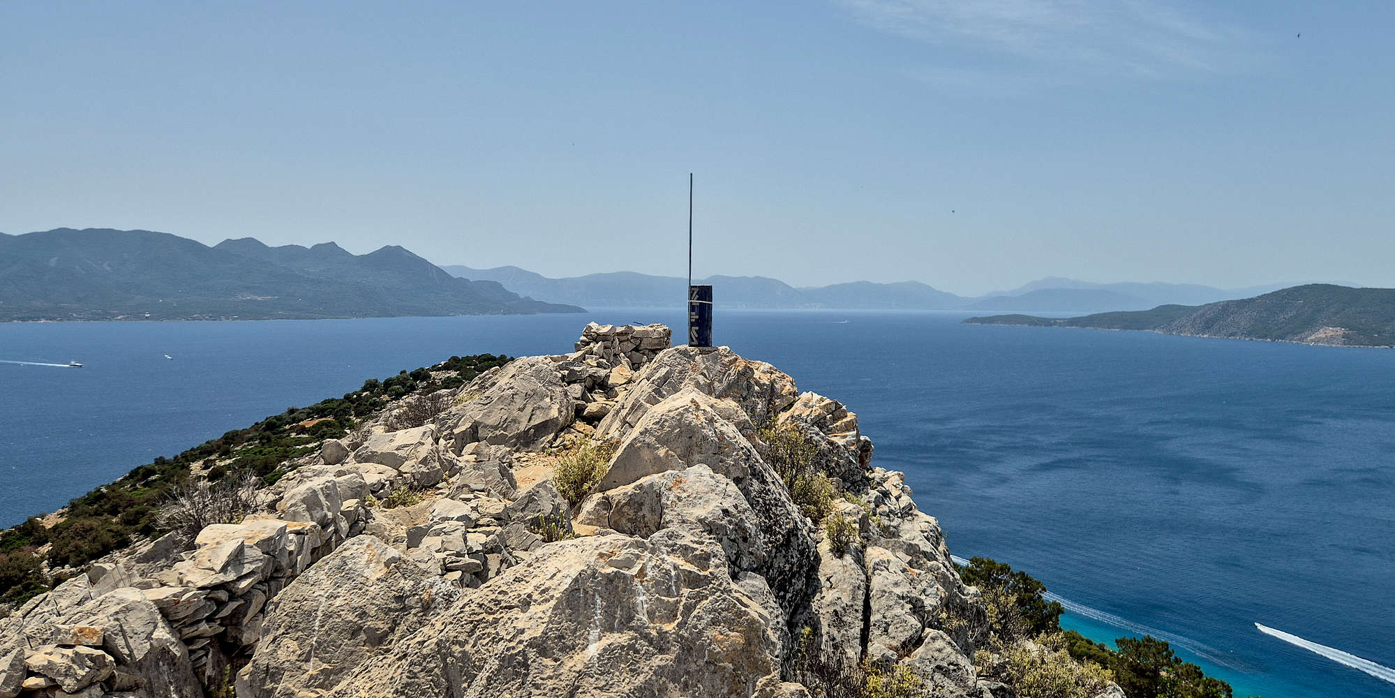
The Moni Island HP trig. at 172m, Methana P-600 visible to the left.
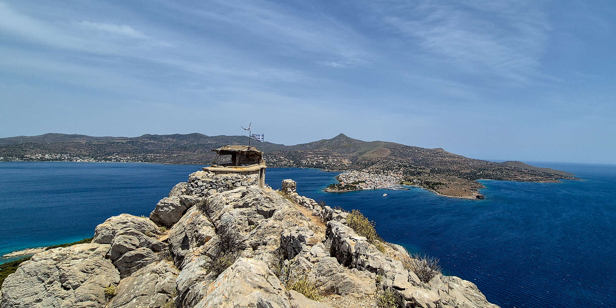
The Moni watchtower and Hellanio P-500.
Doing it all right!
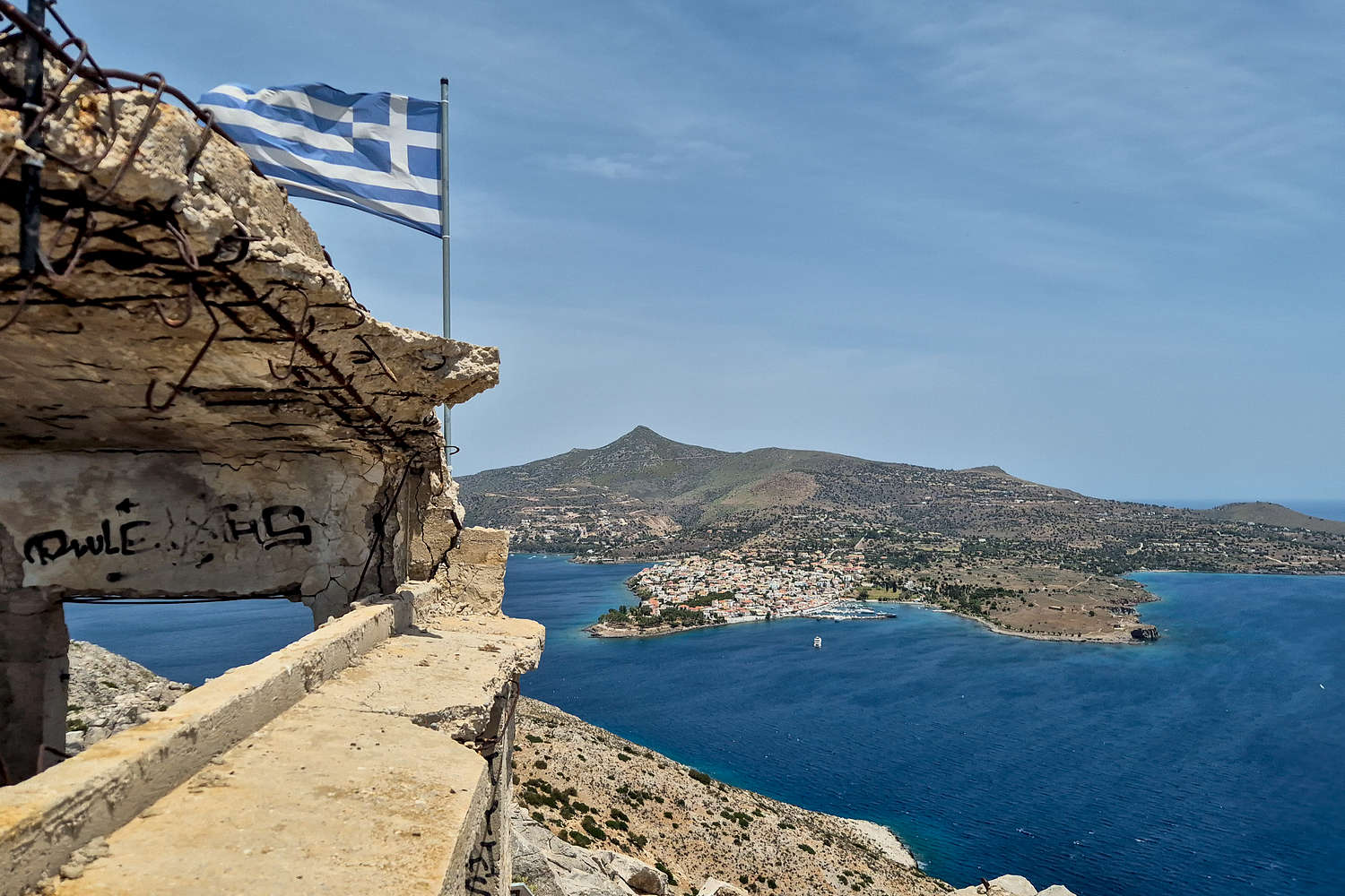
So I left the summit exiting via the stairs (!) from the old - apparently WW2 Germany old - military watchtower on the summit. This deceiving nice section is followed by a steep scree slope with horrendous grip which is thankfully short. The trail condition at the foot of the summit block is especially bad with large rocks strewn around, certainly no place for sandals. I mostly followed the trail back to the Col. taking a short detour, and began the trail-bound descent.
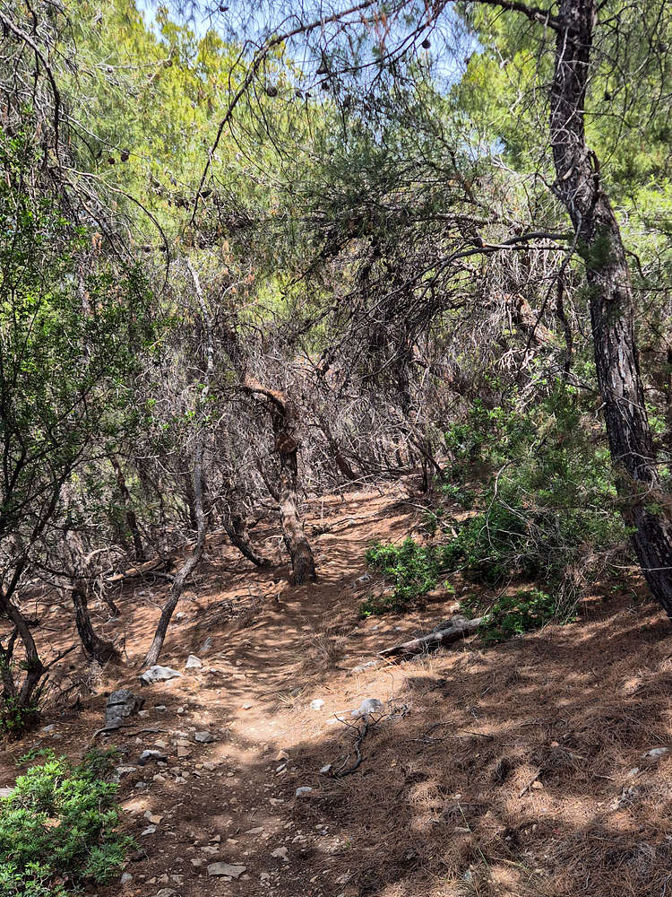
The forest trail of Moni, a nice track.
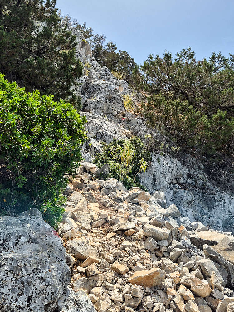
The steepest and sketchiest section just before the summit.
I soon passed the two Romanians and followed a well marked and trafficked forest trail, which using long switchbacks made the descent (and ascent, ouch!) much easier. I was down by the beach almost in no time, making it 45 minutes round trip, and quickly got changed to enjoy the rest of the day by the beach.
Interactive Map
Logistics
This was the first objective of our May 2025 Aegina Trip with Nieve which included a 1 night stay in Perdika and a return on Sunday after an attempt on Hellanio (532m) [P-532] and potentially some swimming. All logistics were self-managed as per usual. We Left Athens via Piraeus and used public transport from door to Port - is there a hiking “eco-point” concept? From Piraeus we used a variety of transport to reach Perdika and then Moni Island.
You can learn more about logistics, such as operators, and bus schedules on the SummitPost.org page for Moni Island (172m).
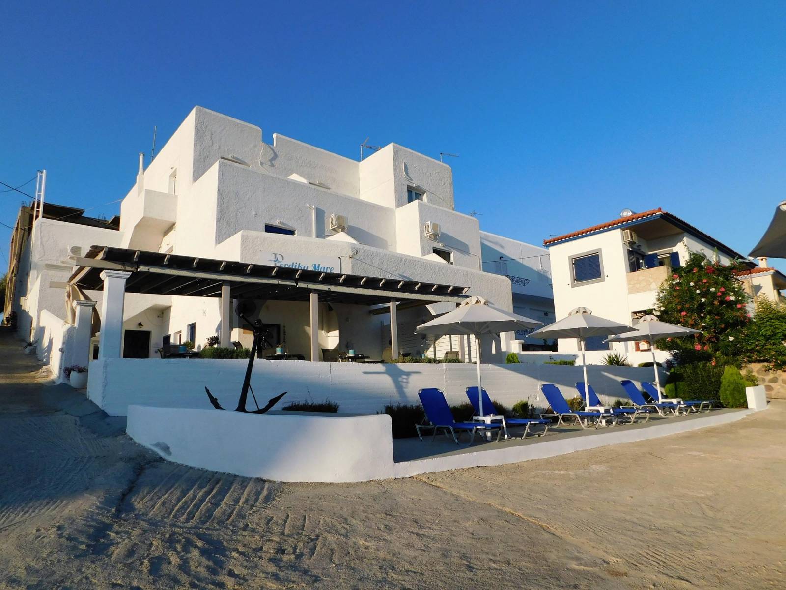
Perdika Mare
For our 1 night stay in Perdika (”Πέρδικα”) we selected this budget-friendly super-basic guesthouse “Perdika Mare” which is located centrally within the village and also has sea access. The room was perfectly reasonable for a 1 night getaway although it was old and the AC was rather weak. Room condition and hygiene as expected were mediocre, but nothing otherwise notable. On the plus side the WiFi was fast and there was a well-sized fridge in the room. We did not opt for breakfast and instead got some from the village in the morning. There were a few other guests but it was still “off-season” for the village.
The staff accommodated our request for the room to be ready upon arrival (around 12pm) such that we can leave the majority of our gear before going to Moni Island (172m) [P-172].
Nearby Peaks
The following are notable summits nearby Moni Island HP (172m) [P-100].
Hellanio (532m) [P-500]
Aegina Limestones (299m) [P-100]
Agistri Island (294m) [P-100]
Methana Volcano (740m) [P-600]