Penteli (1,109m) [P-744]
Summited On: February 28, 2026
Region: Athens, Attica, Central Greece, Greece.
Overview
Oros Penteli (1,109m) [P-744] [”Όρος Πεντέλη”] also known as Pentelikon is the 2nd tallest of the three major mountains which form the Athens Basin, and protects the NNE flank. It is distinct from its neighbors due to the combination of its slender mass and large prominence, and while set father away from the urban center, looks very imposing. Its highest summit is called Pyrgari (”Πυργάρι”) meaning “turret”, and it is extensively developed up to elevations of 500m on both the North and South aspects. While its Southern aspect is a sheer backdrop for Athens, to its North, the massif eases slowly giving way to a sprawling network of foothills, some of which retain the Marathon Reservoir.
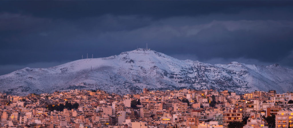
Penteli (1,109m) during a snow-storm with Athens in the foreground.
The mountain has an extensive historical record, which begin early due to the discovery of paleontological specimens of savannah animals such as Rhino, Gazelle, and a rare species of Giant Tortoise. Evidence of Bronze Age settlement have also been discovered although extensive records starting from the 3rd Century B.C., on account of the Demos of Penteli overshadow them. The rapid development of the Demos in classical antiquity and early-roman eras was driven mostly by the extraction and trade of high quality Penetlic marble [1], widely prized and used in the construction of the Temple of Olympia and the Pantheon of Rome. In modern history the mountain is widely associated with the enigmatic Duchess of Plaisance (Sophie de Marbois-Lebrun) who lived out her final years on a beautiful castle on its Southern slopes. Most of the mountain has in recent years been ravaged by forest fires and has lost much of its lush pine-tree cover.
It was said that the Duchess of Plaisance resided in Athens along with the preserved corpse of her daughter, which she decorated with flowers and conversed with.
Route
Like all the Athenian mountains, the route choice is often the most important part of the planning phase, since the extensive networks of trails and dirt road can make or break the experience. As usual, we opted for a longer route, following the classic Three Chapels trail above Drosia (”Δροσιά”). This was in lieu of a more demanding traverse option from Politeia (”Πολιτεία”) to Ano Penteli (”Άνω Πεντέλη”) which we avoided on account of exhaustion from the FWQ 2* Helmos 2026 which took place the weekend prior. As such, on Saturday morning we found ouserlves yet again on the road, this time for a hopeful speedy ascent of Penteli with around 14km of total effort, sufficient for a rest week.
Arriving at the old pump station at the end of Artemidos, a non-descript residential street of Drosia, we quickly geared up, curious as to what this random trailhead had in store for us. The forecasted cloud cover encased the high summits in a white vail; they somehow looked so far. But in the lower forest we were a world away from them and following the pleasant wide track (T1+) we quickly made our way upwards. Within 10 minutes of walking below the creaking foliage we reached the chapel of Profitis Ilias, the first of those on the popular Three Chapels trail which would lead us to the ridge.
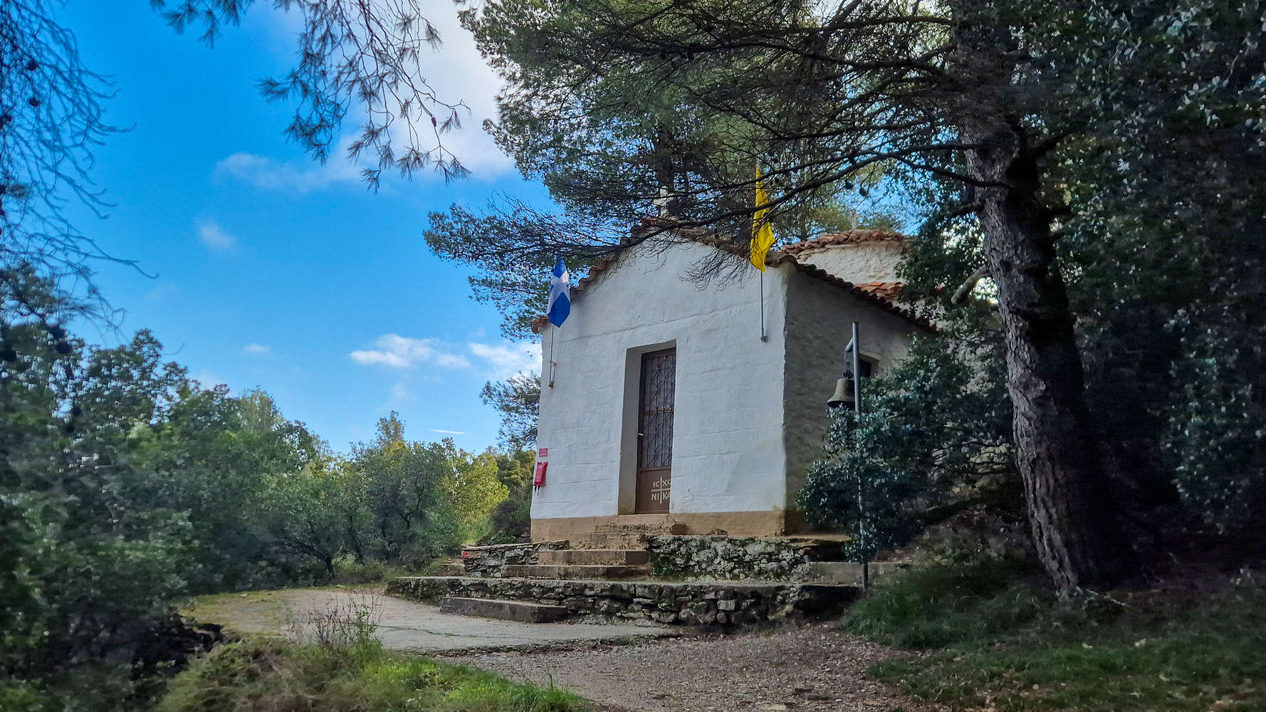
The Chapel of Profitis Ilias at 575m.
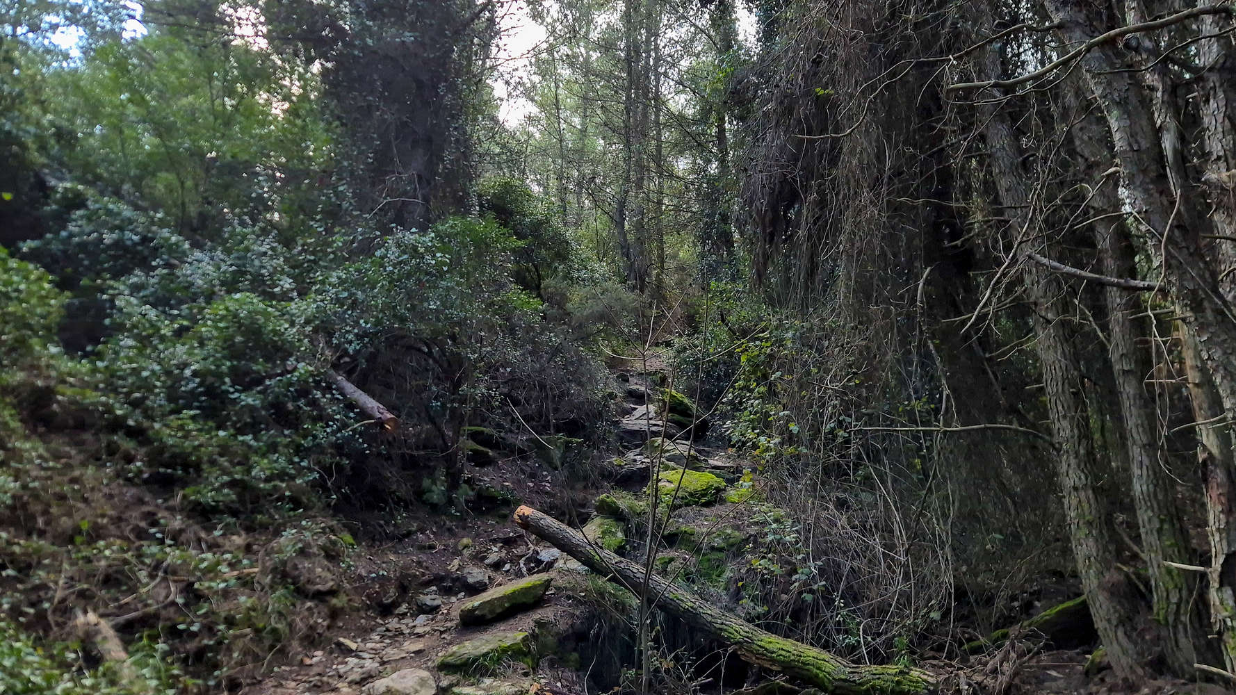
A section of “rainforest” between the chapels.
We didn’t linger and pressed on, looking forward to passing all three and reaching the Col. which would bring us to the summit. Continuing through the lush forest we passed through sections of ample growth fed by the colder temperatures and plentiful water of the North face (T1+). Nestled on a flat section of the overgrown forest we found the Chapel of Saint Nikitas, constructed out of the earthen-colored metamorphic rocks of the area. We continued uphill to the final of the chapels as the vegetation gave way, a sign of our elevation, and views of the ridge became dominant. At the Chapel of Saint Loukas we ran into two fellas and their dogs, who informed us that the spring at the foot of the chapel, once flowing freely has been dry for 2 years. I made sure to drink some water since 30 minutes had passed since we started. We quickly said our goodbyes and continued.
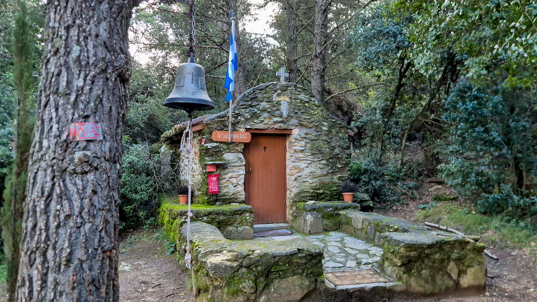
Chapel of Agios Nikitas at 630m.
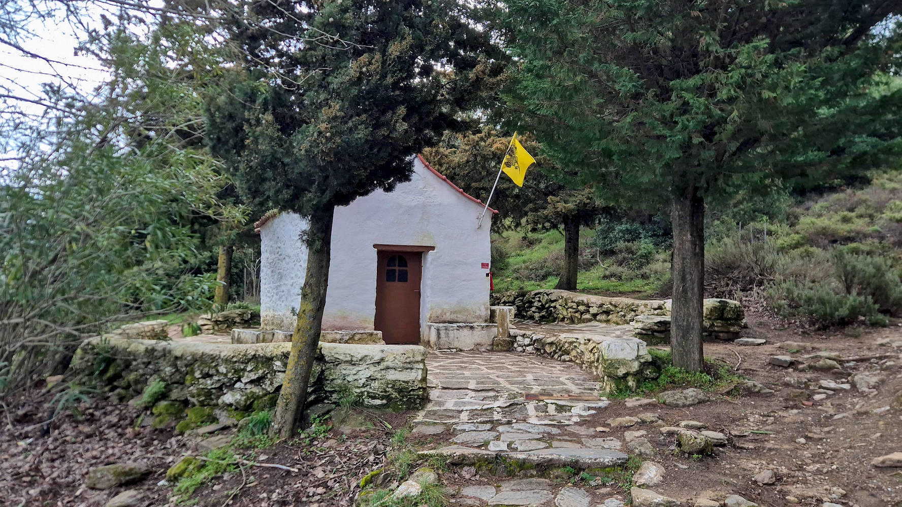
Chapel of Agios Loukas at 670m.
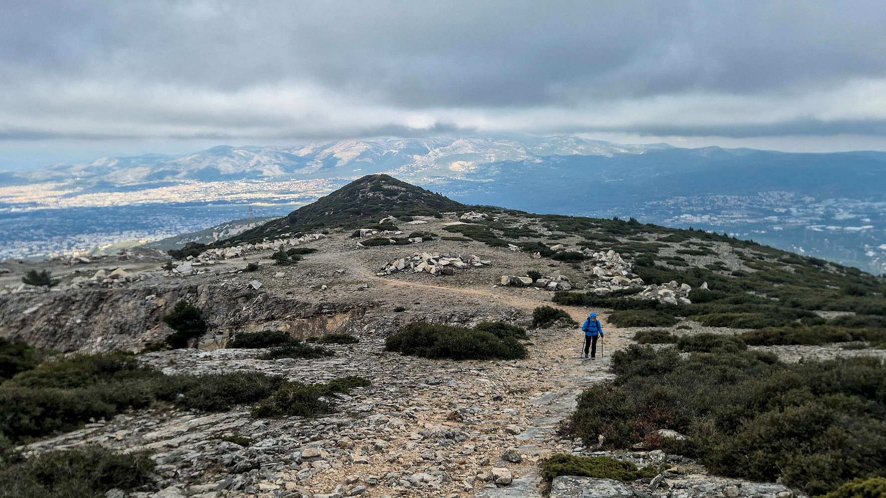
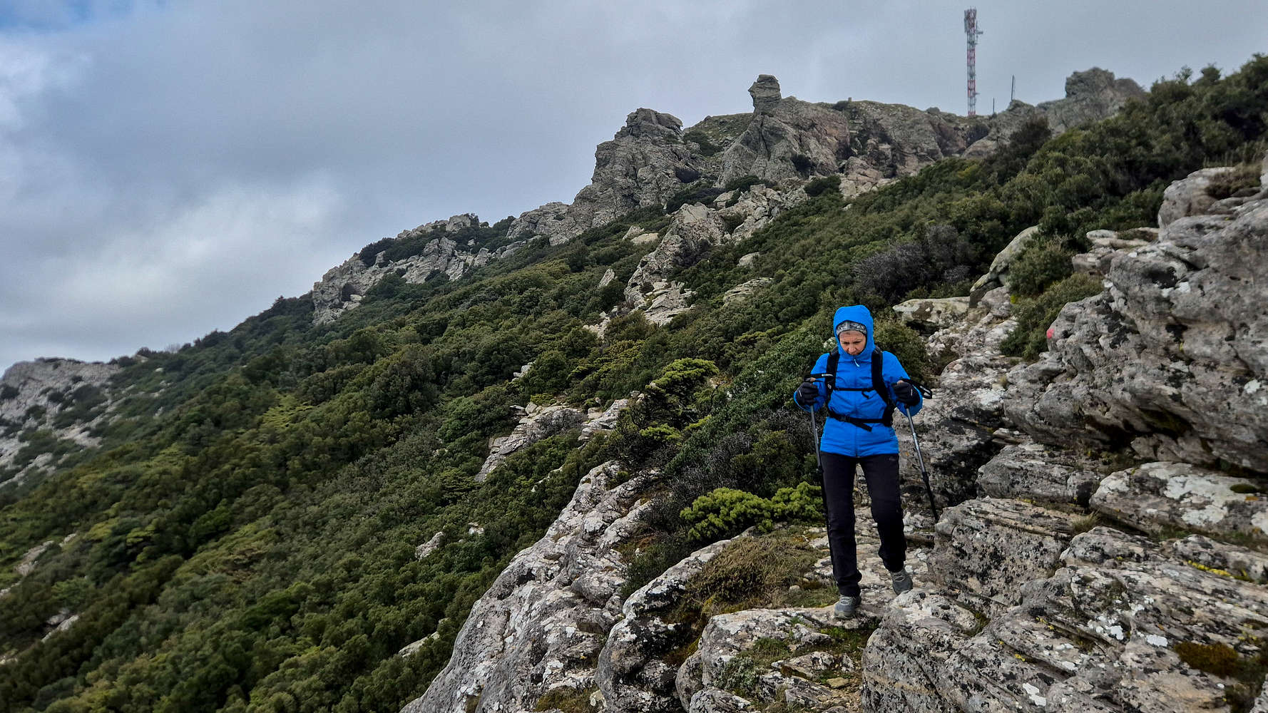
Above the chapel we took care to find the correct trail, which trends slowly left, and after a short section within the upper forest, we exited the vegetation and found ourselves on a long brushy ramp (T2-). This slope, never too steep but always rocky is one of the two, equally sluggish, sections which make up the obligatory cruxes of the route. By the end of the initial SE traverse within sub-alpine forest, a more direct line is gained with a steeper pitch on flat slabs and large scree. The very clear and wide track, evidence of its popularity easy the overall grade (T2-), while the exceptional views to the NE and the rolling sub-peaks of the mountain is worthwhile.
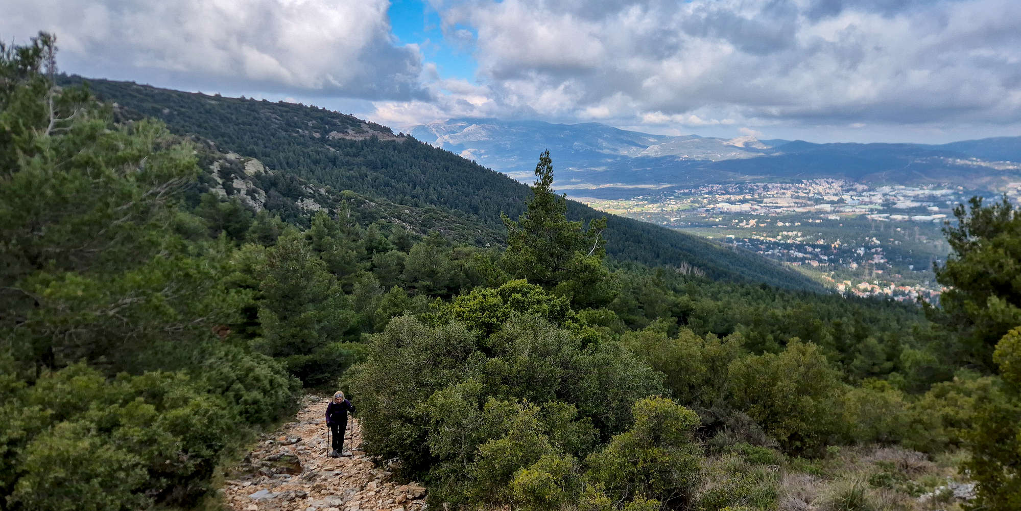
Towards the end of the traverse and our first views.
Here we yet again got passed (uphill) by a trail runner whom responded to my quip, informing us that was his second lap; up until where, I did not know. During the traverse I had taken off my insulated jacket and now, exposed to the winds I stopped to wear it again. The continuous steep pitch was waking us up finally, and the ridge seemed ever closer. Above us also loomed the large cross on Agios Panteleimonas (876m), while Pyrgari (1,109m) was hidden among the clouds.
Agios Panteleimonas (876m) from the Col.
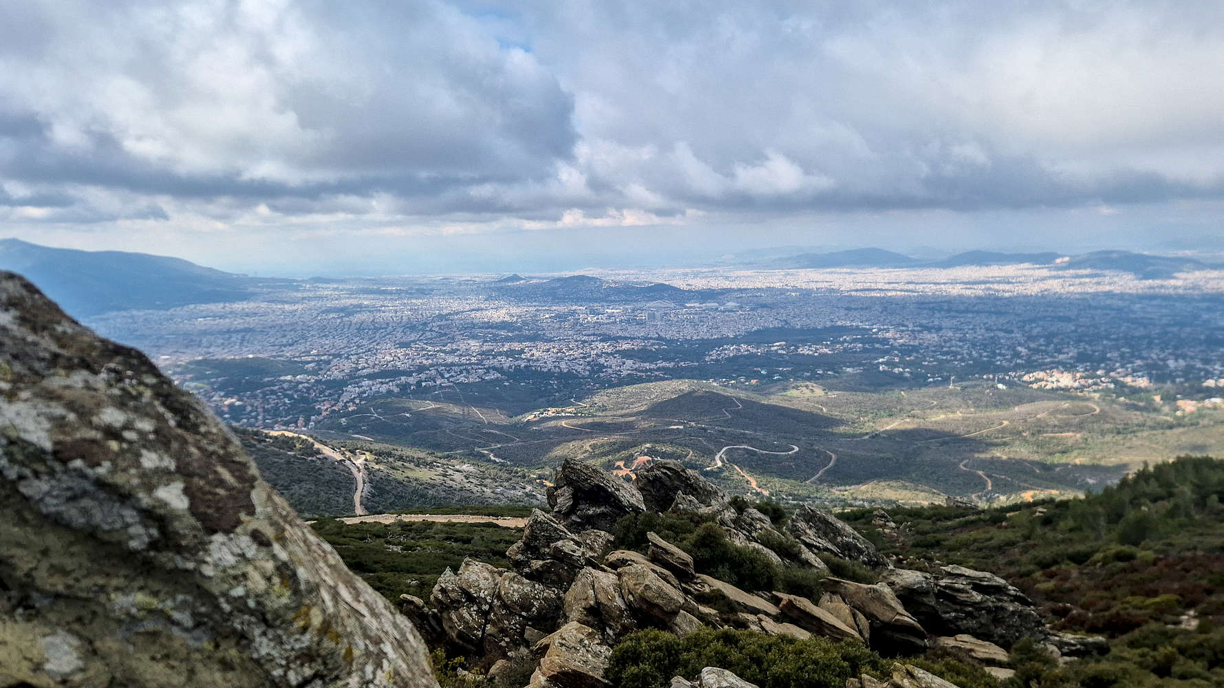
View of Athens from the South face.
We broke onto the Col. at 842m after about 50 minutes from the car, a bit ahead of schedule. Here the quiet forest gives way to the mined outcrops of the South, and the dirt roads which accompany it. We took a left at the Col. following the dirt road towards the upper mining area of the NW Ridge. The dirt-road offered progressively good views of Athens to the South, but very little of the much needed protection from the frigid Northern winds. After a quick break for some water we made our way through the mine and found ourselves at the base of another rocky slope.
Passing through the mine.
Traversing above the Grand Ravine.
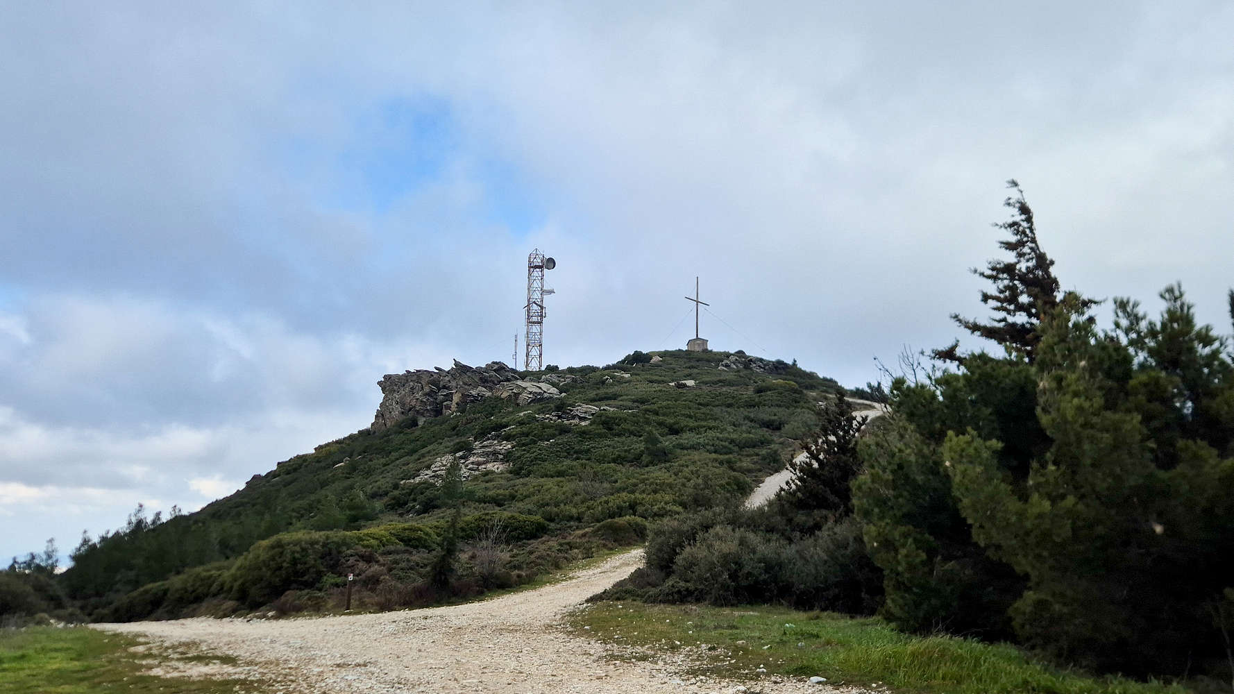
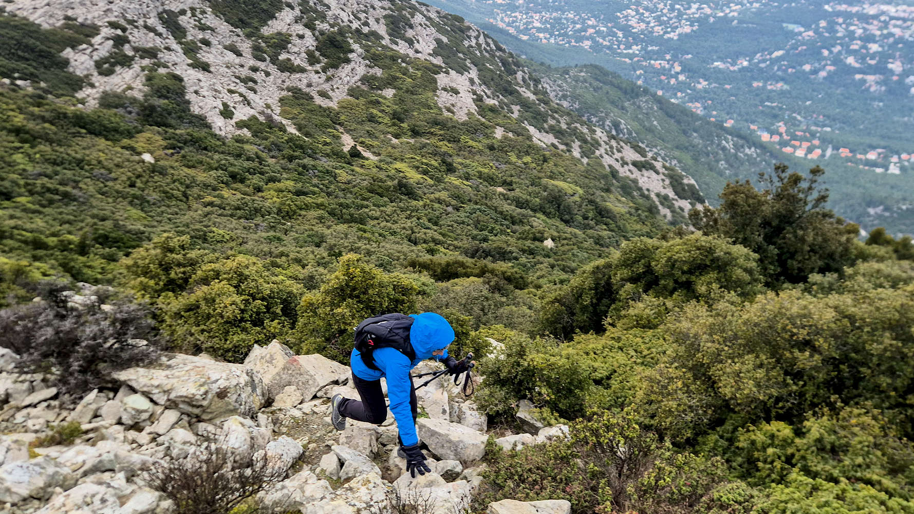
This second obligatory crux is a bit shorter but a little steeper at points (T2-) and after just a few minutes leads to a wide ridge with a set of telecommunications towers. A pick-up truck betrayed the presence of some technicians working on them, but the howling winds kept us from investigating, the summit was near. From here the route makes a left towards an obvious rock-band, which can be avoided by following the paved road instead. We followed the trail, closer and closer to the edge of the great ravine which drops down the NW face.
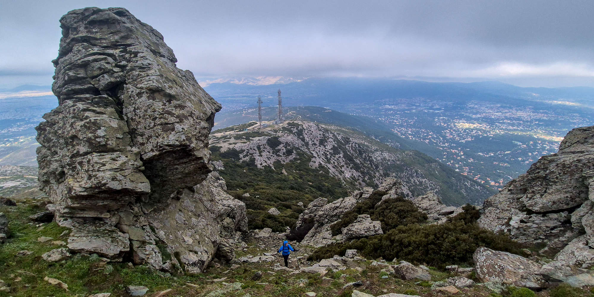
Exiting the ramp past the Sentinel.
This is the true crux of the route at T3 and begins with a traverse of the airy ledge above the great ravine. While wide, and no more than 30 meters in length, a narrow point in the middle (T3) was difficult to overcome with the strong gusts reaching up to 80kph. Once the ledge is completed a small vague track links to the base the final section up the obvious rock-band. Although a number of appealing lines can be found, the obvious and safe choice leads up a ramp boxed by walls of metamorphic rock, and capped by a tall monolithic boulder. The wind still found a way to funnel through the ramp, so often destabilizing us, but the somewhat steep scree and dirt was ineffectual soon giving way to the road leading to the summit.
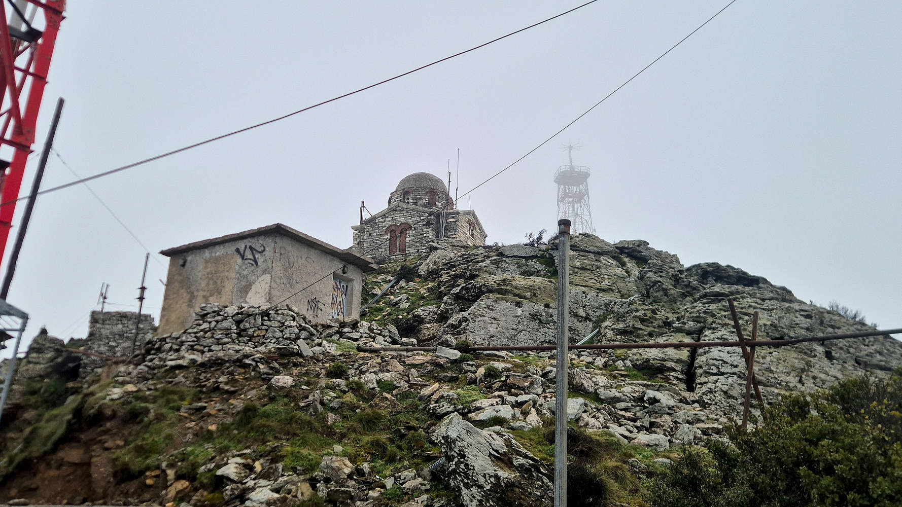
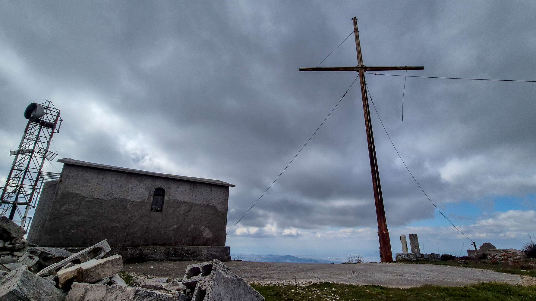
The Chapel which marks the summit.
Retracing the traverse on the return.
Like all the summits we have reached so far this year, in and around Athens, Penteli (1,109m) has a road leading to its summit, vital in serving the military base the house(ed). Unlike others however, the one on Penteli (1,109m) is derelict and thus, we could access the highest point. We followed the asphalt up until the military gate, taking a left onto a short road to some antennas before scrambling up a short section to the summit proper, and the Chapel of the Transfiguration which sits upon it. We reached the top in exactly 1:40 hours. Under the dull overcast sky, and hammered by the winds, the ambiance of the disused military installation and storm-proofed chapel were less than ideal. Even so, we enjoyed 15 minutes with some homemade apple-cake before setting our sights back down.
Chapel and cross at the summit of Agios Panteleimonas (876m).
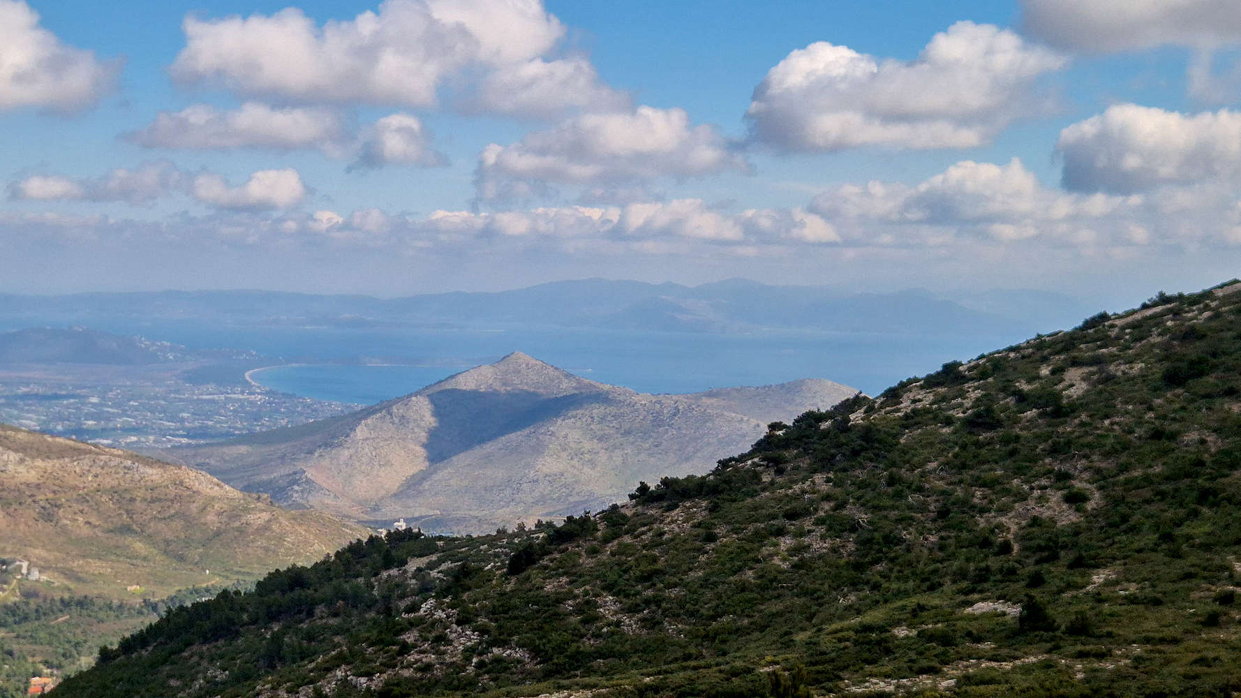
Agriliki (558m) and Sxoinias Bay NP as seen from the route.
The wind did not dissipate initially, although the visibility improved, as we made our way back. We opted to retrace our steps instead of using the paved road, looking to escape the upper mountain sooner than later. Silently we went through the motions, down the ramp, across the traverse, then past the telecom towers. The second rock slope seemed to go on forever, but once back down at the mine-pit we sped up towards Agios Panteleimonas (876m). Having some extra time I was quite happy with this second peak of the day, the fifth chapel, and a look at a very cool summit cross - rather rare in Greece. I made quick work of the last of my water and we sped off back down into the forest, looking forward to getting some Penirli on the way home. We reached the car just after 3:15 hours in total walking time including breaks, having spent just over 1 hour on the descent.
Interactive Map
Logistics
As an Athenian peak there were no logistics, we left home at around 8:45am and drove about 40 minutes to the trailhead (📍 Google Maps), where we parked by the old pump station. After our hike we picked up some takeaway Penirli from Penirli Eleutheriadis (4.1⭐ | +3,000) in Drosia.
Nearby Peaks
The following is a list of significant nearby peaks.