Gkiona (2,510m) [P-1702]
Summited On: October 18, 2026
Region: Kaloskopi, Delphi, Phocis, Central Greece, Greece.
Rating: ★★★★★
Partners: Panos Kostopoulos Kyrimis, Iasonas Mourounas, Giannis Markakis, Giorgos Tsidimas
Overview
Gkiona (2,510m) [P-1702] [”Γκιώνα”] is the highest mountain South of Olympus (2,917m) [P-2354], and the 5th tallest in Greece, it is considered one of the most aesthetic, with its summit, Pyramida (”Πυραμίδα”) hosting a wild and beautiful limestone headwall. Featuring a long and high ridgeline along with one of Europe’s largest headwalls, the massif is well regarded among the Giants of Roumelis. Ancient Hellenic tradition called the mountain “Aselinon” (”Ασέληνον“) - i.e. one without a moon - due to its connection with the myth of Selene and Endymion (”Ενδυμίων”), where it was said they would meet at the mountain’s slopes. Not much else is known about the mountain as it formed a uninhabitable heartland better known for its association to outlaws.
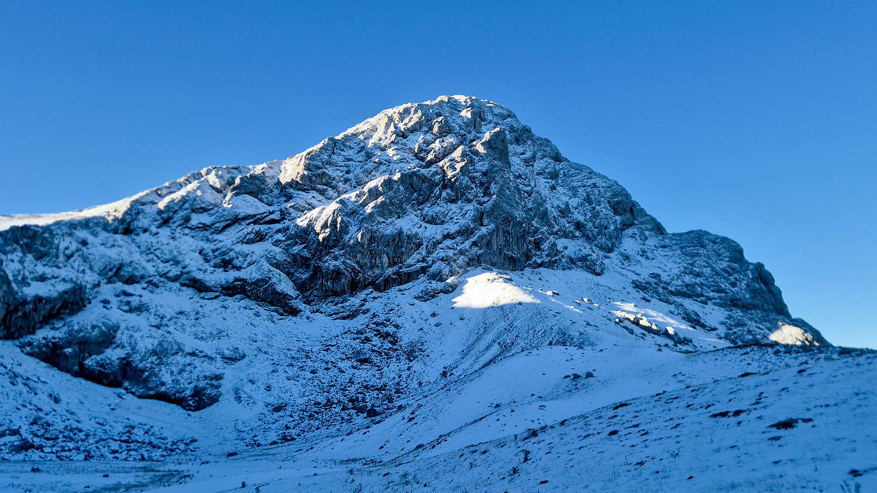
The North face of Pyramida (2,510m).
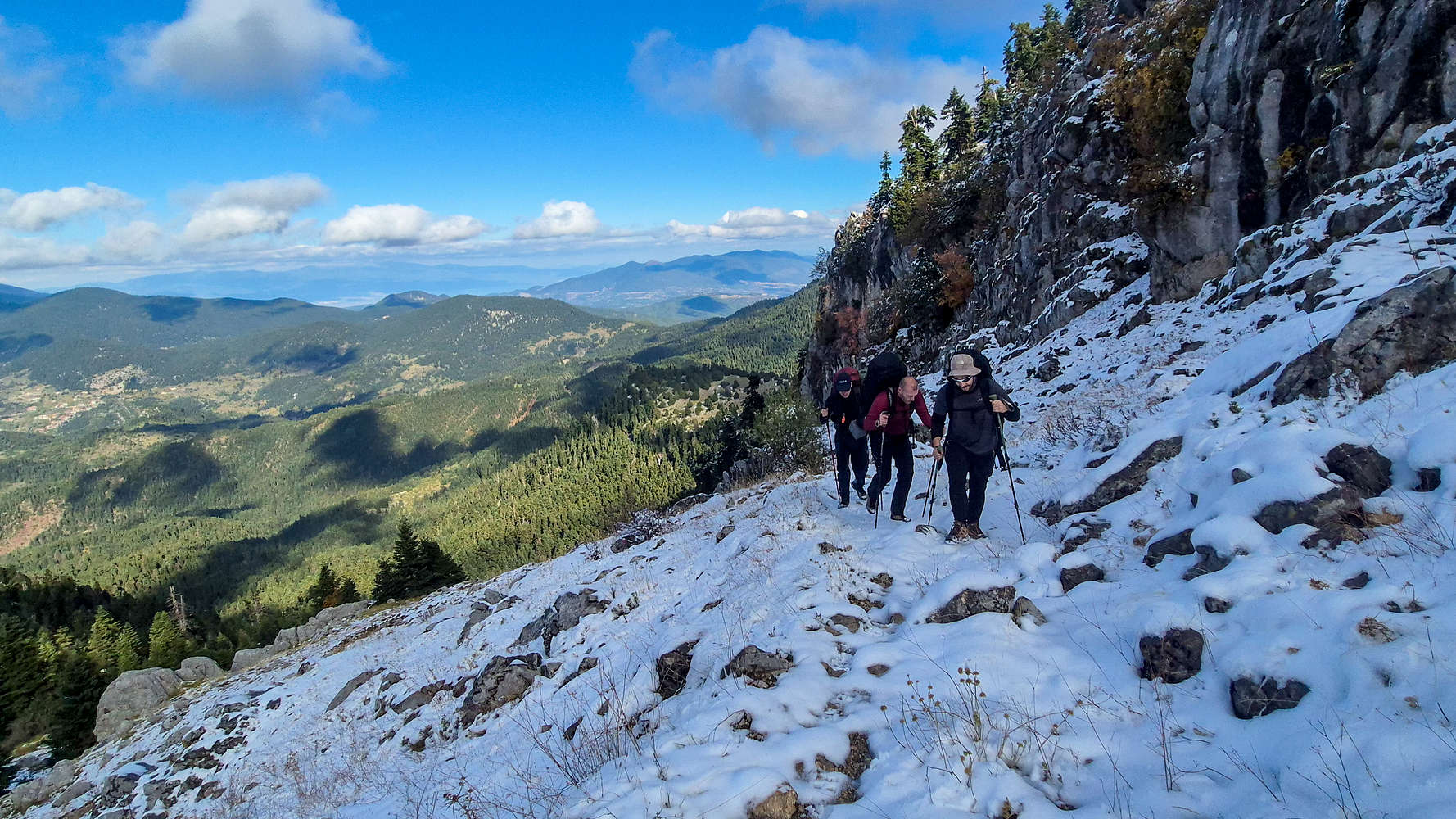
Hiking above the lush Fir valleys.
It was not until the 19th century, and the Greek War of Independence that Roumeli thrived as a center for Hellenic pastoral culture, its relevant industry, and the revolutionary spirit which propelled the cause. In fact, the rugged landscape of Roumeli proved especially useful to the armed bands of bandits which formed the unofficial revolutionary guerilla, and draw these associations in popular culture even today. It is therefore not surprising that both anti-German sabotage activity, and later pro-communist units were directed from remote locations on the mountain, with the sheer and remote valleys of Gkiona making the perfect base of operations. In later years a portion of the mountain was conceded for mining of Bauxite ore, and industry which remains very critical to the locals, especially to the South, while traditional pastoral practices of the South and West have been replaced with investment in the tourism industry.
The Route
I was first acquainted with the Via Normale in May 2019, when with over 1m of snow, we attempted to summit in a single push, turning around at the shoulder at 2,200m or so. The route is not particularly difficult from a technical standpoint, although the full asphalt-to-asphalt jaunt is very long and best completed in 2 days. Similarly, parking at the war monument (”Μνήματα”) the route is still long enough to make an overnight stay compelling. Having avoided visiting Gkiona a few weekends ago, instead heading to Pheneus, we were now faced with an even better prospect, the first snowfall of the year, and the earliest snowfall I can remember.

A snowy Parnassos rises above the old national road.
We met late in the morning of Saturday the 18th in Athens, and Panos drove us, quickly and efficiently through Roumeli (”Ρούμελη”). It was hard not to be upbeat as we drove below a snow-capped Parnassos (2,455m) [P-1588] [”Παρνασσός”]. After a few navigational errors on my part, we reached Amfikleia and stopped at a bakery, then drove the last hour to Kaloskopi (”Καλοσκοπή”) through poor mountain road, arriving at the trailhead of Mnimata, after a small off-road ‘incident’ at the late hour of 14:00. Soon after we arrived, another car did the same, and we quickly got to talking with its two occupants, Giorgos and Giannis. They had the same plan as us, and naturally, we joined forces.
Day I: Vatheia Lakka
We started along the FSR, quickly acquainting ourselves with our new friends, Giannis and Giorgos, but also the peculiar cold conditions of the day. The front which brought the snow was replaced by an icy clarity that made for great hiking conditions as each of us lugged a minimum of 10kg. We made good time through the FSR, reaching the switchbacks in 20 minutes, but unable to find the trail, continued along the road. Just 10 minutes later we reached the base of Voidholivadho (”Βοϊδολίβαδο”) from where were would continue mostly on trails.
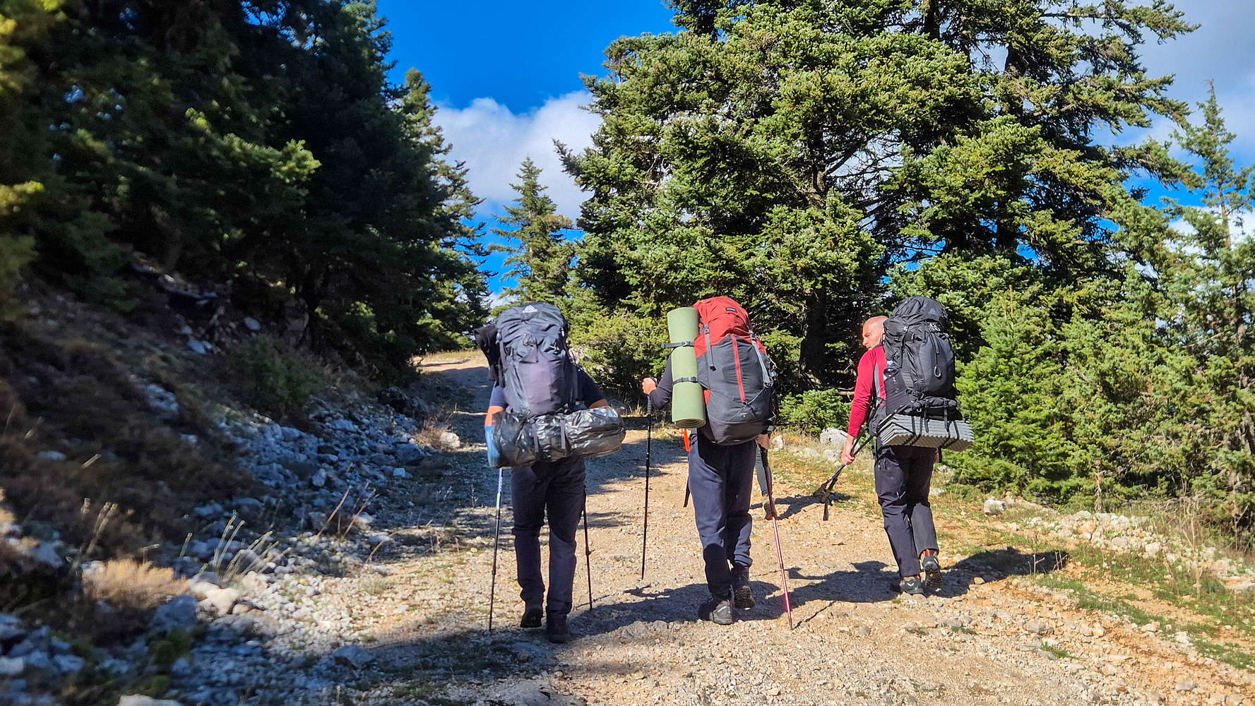
Our extended group along the FSR.
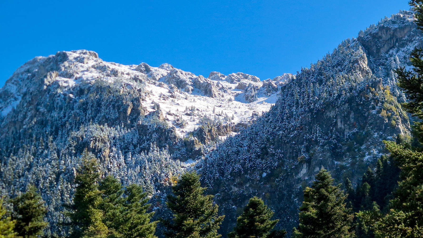
The icy North slopes of Vraila (2,066m).
As soon as we broke unto the small meadow, we were greeted by the interspersed white cover of snow on the grass, along with the giant icy cliffs rising far above. Panos led, maintaining a pace enjoyed by all, and avoiding the snow on the rougher terrain near the road (T2+), we reached the short and final FSR in under an hour. Strolling downhill and along the shadowy base of Platyvouna (2,317m) [”Πλατυβούνα”] the cold was not missed on us, and everyone felt read to continue upwards. In just an hour from the car we reached Larkanos (”Λαρκάνος”), the highest trailhead.
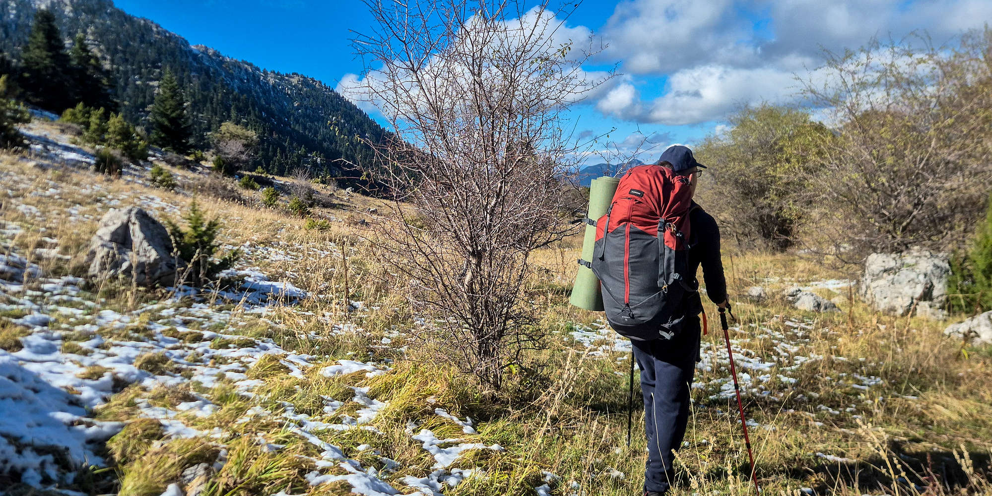
Panos at Voidholivado and the lowest ‘snow-line’.
We set off on the steep dirt track, passing among overgrown foliage (T2+), while Firs under the shinning sun shed their cover of snow. The trail is steep, and a mix of stones and dirt, and even with a well-trodden track, the passages amongst the foliage can be demanding. But after 15 minutes of toiling we surpassed the first 60m of gain, and were greeted by a curious Balkan Chamois (Rupicapra rupicapra balcanica) as we neared the long switchbacks (T2). It stayed for a second, seen by all, and then hopped away into the veritable winter wonderland which sprawled in front of us; the blank snow on the trail meant we were the first to ascend after the snowfall.
On the snowy trail, far above the valleys.
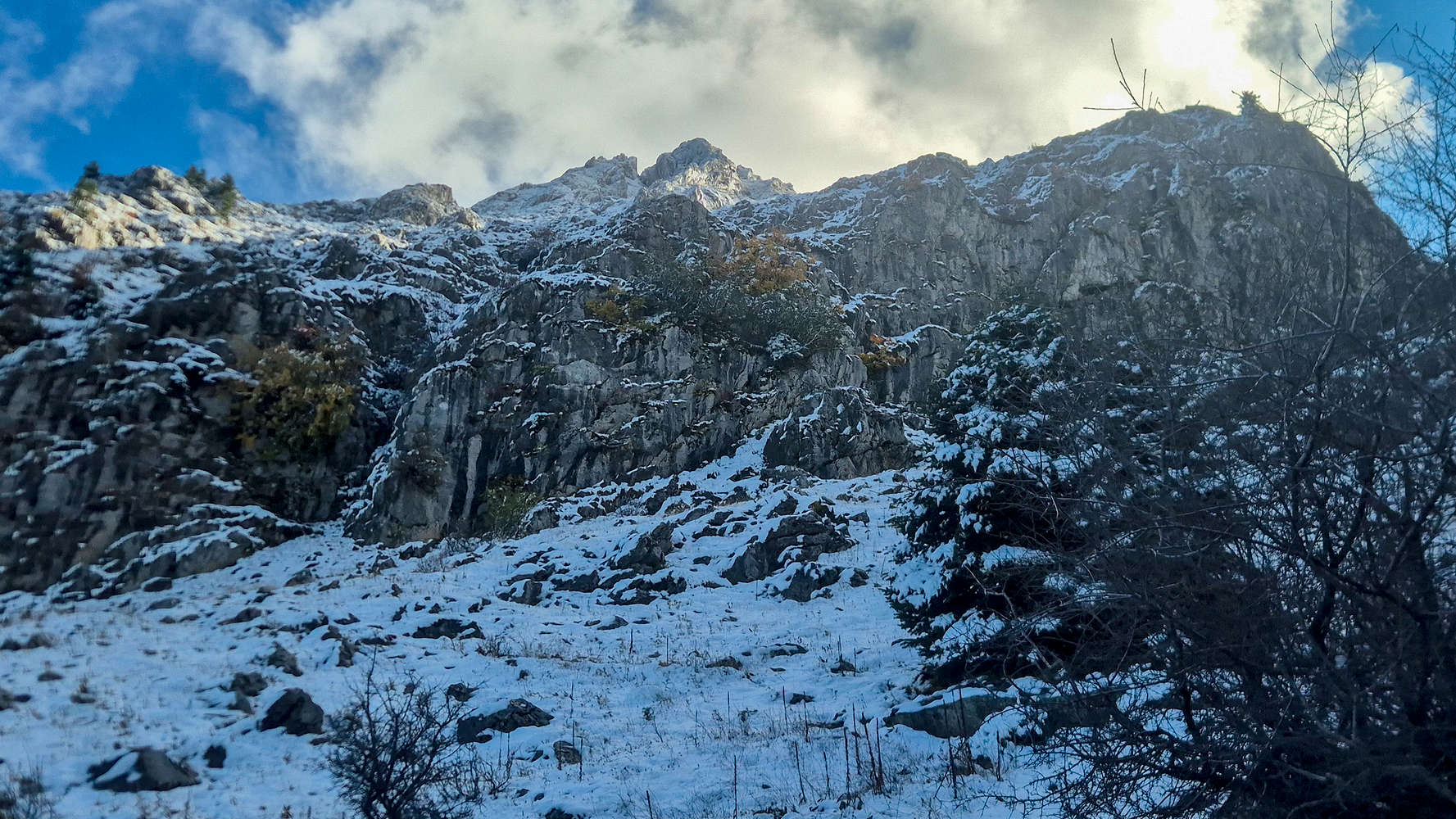
Autumn and winter colliding near Stavros.
Autumnal colors intermixed with ice and snow dominated the scene unravelling in front of us. The solemn quiet which persisted all day was now all too hard to ignore. I broke trail in silence, in the moment perhaps occupied by my heavy pack, but looking back perhaps transfixed on the landscape. Everyone followed along in a similar fashion, but expressions of happiness were visible on their faces. We were already somewhere.
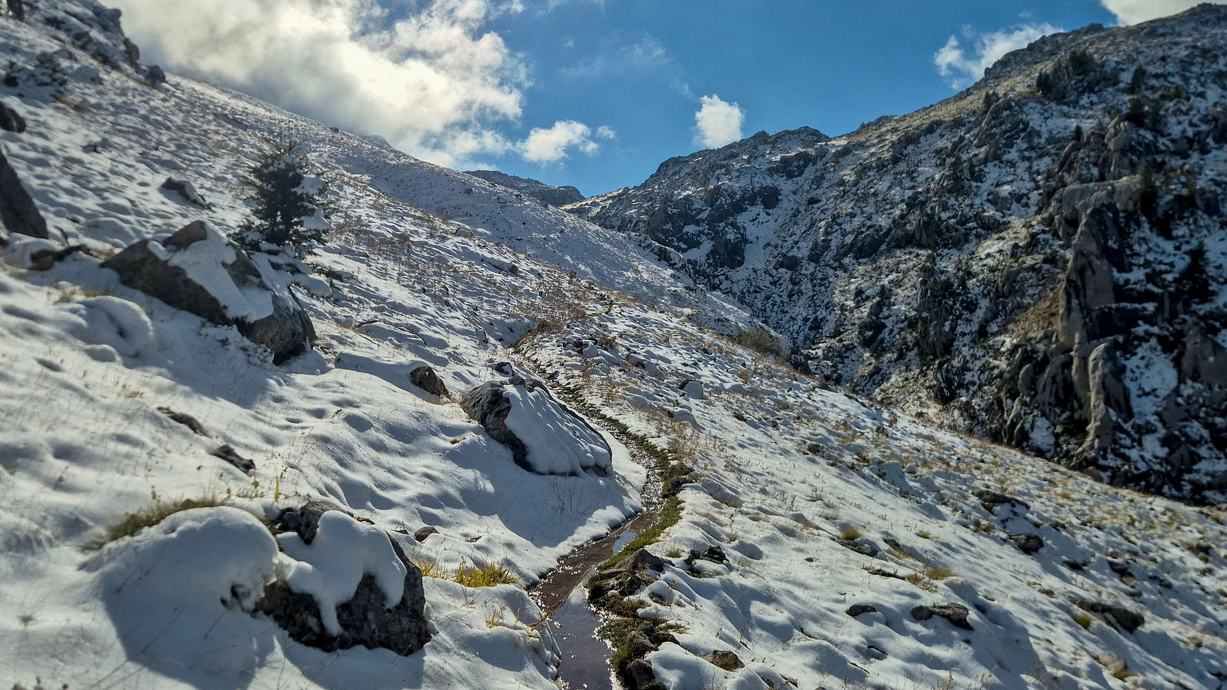
Walking into a snowy October paradise.
With the team being so strong we had avoided taking a break, but now at the cusp of the alpine meadows of Vatheia Lakka, and at a familiar flat, we rested, if just for a few minutes. Continuing on along the ravine and its long traverse (T2/+) we were greeted by the sun, and ascended gently, accompanied by the sounds of rushing water. Everyone was rather excited to make camp, and doubly so once after just under 2 hours, we reached the mouth of lower Vatheia Lakka and got a glimpse of Pyramida (2,510m) [”Πυραμίδα”]; the beginners in the group did not believe that it could even be our objective. But that was for tomorrow.
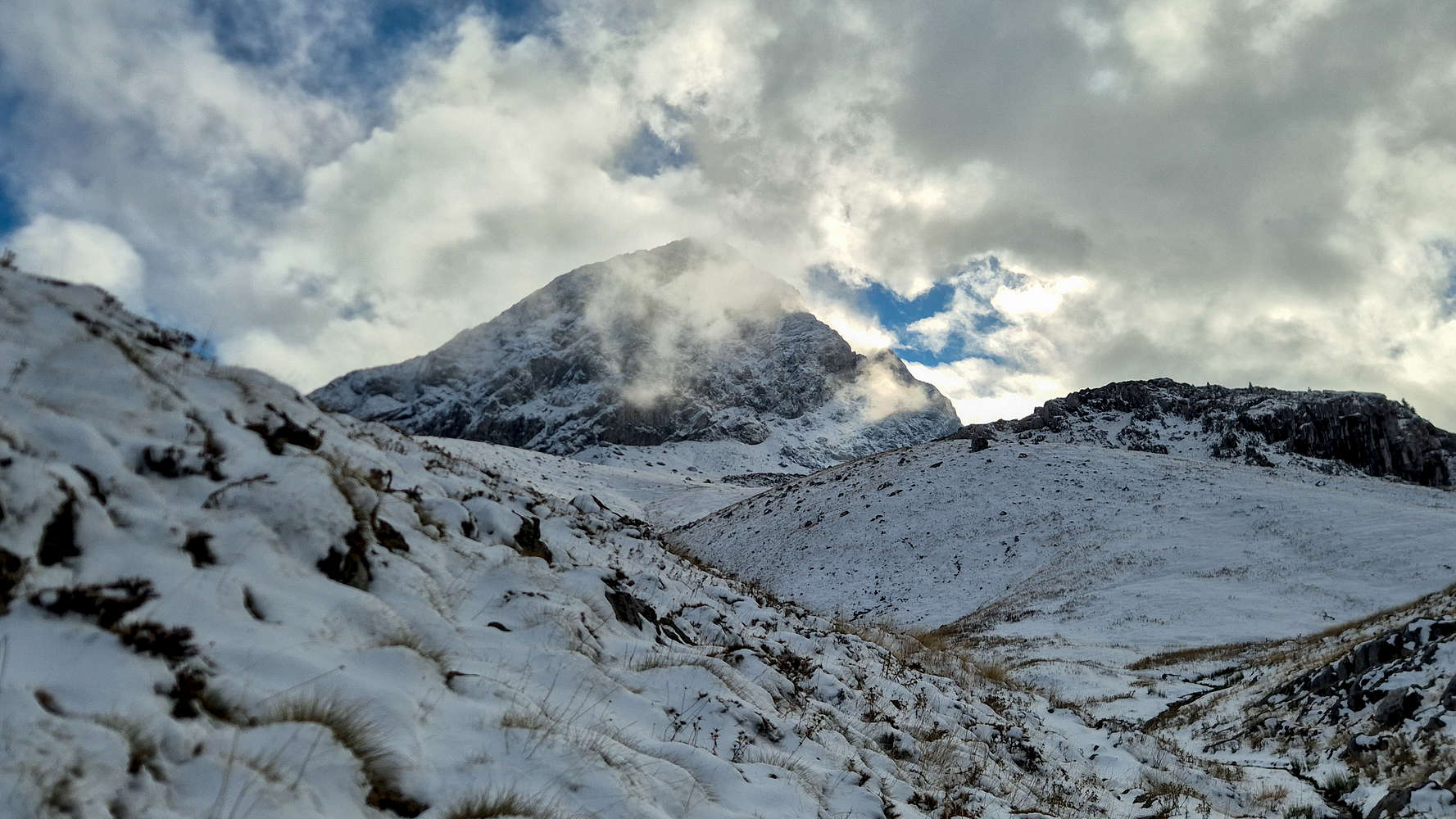
Pyramida (2,510m) among passing clouds.
Now we were tasked with finding, and making use of the ‘campsite’. Leading through the central stream of lower Vatheia Lakka, I became disorientated and continued approaching Pyramida, before veering right, and off-trail towards the campsite, near the Col. for Lazorema (”Λαζόρεμα”), named Chaliki (”Χαλίκι”). We reached the Col. after a plod in knee-deep snow from the North side, which gave us at least, a first look at the approximate area of the spring. We arrived at the large flat which can be used as a campsite for windless nights like this one after 2:16 hours.
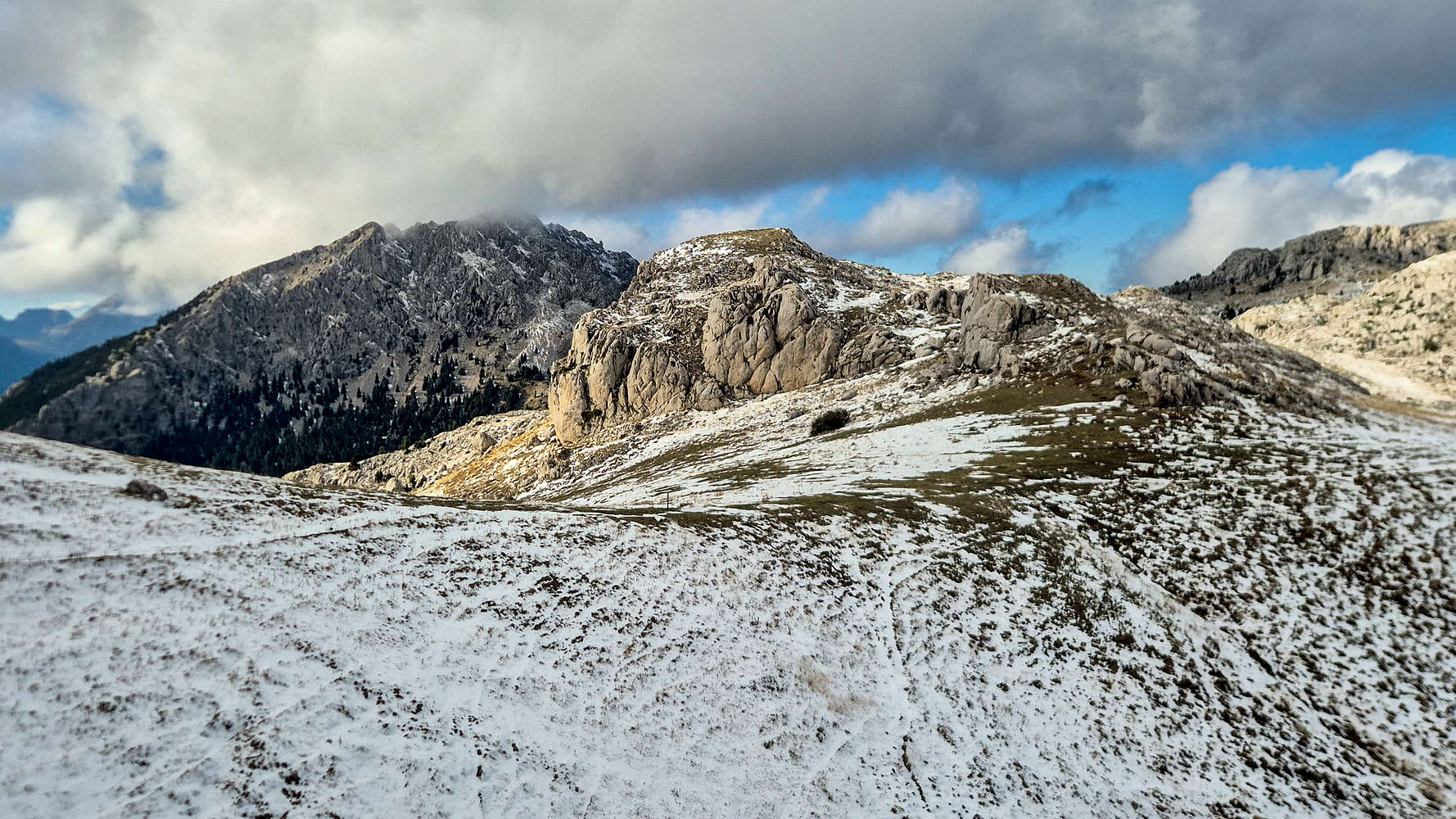
The Col. to Lazorema, with Chaliki spring, and the Vatheia Lakka campsite.
As we gathered to set up camp so did the afternoon clouds, but instead of rain served a searing frost which saw Panos’ pocket thermometer reach -10℃. All we could do was suffer while we cooked. My ultralight stove did its best to boil water, Panos ate canned tuna, and Jason walked around, realizing that we were next to a large herd of Chamois; they grazed unbothered, and we decided to do the same. Eventually I managed to make ramen, and then began the first of countless cycles of tea brewing. Giannis and Giorgos took a longer, preparing pasta with salami, even offering us some.
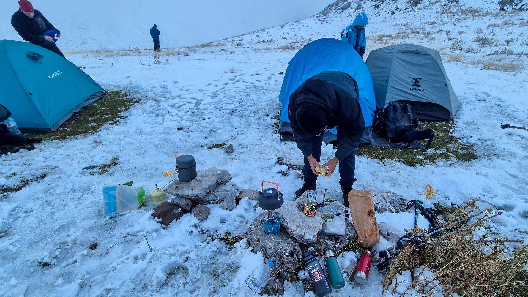
Our spartan kitchen setup.

View of our camp in the fog (c. Giannis).
As the sun began to set, Panos and Jason set off for the spring, and taking longer than expected to return, I went out to find them, only to see Panos scrambling up a ledge. I corralled them back into the tent, and making tea and chatting we managed to slowly warm up. Our new friends were generous enough to gift us two small bottles of Tsipouro, which I mixed into the tea; a perfect drink in such conditions. The clouds passed, and the starry night offered us a little more warmth, but at 20:30 a set of distant headlamps kept us awake. After an hour these surprise visitors reached our camp, and after ascertaining they didn’t need assistance, we were free to doze off into sleep, doing so rather quickly.
Day II: Pyramida & Return
We didn’t rush waking up, after all the route had to melt out. So I must have lazily unzipped the tent at around 07:30 as the first rays of light bathed the summit limestone in gold. Both Jason and I had slept well in the old Vango tent, unlike Panos in his new Simond, but still it was smart to have snuck up a Red-Bull seeing as there were 600m of snow and ice between us and the summit; we were in for a long day. Everyone took their time, to get ready, eat breakfast, and partially pack camp, and by 08:30, still in the shadow of Platyvouna we begun our day.
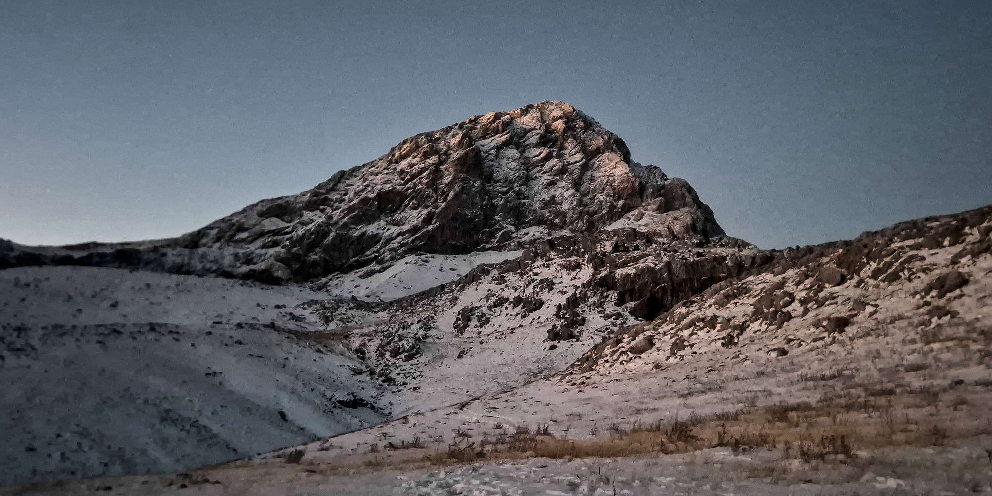
A golden dawn dresses Pyramida (2,510m), as seen from the tent.
First order of business was the spring, which I visited with Jason, while Panos, Giorgos, and Giannis went ahead. A lonely Chamois looked down at us from the craggy Nisi (”Νησί”) formation as we filled our bottles with the mountain’s crystal clear water; it would be the only one we’d see all day. I felt off while carrying our (Jason’s & I’s) shared backpack, I huffed and puffed on the hilly rises leading to Vatheia Lakka proper, and the long traverse to the col. I hoped it would abate, but couldn’t spare much thought standing in awe of the iced-up north face; it certainly did not feel like October.
Pyramida (2,510m) looking its best.
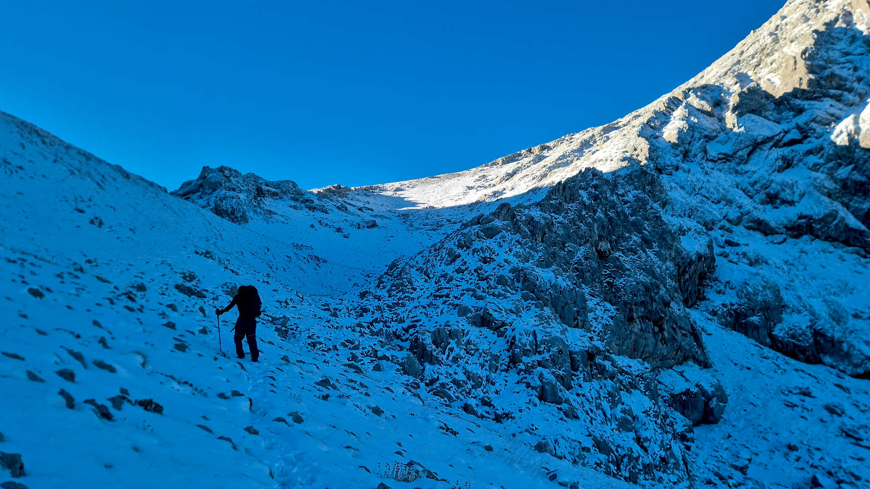
Panos at the choke, as sun lights the Col. and bowl.
Panos led us through the traverse and into the choke, where I took over, following the tracks left by the night’s visitors. I decided to break away right and hike through the snowy bowl directly, which meant trail-breaking, including ice; this was also the technical crux at a maximum angle of 26° (T3). After just an hour from the tents we reached the Col. at 2,190m and took a break under the sun. Not feeling any better, I relinquished the lead to Giorgos and the pack to Jason, taking my place at the tail of our procession. The route proved easy enough with the long steady ascent of the lower slope taking just 30 minutes, and bringing us up to 2,350m. From here the trail steepens navigating through switchbacks towards the ridge (T3-), but even with deeper snow, it presented little problem. It took us just 15 minutes to reach the short exit traverse onto the crest.
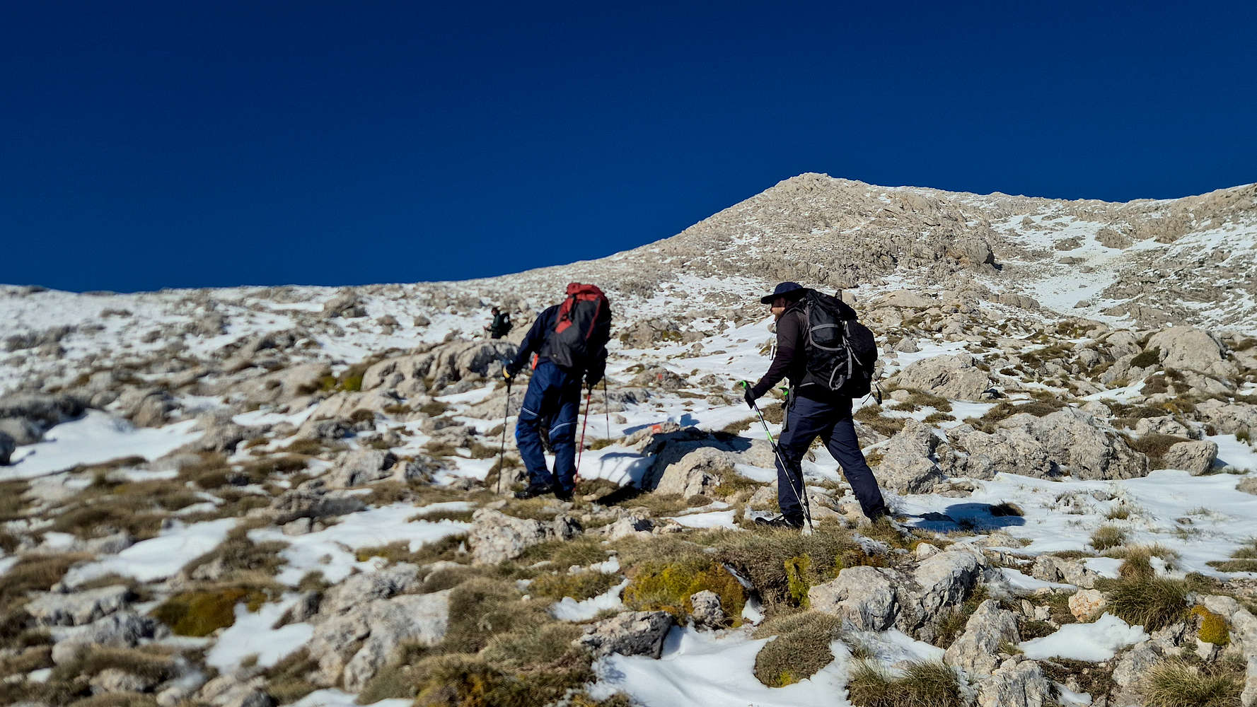
Panos & Jason at the end of the lower section.
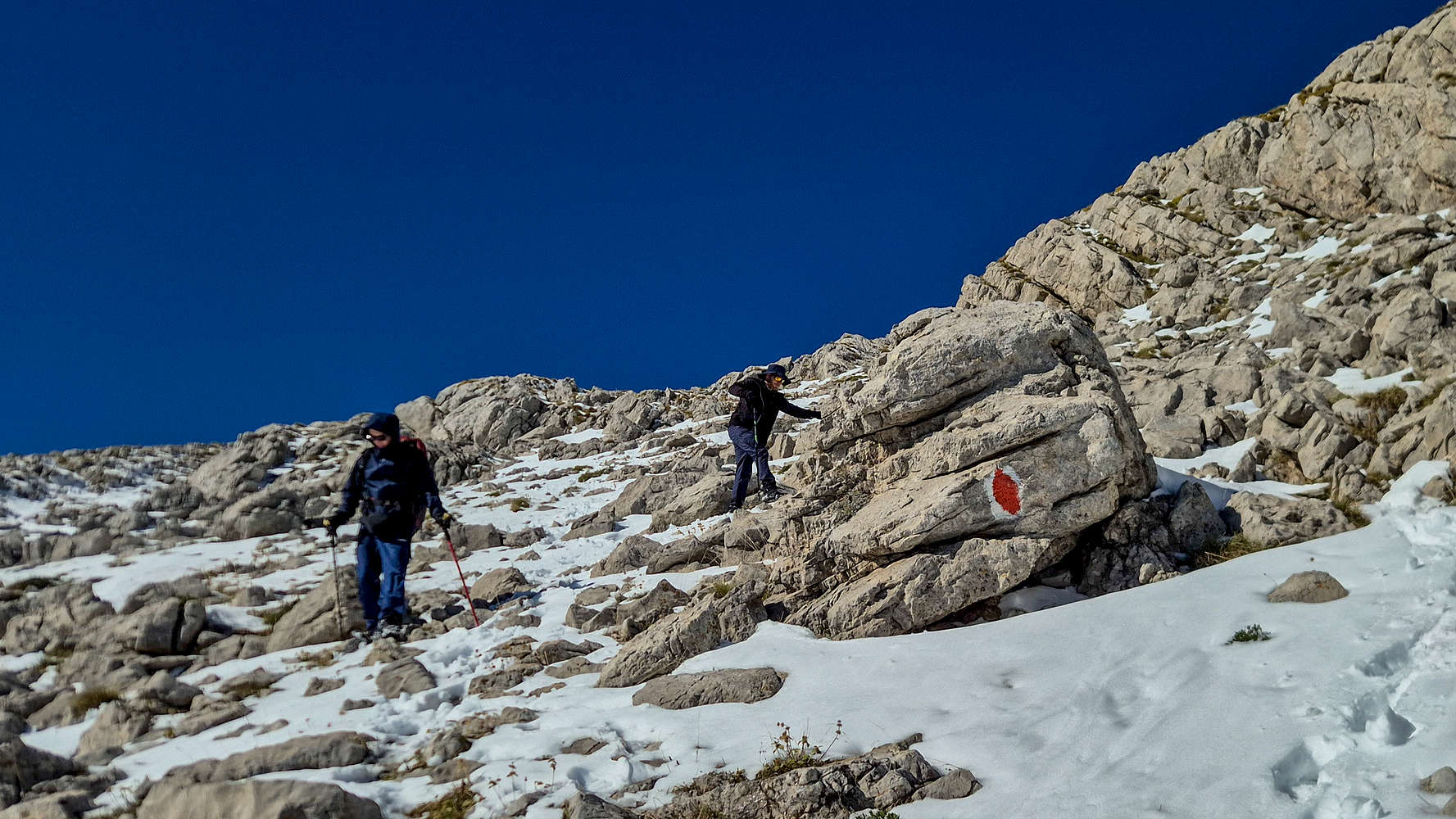
A boulder marks the steepest section of the ascent.
After just over 2 hours from our tents we had reached the summit crest of Gkiona, the proud formation which runs for 13km to the South, mostly above 2,400m, making it stand out among the Giants of Roumeli. The aerial position above Plaka Sykias (”Πλάκα Συκιάς”), the tallest headwall in the Balkans, was breathtaking, making even nearby Vardousia (2,495m) look small. I passed Panos and Jason who stopped for photos, joined Giannis and traversed along the locally exposed crest (T3-), slowly and carefully. Only a small notch proved somewhat engaging and quickly we joined Giorgos who was waiting for us at the summit.
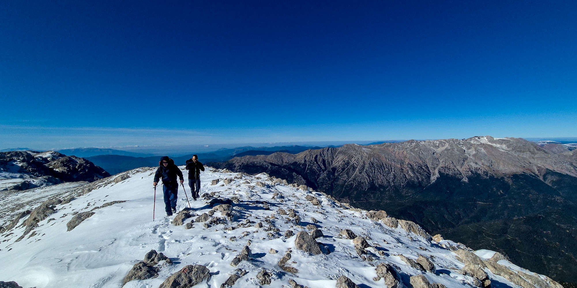
Panos & Jason on the summit crest of Gkiona (2,510m) with Vardousia (2,495m) behind.
It would be hard not to spend a long time there. Not to rest, after all we summited after just 2:15 hours, instead to bask in the glorious views. The frost of the day before had now given way to an incredibly clear day, and Gkiona, the highest peak in Southern Greece, turned out to be the perfect vantage point. Our views extended an impressive 370km, from Mainalo (1,981m) to Kaimaktsalan (2,528m), while the Corinth Gulf sparkled by our feet. Some couldn’t help but video-call family to share the sight. I quietly savored a summit which concluded a 7-year wait for the “right time”. Surrounded by old and new friends, I concluded that there couldn’t ever be a right-er time.
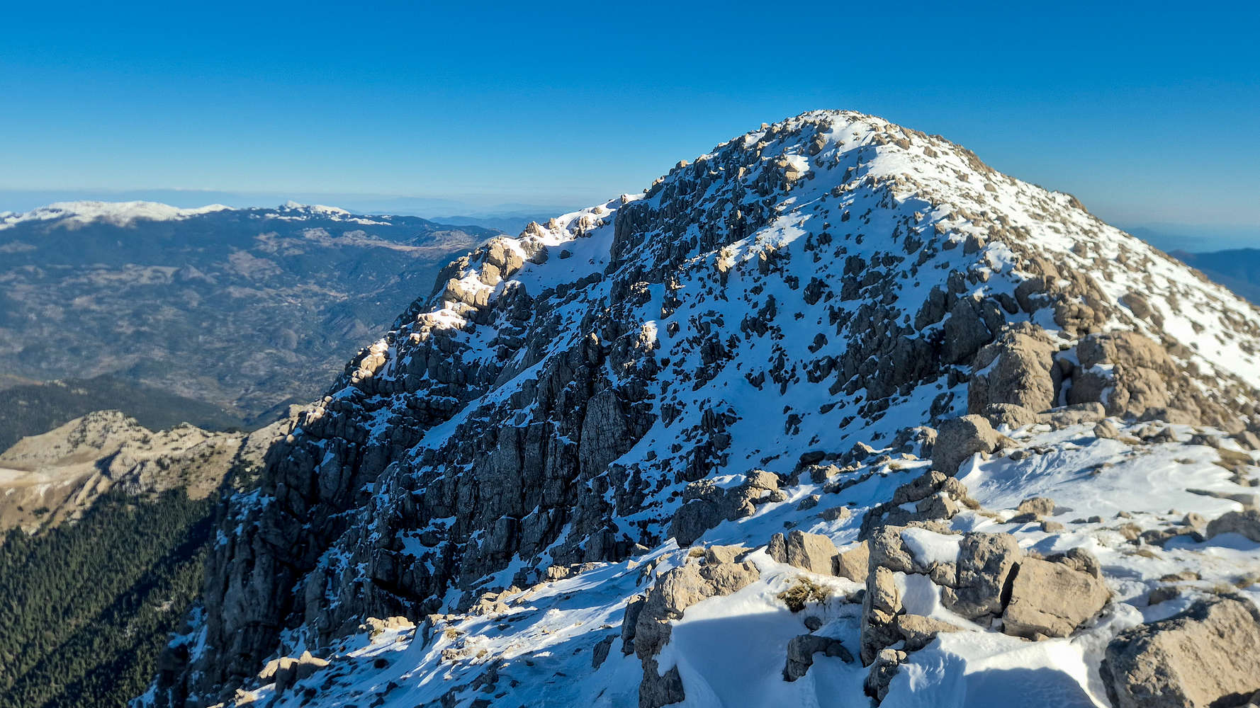
The summit cone of Pyramida (2,510m).

Left to right: the author, Giorgos, Giannis, Panos, and Jason.
We set off for our long descent to camp after 45 minutes. Retracing our steps on the first descent into the slope proved easier said than done, and Giorgos cajoled me into essentially running down the upper snow-slope, and inadvertently leaving the others behind. Luckily, the first of the day’s other parties were ascending and we stopped to chat. The first was the large group of EOS Lamias which we found spread over almost an hours ascent across the summit slopes. We reached the Col. in just over 30 minutes, and with the noon sun the heat had become unbearable. After a short wait, I continued alone down the bowl, looking to entice the others to increase their pace. After talking to a few more groups I found that still the rest were no closer, other than Giorgos, so I began the traversing section to Vatheia Lakka.
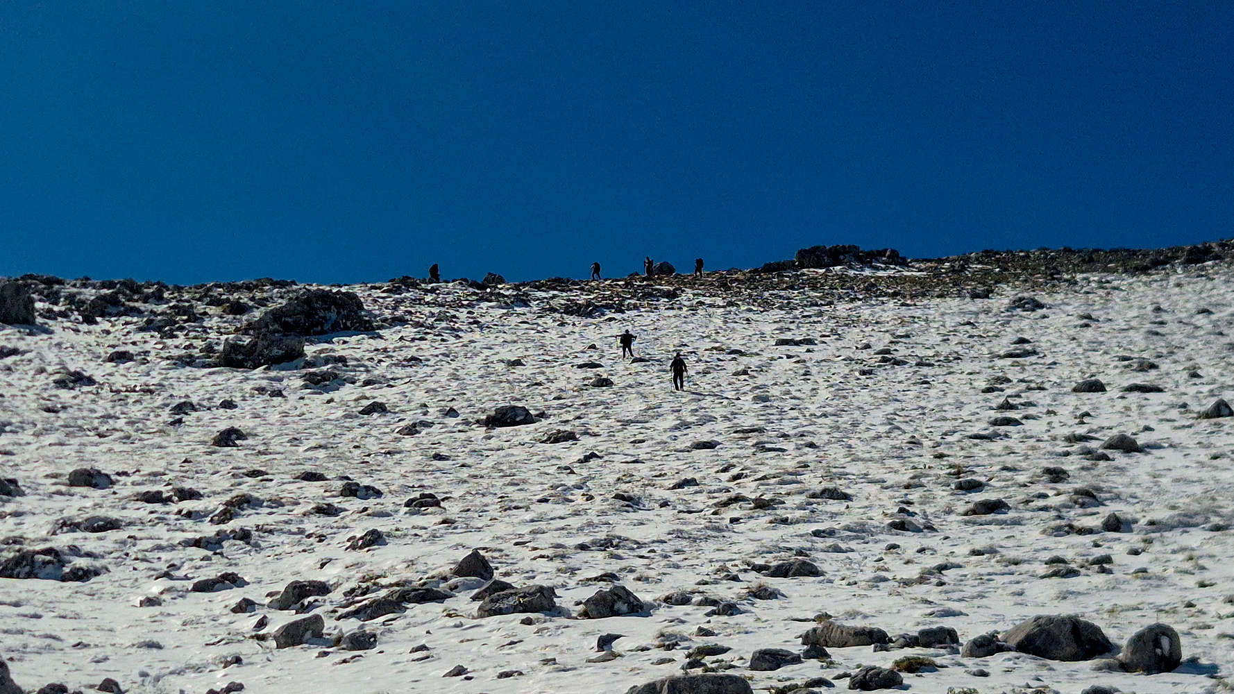
Traffic at the bowl, Girogos & Jason descending.
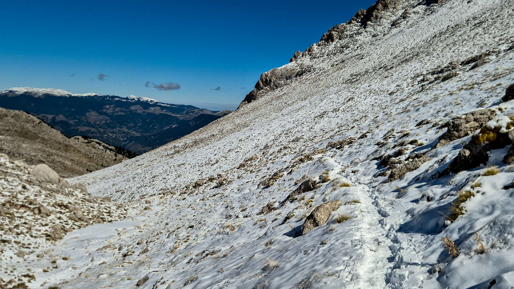
The traverse under the noon sun.
Upon reaching Vatheia Lakka at 12:30, I met a couple whom I warned about the possibility of darkness, since Pyramida - Larkanos would take them at least 3 hours. In doing so, a larger guided group caught up, and after providing some tips to the first hikers, I went to talk to the group guide. At this point Giorgos had also arrived, and the guide seemed to take little interest in what I had to say about bringing up a group here at that hour, some of which wore sneakers. Nonetheless, we all took a break there in a good atmosphere, and waited for Panos and Giannis, since Jason had arrived in the meantime. The two of them almost got lost on the traverse but after some helpful shouting they reached the basin, and we continued down into camp. Once again, Jason and I would head to the spring to refill our bottles before packing camp; I found myself momentarily lost under the sun and among the melting snow, and for a second thought it was late Spring.
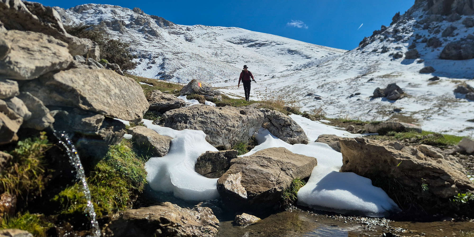
Jason approaches the spring of Chaliki on Gkiona.
A few minutes later we were joined by Giannis & Panos at camp, learning that they had a proper adventure on the descent, slipping up to 7-9 times each, something which we did not realize, finding the route rather easy. Giving them ample time to decompress, we packed our camp under the blazing sun, taking somewhat longer than expected. We set off to return to the cars after 4:50 hours of hiking, and 1:00 hours packing. Soon we found ourselves descending through a mountain much different than the one we ascended the day prior. Some snow was still present as we traversed the ravine towards Stavros, but the once nicely packed snow on the trail was replaced much slippery ice & mud. We thought of the other groups and how grueling their descent will become in the afternoon, we were happy to have left when we did. Taking a slower pace, and enjoying our time together, we reached Larkanos trailhead after less than 1 hour from the campsite.

A snowmelt stream near Vatheia Lakka.

Descending through the now grassy traverse.
Once more in the shadow of Platyvouna we traversed to Voidholivadho which was now lacking any snow, and carefully managed the steep trail descending into the FSR. Clouds had gathered around the high summits and the last light was on our heels as we began retracing our steps through the FSR. Luckily, a chance navigational error the day before had clued us into where the trail cutting the lowest part of the FSR lay, and doing so we reached the final roads rather quickly. We followed the last FSR at a relaxed pace, eating leftover snacks, and chatting, but the 1km between the end of the steep slopes and Mnimata ended up passing rather slowly, with everyone seemingly awaiting to see our parked cars at every turn of the dirt road. Eventually we reached them, having been active for nearly 8 hours since leaving our tents that morning. After sorting out our gear, and changing into cleaner clothes, we set off to Taverna Miranda (⭐4.8, +1500) at Kastellia (”Καστέλλια”) for a well-deserved and highly anticipated group dinner in celebration of our success.

Giannis & Giorgos at Voidholivadho.

Pushing along the final meters to the cars.
Interactive Map
Logistics
As usual this was a self-planned trip, with logistical assistance from Panos & Jason. Panos drove us to the trailhead (📍38.671319, 22.289729) on Saturday, and back to Athens on Sunday, which is about a 4 hour drive depending on driver’s confidence. We camped at Vatheia Lakka near Chaliki spring (📍 38.660052, 22.258679) as part of our ascent, so there were no hotel logistics, outside of bringing and carrying all the appropriate equipment. We ate one meal outdoors, being our dinner on Saturday, for which we had planned during the week, and had brought with us an assortment of pack foods for breakfast and snacks. We only carried less than 2lt of water each on the way up given the spring near our campsite, through which we drew well over 12lt (for 3 people) in the following 24 hours. We had a second meal on Sunday at the village of Kastellia on our way back to Athens. We left Athens at around 10:00 on Saturday and returned around 22:00 on Sunday.